
10 June 2014
Ferebee Glacier: another rock avalanche in Alaska
Posted by Dave Petley
Ferebee Glacier rock avalanche
The Ferebee Glacier is located in the Alaska panhandle, in the same general area as a number of other rock avalanches that I’ve described in the last two years or so (e.g. Mount La Perouse, Mount Jarvis and Mount Lituya). Pilot Drake Olson, of Fly Drake, very kindly keeps his eyes open for such events in this area, and over the weekend spotted a new rock avalanche that has descended on to the upper reaches of the Ferebee Glacier (the location is 59.610, -135.625 if you want to take a look at the site). Marten Geertsema very kindly highlighted this event to me, and Colin Stark has also done a lot of work in the last 24 hours to characterise the slide from satellite imagery.
This is an image of the landslide, taken by Drake:
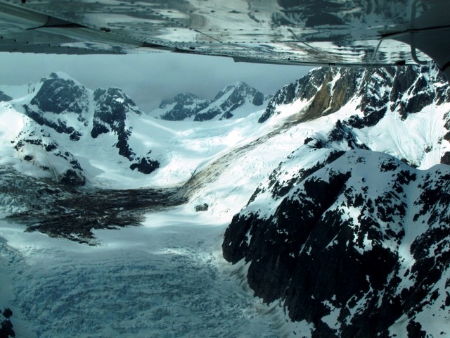
Picture copyright of Drake Olson
..
The slide has broken off a near vertical rock face and then has descended a steep ramp to flow out over the glacier. Note the lack of deposition on the ramp itself, the clear flow in the deposit (and see below) and the apparent deposit on the opposite flank. Colin has suggested, and I agree with him, that this might be the remains of a dust cloud. If so I suspect that the landslide was moving quite fast, given the size of the dust deposit. To give an idea of scale, the total vertical height difference of the landslide is over 700 m and the total distance traveled in over 2,000 m. Colin has done a rough calculation of the volume, which is in the order of 130,000 cubic metres.
Brett has also supplied this nice image of the landslide source – the bluff on the left side appears to be the one that has collapsed:
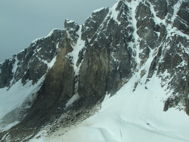
Picture copyright of Drake Olson
…
And this is a shot of the lower part of the landslide deposit:
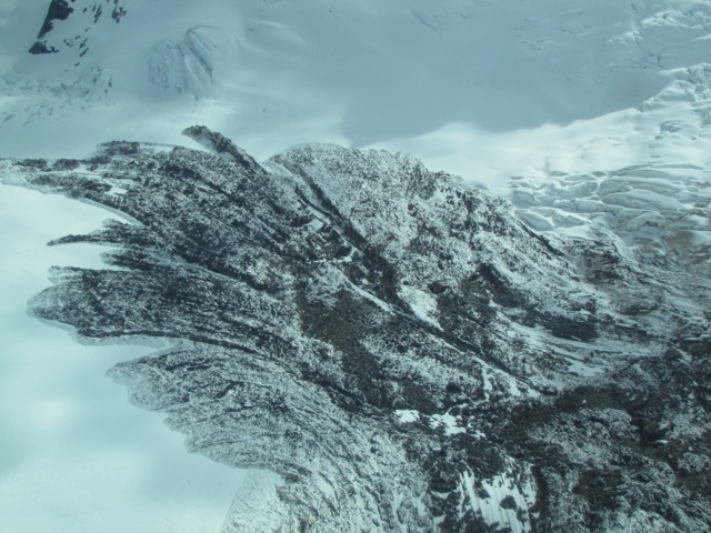
Image copyright of Drake Olson
..
On the right side of this image is the edge of the main landslide deposit. The fine, “fingered” structure of the deposit shown above is probably the result of late stage slow sliding – a mechanism that only came to our attention from the Mount Haast / Mount Dixon rock avalanche video.
The date of the landslide is unclear. There is a good quality Landsat 8 image from 7th May 2014 on which the landslide is not present, and another from 6th June 2014 in which it is. However, we do not have a fix from between these dates. Unfortunately, it is unlikely that this landslide generated a strong enough seismic signal to be detectable, so we may never know precisely..
 Dave Petley is the Vice-Chancellor of the University of Hull in the United Kingdom. His blog provides commentary and analysis of landslide events occurring worldwide, including the landslides themselves, latest research, and conferences and meetings.
There was a 5.8 earthquake centered not far from this area last Wednesday, June 4. Might that be a likely date?