
5 November 2010
Hurricane Tomas, Mount Merapi and landslides in Costa Rica
Posted by Dave Petley
With three substantial natural hazard events occurring simultaneously, I thought I would post a round-up of those rapidly-evolving events:
 1. Hurricane Tomas
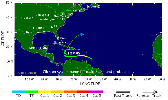
As feared, Hurricane Tomas is now bringing heavy rainfall to Haiti. The path of the storm has been somewhat erratic, as the Tropical Storm Risk track map shows. However, the storm is now tracking in a generally north-northwesterly direction, and is likely to pass just to the west of Haiti, if the latest forecasts are correct.
NOAA have provided two very useful images at this stage. The first is a map showing in detail the forecast track of the storm, with the areas most at risk highlighted.

The second is a map of rainfall potential over the next 24 hours, unfortunately in inches (1 inch = 25.4 mm):

This suggests that Port-au-Prince may avoid the worst of the storm, but that much of the earthquake-affected area can expect 100 to 200 mm of rainfall over the next 24 hours. This is a very significant amount, resulting in a high level of hazard. Of course there are many uncertainties in the equation here, and so no particular outcome across the spectrum of realistic possibilities can be considered to be likely at this stage, and no-one should assume that Port-au-Prince will escape the worst of the storm. The Wall Street Journal has a good article on the challenges of preparing for the storm. The next 24 hours will be very interesting.
2. Mount Merapi
The eruption at Mount Merapi has intensified very significantly over the last 24 hours, resulting in pyroclastic flows travelling over 15 km from the volcano. Some dramatic footage has been collected of much smaller pyroclastic flows travelling down the flanks of Merapi from an earlier eruption:
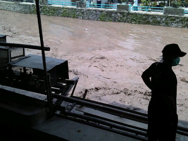 The latest events may have one of two causes. First, they could be the result of collapse of the eruption column, which reportedly reached 16 km in altitude. Secondly, and more likely, the lava dome that was forming at the summit of the volcano underwent a partial or complete collapse. This is the normal mode for catastrophic pyroclastic flows on Merapi. The largest impact appears to have been in the village of Argomulyo, 18 km from the crater, with 56 people reported to have been killed and a further 66 injured. Over 75,000 people have been evacuated, putting great strain on local resources. A substantial secondary hazard associated with Merapi is that of volcanic landslides (lahars). There is some evidence, including the image to the right (from here), which reportedly shows the Code River in flood downstream of the volcano. Heavy rainfall is occurring in the area, and CNN is reporting lahars being seen on the volcano itself.
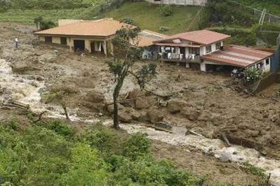 3. Landslides in Costa Rica
 Dave Petley is the Vice-Chancellor of the University of Hull in the United Kingdom. His blog provides commentary and analysis of landslide events occurring worldwide, including the landslides themselves, latest research, and conferences and meetings.