
13 July 2009
Disastrous mining related landslide in Burma / Myanmar
Posted by Dave Petley
A few days ago on 3rd July a major landslide occurred in northern Burma (Myanmar) that appears to have affected a huge number of people. The excellent ReliefWeb site is carrying reports of the UN OCHA response to the disaster. The OCHA report states that:
“On the 4th of July 2009, a landslide caused by heavy rains swept away a jade miners’ settlement along the Uru River in Hpakant Township (also sometimes spelt Phakant), northern Kachin State. Another jade mining city, Seng Tawng, was also reported to have been affected by the floods. Villages in the surrounding area are also reported to be affected. In the absence of a credible assessment, initial information collected reveals a wide range of disparate mortality and affected population levels. It is anticipated that clearer fatality and casualty figures will be available within the next days. The New Light of Myanmar, a State-run newspaper, reports the number of fatalities to be 24 at this stage.In Hpakant, it is reported that a total of between 900 and 1,000 individuals are currently accommodated in a total of five informal displacement locations, including four monasteries and one school. Similarly, approximately 200 individuals are currently accommodated in a monastery in Tar Ma Hkan. The population in these locations is reported to include families”
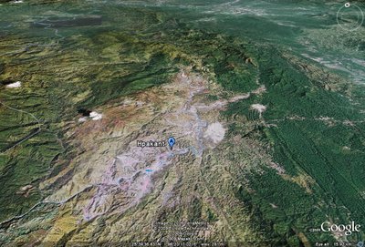
So clearly this was a pretty serious event. Unfortunately, this is one of those occasions in which Google Earth just doesn’t do the business due to the resolution of the imagery:

However, there is a local website for Hpakant set up by AKSYU (a campaigning human rights group from the Kachin area). Interesting, the website reports that:
“The death toll has risen to 70 in the aftermath of floods and landslides in Burma’s Hpakant jade mining area in the country’s northern Kachin State on July 4 and 5. Hundreds have been injured including over 10 people from local Kachin Baptist Churches, according to official figures available from Burmese Army authorities. The floods and mudslides were the biggest ever witnessed in Hpakant jade land. The devastation was said to have been caused because the ruling junta has been allowing indiscriminate jade mining activities with sophisticated machines following the ceasefire agreement between the regime and the Kachin Independence Organization (KIO) in 1994, said local environmentalists. The death toll was compiled till yesterday by the administrative office of the Hpakant Jade Mining City also called the City Peace and Development Council (Ma Ya Ka) of the junta, said Hpakant residents. The search for bodies in jade land is underway and an additional 30 bodies were found under soil and slush dug out from the jade mines yesterday evening, a resident of Hpakant told KNG today. Eyewitnesses said they saw dozens of bodies being carried in trucks while people were searching for more bodies under the soil heads which came crashing down in the heavy downpour. Most of the deaths resulted from the mudslides because of the high land dug for the jade mines and because most villages were constructed on low land near the Uru River, according to residents of Hpakant. The Hpakant government hospital is full of people with injuries as of Saturday night but a callous Burmese military authority is yet to launch any rescue mission for the victims, said residents of Hpakant. Residents expect the death toll to touch several hundred because over seven main jade mining villages were severely affected by the flood from the Uru River which brought down heaps of soil and mud dug out from thousands of jade mines near their villages. The three major jade mining cities of Hpakant, Lonkin (also called Lawng Hkang in Kachin) and Seng Tawng were flooded by the Uru River. However the water is receding since yesterday, added residents. Private and non-government rescue and relief missions were started yesterday in some of the flood and landslide affected areas like Hpakant city, Maw One, Seng Tawng and Lonkin after the rain and floods stopped, said locals. Soon after the floods, the Hpakant Regional Kachin Baptist Convention under the Kachin Baptist Convention (KBC), the biggest Kachin Christian body in the country formed an emergency committee. It is implementing rescue and relief missions, said a KBC staff member in Myitkyina, the capital of Kachin State. Roads in most villages in Hpakant jade land are covered with over three-foot of mud and slush allowing only ferry transportation, said local residents. Residents of Hpakant city are now busy cleaning their inundated homes. They are facing an acute shortage of clean water, said residents.”
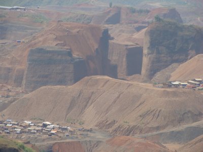
So is it possible that a death toll of several hundred could have occurred here, or is it an exaggeration? Well, let’s take a look at a couple of the images of the mines in the Hpakant area that AKSYU have on their site, which can be accessed here:
 (click on the images for a better view in a new window)
To call this a disaster just waiting to happen is something of an understatement. This image shows how the spoil dumping has occurred (note the people on the nearer slope for scale):
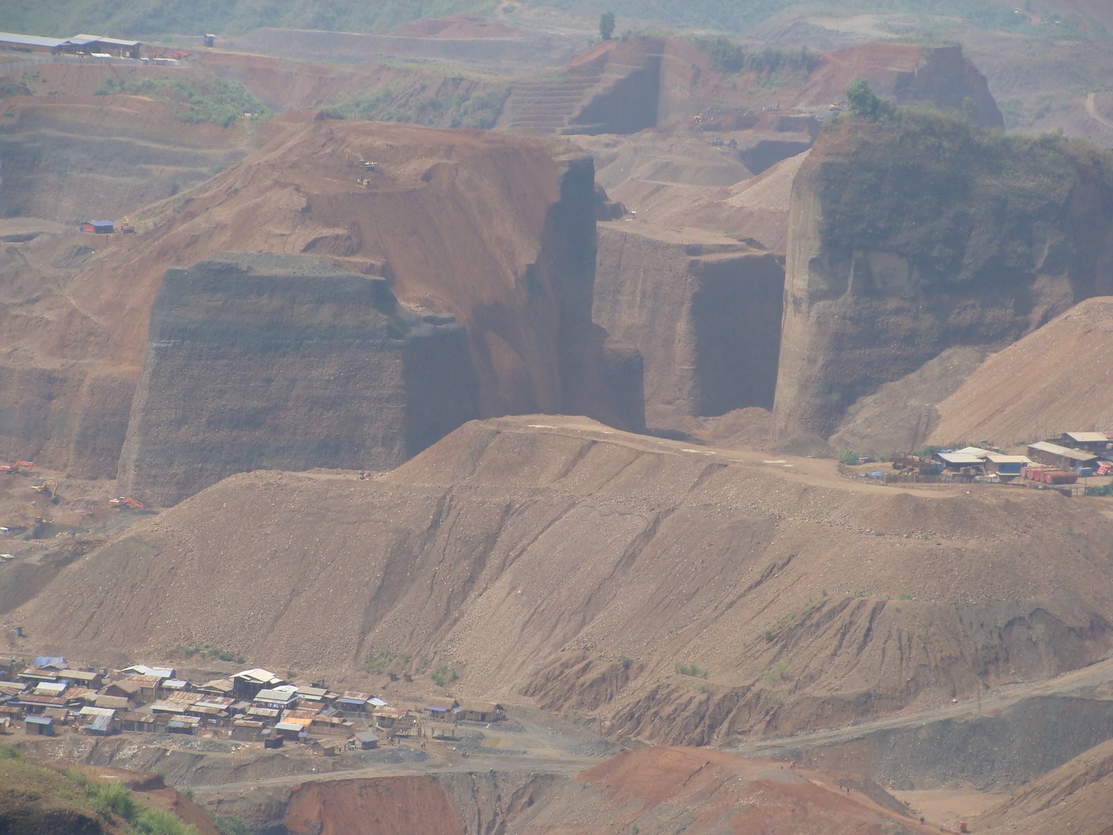
The combination of dumping at the angle of repose in dry conditions, and the villages in such close proximity to the mine dumps, makes a large-scale landslide disaster a distinct possibility:
 It remains impossible to know what has happened – I will keep an eye on the UN a
nd other web sites to see if anything appears. An flowslide type of failure must be a worry in this sort of setting though.
 Dave Petley is the Vice-Chancellor of the University of Hull in the United Kingdom. His blog provides commentary and analysis of landslide events occurring worldwide, including the landslides themselves, latest research, and conferences and meetings.
[…] Disastrous mining related landslide in Burma / Myanmar […]