
15 October 2021
Indications of landslides on Google Street View
Posted by Dave Petley
Indications of landslides on Google Street View
Yesterday I was reading an article (Rayes-Carmona et al. 2021) in the journal Landslides that described the movement of a large landslide on the banks of the Rules Reservoir in Spain. This slide, the El Arrecife Landslide, is a 14.7 million cubic metre creeping mass movement (location = 36.872, -3.491) that was detected comparatively recently. Analysis using historic InSAR data indicates that it is moving on average at about 2 cm per year, but that sections of the slope are moving at 26 cm per year. There are no immediate causes for concern, but clearly the landslide needs careful attention.
This Google Earth image shows the slope in question:-
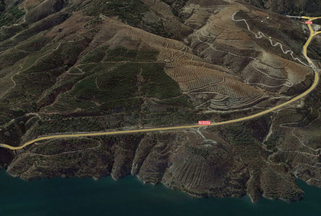
Google Earth image of the El Arrecife Landslide in Spain.
.
The slope shows few signs of classic landslide morphology such as obvious lateral scarps and a rear tension crack or scarp. There is a large spoil heap toward the toe of the slope on the centre right of the image – it is this feature that is showing the greatest movement, probably because the spoil is compacting – but the rest of the landslide is creeping.
An aspect of the paper by Rayes-Carmona et al. (2021) caught my attention:
The activity of the El Arrecife Landslide has been also evidenced by the N-323 National Road that runs across the landslide. This road has been consistently in need of repair work due to the existence of bumps, cracks, and partial collapses of the road pavement … In 2013, the Spanish Ministry of Public Works and Transport invested a total of 3.8 million Euros to repair 8 km of the N-323 National Road, which entailed the resurfacing of the pavement and the structural restoration of the northern abutment of the El Arrecife Viaduct …, located in the southern limit of the El Arrecife Landslide.
There is good coverage of this area in Google Street View. The image from June 2021 at the margin of the landslide looks like this:
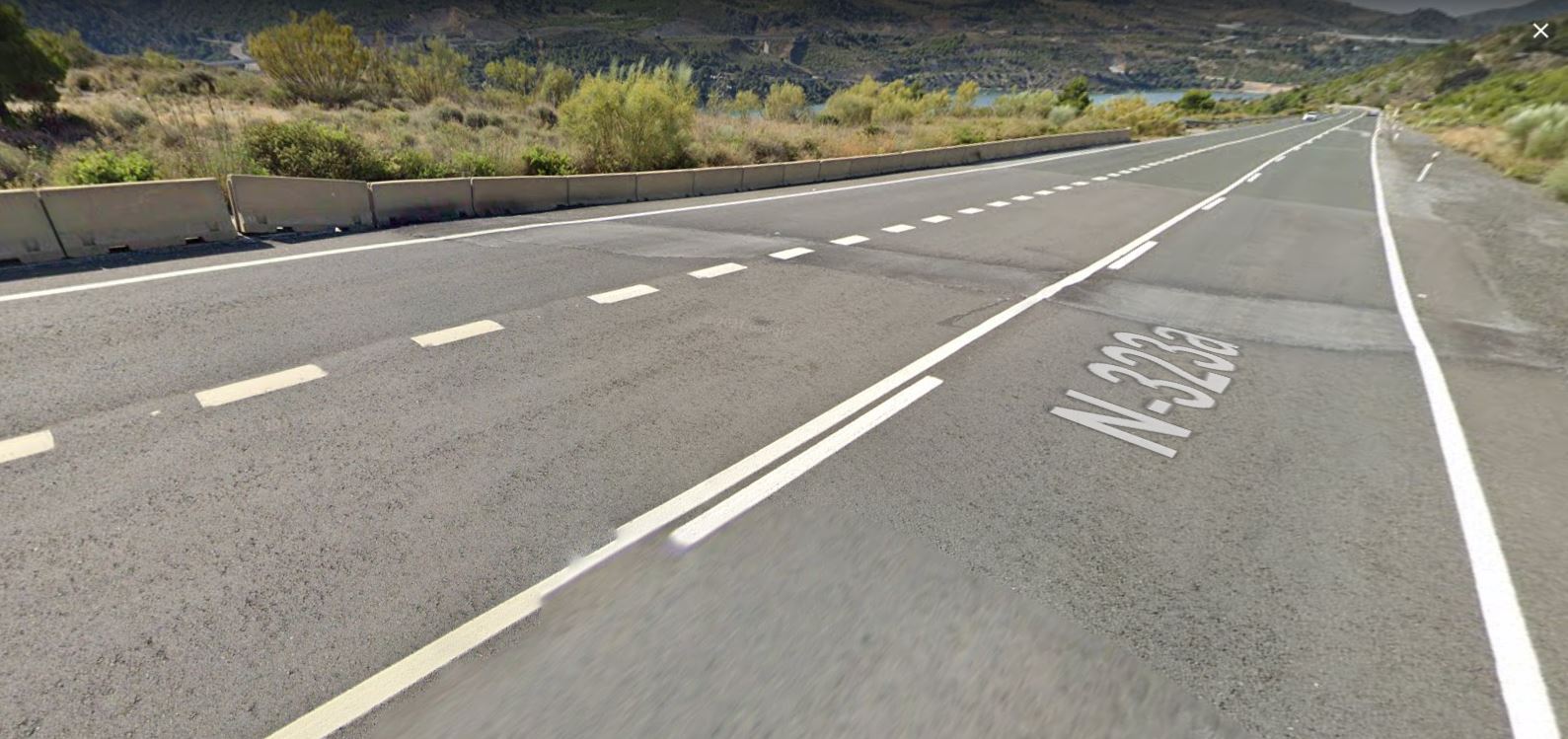
June 2021 Google Street View image of the lateral margin of the El Arrecife Landslide in Spain.
.
The image beautifully captures the lateral margin of the landslide, with a large patch in the road where repairs have been needed. Note also the subsidence of the blocks on the downslope margin of the highway, coinciding exactly with the road repairs. These are classic indications of landslide movement.
The images also allow the history of movement to be determined. This image is from May 2011:
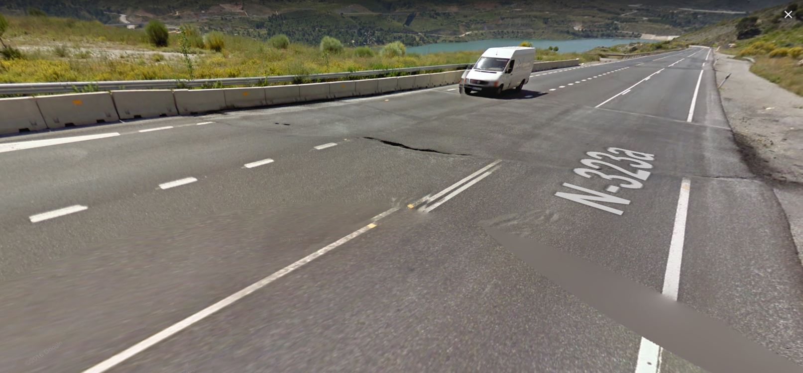
May 2011 Google Street View image of the lateral margin of the El Arrecife Landslide in Spain.
.
At this point a much larger repair to the road had been required. Note the lateral offset of the white line on the edge of the road, indicating relative motion. There is less evidence of vertical motion. Further down the road there is another large set of repairs, possible indicating an arcuate scarp defining a smaller area of more rapid motion.
In the image from May 2014 the road had been upgraded and repaired, such that the tarmac surface appeared undamaged. But by October 2018 cracks were reappearing and the curb side blocks were showing clear signs of movement. There is some evidence that this short section had been resurfaced once more:
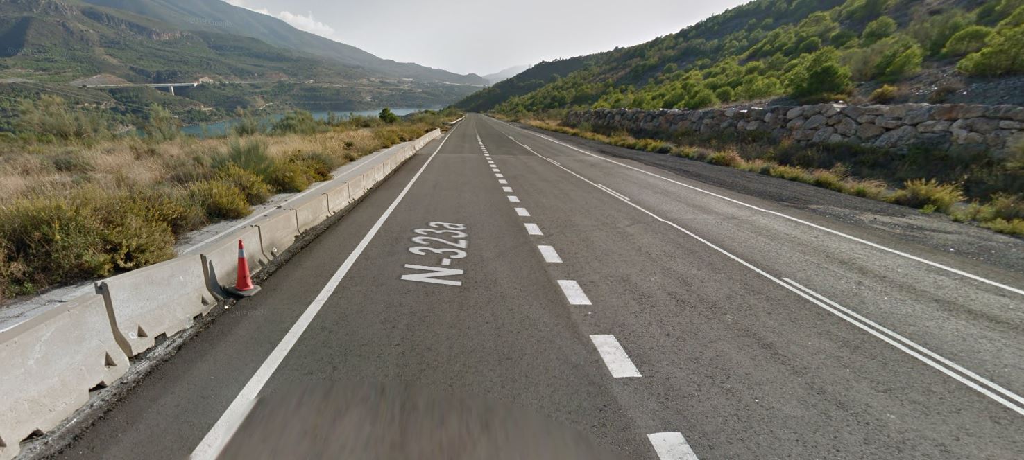
May 2014 Google Street View image of the lateral margin of the El Arrecife Landslide in Spain.
.
Understanding landslides is often a fascinating piece of detective work, piecing together multiple strands of evidence to create a coherent understanding in the three dimensions and in time. That is one of the reasons why I love studying them so much. Google Street View can be a remarkably powerful tool to aid this process in the right circumstances.
.
Reference
Reyes-Carmona, C., Galve, J.P., Moreno-Sánchez, M. et al. 2021. Rapid characterisation of the extremely large landslide threatening the Rules Reservoir (Southern Spain). Landslides (2021). https://doi.org/10.1007/s10346-021-01728-z.
 Dave Petley is the Vice-Chancellor of the University of Hull in the United Kingdom. His blog provides commentary and analysis of landslide events occurring worldwide, including the landslides themselves, latest research, and conferences and meetings.
It looks to me that the dates are wrong and the 1st Google Street photo is from 2011 and the 2nd is from 2021. If not, could you give some more details on what shows that the 1st is older?