
28 July 2020
Mapping landslides in Nepal
Posted by Dave Petley
Mapping landslides in Nepal
Heavy monsoon rainfall continues to drive landslide losses across Nepal. As in all disasters, a key aspect of an appropriate response is highly quality spatial data. In the summer of 2019 the National Emergency Operation Centre (NEOC), a part of the Ministry of Home Affairs, launched a new disaster management portal (bipad.gov.np) to provide high quality data. It collates and displays spatial data for a range of natural and anthropogenic hazards, including floods, landslides, GLOFs and fires. The data can be displayed in a variety of formats, including events for the last 3, 7 and 14 days, as well as having a customised date range facility.
This is the distribution of recorded landslides for the last seven days, as of 7 am (UK time) on 28 July 2020:-
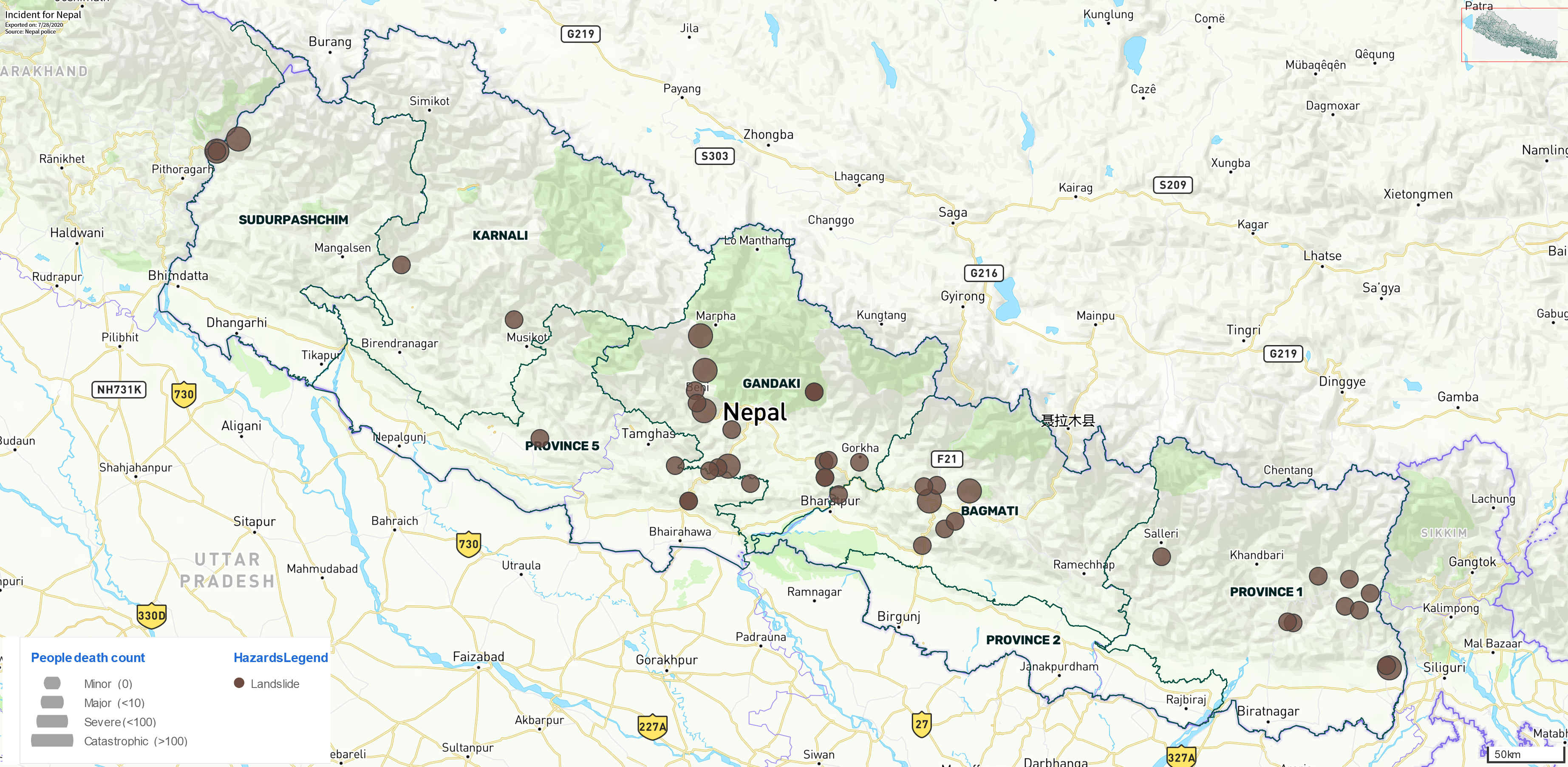
A map of landslide events in Nepal for the 7 days to 28 July 2020. Data from the bipad.np.gov tool.
.
Each brown dot here is a landslide event recorded in the last seven days, with the size of the dot representing the losses (see the key in the bottom left corner). The tool indicates that 16 landslide related fatalities were recorded in this period. Note the cluster of landslides in the centre of the country – it is interesting to compare this with data on precipitation over the same period, using the NASA Global Precipitation Measurement system, mapped with the GPM IMERG Global Viewer tool:-
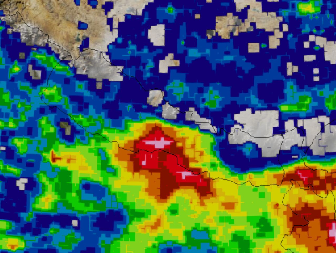
The last seven days of rainfall in Nepal using data from the NASA GPM mission. Warm colours indicate high levels of rainfall. Mapped using the GPM IMERG Global Viewer tool.
.
Note the area of higher levels of rainfall in the centre of the country, which corresponds with the area of higher levels of landslides.
The map below shows the reported landslides over the last 28 days:-
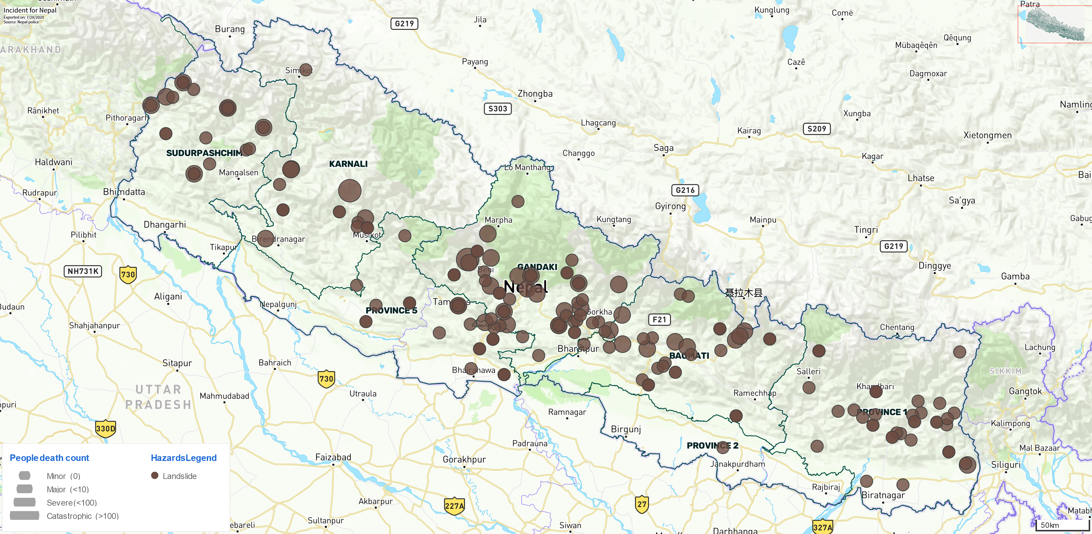
A map of landslide events in Nepal for the 28 days to 28 July 2020. Data from the bipad.np.gov tool.
.
In this period the tool has records for landslides that resulted in 111 deaths.
Very few countries have a publicly accessible database of disaster information of this quality. Nepal deserves great credit for setting up such a system.
.
Quickslide 1: An Irish peat bog landslide in 1896
The Irish Examiner has a story about a peat bog landslide at Shass Mountain that killed eight people, of whom six were children. The landslide had a runout distance of up to 8 km.
.
Quickslide 2: A journal article about the Brumadinho tailings dam failure
The journal Landslides has published a research article (de Lim et al. 2020) about the Brumadinho ( Córrego do Feijão) tailings dam failure in 2019. It concludes that the event can be caharcterised in four phases: “(a) a rotational slide which destroyed the complete dam structure; (b) a debris avalanche; (c) a debris flow; and (d) a mudflow, composed by a mixture between tailings material and the soil.” The article has been placed on Research Gate, so you can request a copy from the authors.
.
Reference
de Lima, R.E., de Lima Picanço, J., da Silva, A.F. et al. 2020. An anthropogenic flow type gravitational mass movement: the Córrego do Feijão tailings dam disaster, Brumadinho, Brazil. Landslides https://doi.org/10.1007/s10346-020-01450-2
 Dave Petley is the Vice-Chancellor of the University of Hull in the United Kingdom. His blog provides commentary and analysis of landslide events occurring worldwide, including the landslides themselves, latest research, and conferences and meetings.
Hi! I’m working on a research project for landslide prediction and I’d like to use this data but it seems the links are broken. Do you think you could email me the dataset that you compiled?
Thanks
~Shrey Joshi
Junior at Plano East Senior High School