29 August 2018
Landslides from the 16 August 2018 Mw=5.1 Molise earthquake in southern Italy
Posted by Dave Petley
Landslides from the 16 August 2018 Mw=5.1 Molise earthquake in southern Italy
Text and photographs supplied by Salvatore Martino, University of Roma “Sapienza”
On 16 August 2018, a Mw=5.1 earthquake occurred 4 km SE of the Montecilfone village (Molise, Southern Italy); by 20 August about 200 aftershocks, of which nine with a magnitude of Mw=3 or greater associated with the Molise earthquake, (Fig.1) had been recorded by the Italian National Accelerometric Network (RAN), supported by some temporary stations installed by the Italian National Institute of Geophysics and Volcanology (INGV).
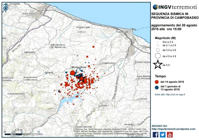
Figure 1: Aftershock distribution for the Mw=5.1 Molise earthquake in Italy. Map via INGV Terremoti.
The epicentral area corresponds to the hill-slope landscape between the Biferno and Trigno Rivers. According to the official geological map of Italy, in the epicentral area outcrops a complex sedimentary succession of terrigenous deposits including scaly clays ascribable to the Argille Varicolori Formation of the Paleocene, arenaceous-pelitic flysch of the Miocene-Pliocene and silty-clays of the Pliocene (Fig.2).
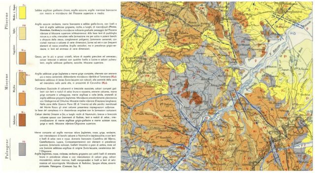
Figure 2: Geology map of the area affected by the Mw=5.1 Molise earthquake in Italy.
During the days before the mainshock occurrence, intense rainfall occurred in the epicentral area, increasing the susceptibility to earthquake-induced landslides. Immediately after the earthquake the CERI “Sapienza” research center in co-operation with the local geological office Geoservizi S.r.l. carried on field surveys to create an inventory of the earthquake-induced ground effects as soon as possible, to avoid possible deletion of the ground evidence due to new rainfall and the action of local farmers.
No earthquake-induced effects had been previously documented in this area (between Guglionesi, Larino and Montenero di Bisaccia villages) according to the available catalogues (Figs 3 and 4). Therefore, this is the first time that in this sector of the Central Apennine it is possible to inventory earthquake-induced effects and to analyze their spatial distribution.
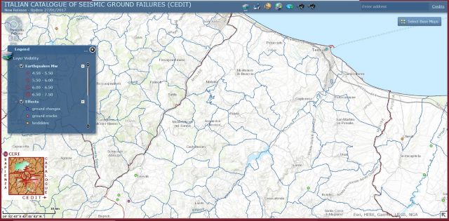
Figure 3: Previously documented earthquake-induced ground failures in the area of the Mw=5.1 Molise earthquake in Italy.
.
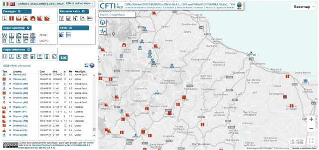
Figure 4: Landslides triggered by the Mw=5.1 Molise earthqauke in Italy.
.
Until now some tens of earthquake-induced landslides have been identified, which are concentrated in a radius of almost 2 km from the epicenter. These landslides mainly consist in re-activations of earth slides (Fig.5); for several of them, local people testified that the movement occurred following the mainshock. The landslide reactivation caused, in some case, not negligible damage to roads and infrastructures (Figs 6, 7 and 8).

Figure 5: The landscape of the area affected by the Mw=5.1 Molise earthquake in Italy
.
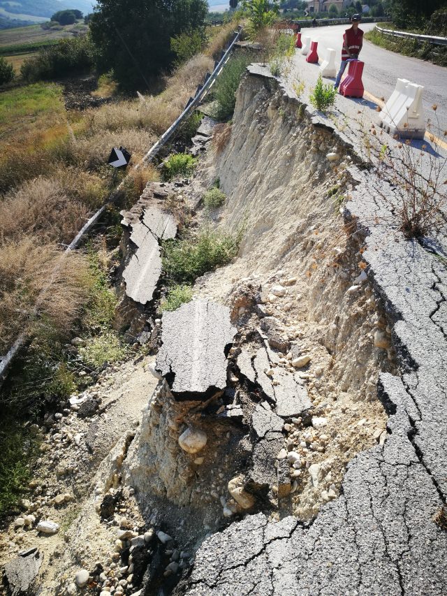
Figure 6: a slope failure induced by the Mw=5.1 Molise earthquake in Italy.
.
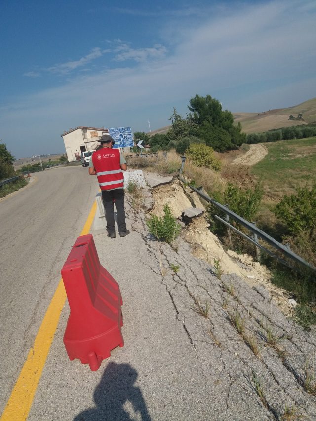
Figure 7: a slope failure induced by the Mw=5.1 Molise earthquake in Italy.
.
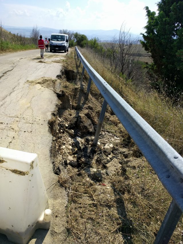
Figure 8: a slope failure induced by the Mw=5.1 Molise earthquake in Italy.
.
The inventory of the ground effects will be included in the on-line CEDIT catalogue managed by the CERI “Sapienza”.


 Dave Petley is the Vice-Chancellor of the University of Hull in the United Kingdom. His blog provides commentary and analysis of landslide events occurring worldwide, including the landslides themselves, latest research, and conferences and meetings.
The grass in the cracks in the pavement clearly indicate the mechanisms were active prior to the quake.
There is some significant vegetation growth within the cracks along the road edge in Figures 6 and 7. This failure may have likely occurred in the near future even without the trigger of the latest earthquake.
The felt area is interested by several landslides (already inventoried) but many of them were recativated by the earthquake (also thanks to increased soil saturation due to the intense rain of the previous days) …therefore, the detailed field surveys revealed that in the detachment zones of the existing landslide new cracks or renewed scarps are clearly visible. Vegetation, of course, was already present within the existing landslide masses.