
5 December 2016
Lidar – the amazing landslide mapping tool
Posted by Dave Petley
Lidar is defined by Wikipedia as:
a surveying method that measures distance to a target by illuminating that target with a laser light. The name lidar, sometimes considered an acronym of Light Detection And Ranging, (sometimes Light Imaging, Detection, And Ranging), was originally a portmanteau of light and radar. Lidar is popularly used to make high-resolution maps, with applications in geodesy, geomatics, archaeology, geography, geology, geomorphology, seismology, forestry, atmospheric physics,[4] laser guidance, airborne laser swath mapping (ALSM), and laser altimetry. Lidar sometimes is called laser scanning and 3D scanning, with terrestrial, airborne, and mobile applications.
The Washington State Department of Natural Resources has the most brilliant example of the ways in which Lidar can transform landslide mapping. One of the great strengths of Lidar is that it can give the form of the land surface through dense vegetation. This works because a small proportion of the laser pulses make it through the vegetation and back to the sensor. These pulses can be filtered from the main data to provide a model of the land surface. Although these returns represent only a small proportion of the total data points, the density of information generated by Lidar can mean that in all but the most densely vegetated areas there is enough data to resolve the ground surface.
This is a Google Earth image of an area of the Cedar River south of North Bend in Washington State.
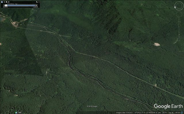
Google Earth image of landslides on the Cedar River Valley south of North Bend by Rattlesnake Ledge.
.
The only obvious morphological feature that hints at the presence of landslides in this image are the small arcuate scoops out of the ridge, although there are no obvious landslide features on the slopes below. Looking at this area in a true vertical image provides no improvement in understanding:
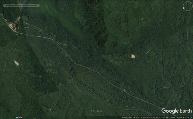
Geeogle Earth image of the Cedar River Valley south of North Bend by Rattlesnake Ledge.
.
But the Lidar image, which is online as part of an article about landslide mapping in Washington State, provides a completely different understanding:
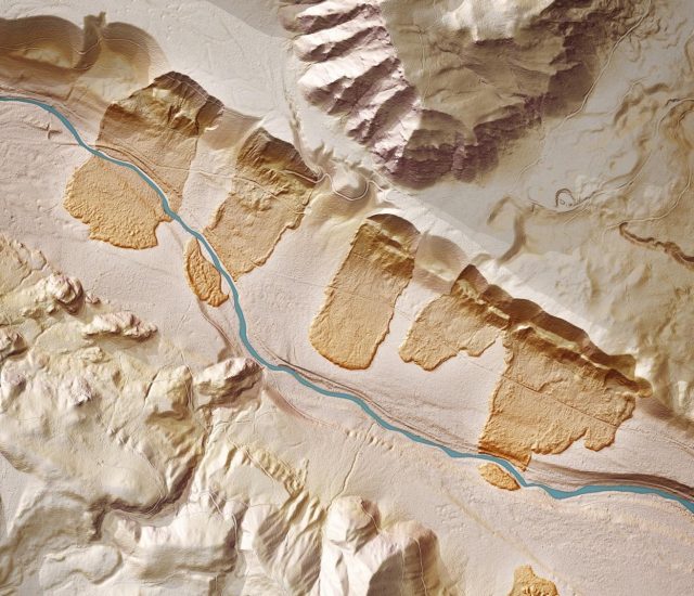
Lidar image showing landslides in the Cedar River Valley south of North Bend by Rattlesnake Ledge. Image by Washington State Department of Natural Resources.
.
Now five major landslides, all long runout flows, are evident. These have taken indeed taken a scoop out of the ridge, and have shown high mobility to flow across the plain below. In three cases the river has then eroded through them. Note the one on the left of the image has even flowed up onto the terrace on the far side of the river.
Others will be able to comment on the origin of these remarkable landslides, but in a seismically-active area my starting point might be an historic earthquake. Understanding the presence of these flowslides transforms any analysis of the risk associated with landslides in this area. Without the Lidar these landslides would probably have been undetected.
 Dave Petley is the Vice-Chancellor of the University of Hull in the United Kingdom. His blog provides commentary and analysis of landslide events occurring worldwide, including the landslides themselves, latest research, and conferences and meetings.
Nice post, Dave. Stephen Slaughter, head of the DNR landslide effort, uses the lidar images of these slides in many of his public presentations on the issue; they’re pretty spectacular. Even more so when you consider what it looks like on the old 10-m DEMs :
https://www.google.com/maps/@47.4053124,-121.8255806,14.16z/data=!5m1!1e4