1 February 2016
Images of the Tbilisi Zoo landslide and flood disaster
Posted by Dave Petley
Images of the Tbilisi Zoo landslide and flood disaster
Last week I posted Google Earth images of the Tbilisi Zoo landslide and flood disaster last year, and suggested that contrary to reports at the time, the losses were not caused by a valley blocking landslide, but rather a more conventional landslide that transitioned into a debris flow and combined with many other smaller events. Since then I have been contacted by Dr Sergey Chernomorets, who is Senior Scientist of the Laboratory of Snow Avalanches and Debris Flows in the Faculty of Geography at Lomonosov Moscow State University in Russia. He visited the site in September 2015 with Prof. Igor Bondyrev from Tbilisi State University and Elena Savernyuk, also from Lomonosov Moscow State University. Sergey confirms that the major cause of the disaster was the landslide at Akhaldaba village, and that there is no sign of valley blockage.
He also points out that the disaster at Tbilisi Zoo was a new road junction at Gmirta Moedani (Heroes Square), which dammed the flow.
Sergey has very kindly provided some photographs of the disaster, which I reproduce here with his permission. These two images show the landslide at Akhaldaba that initiated the Tbilisi zoo landslide and flood disaster:
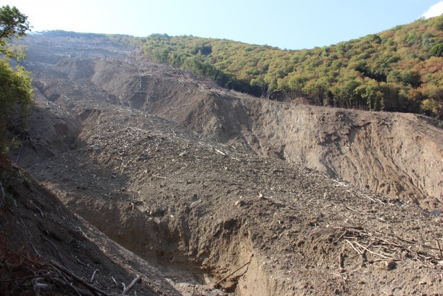
The Akhaldaba landslide courtesy of Dr Sergey Chernomorets
.
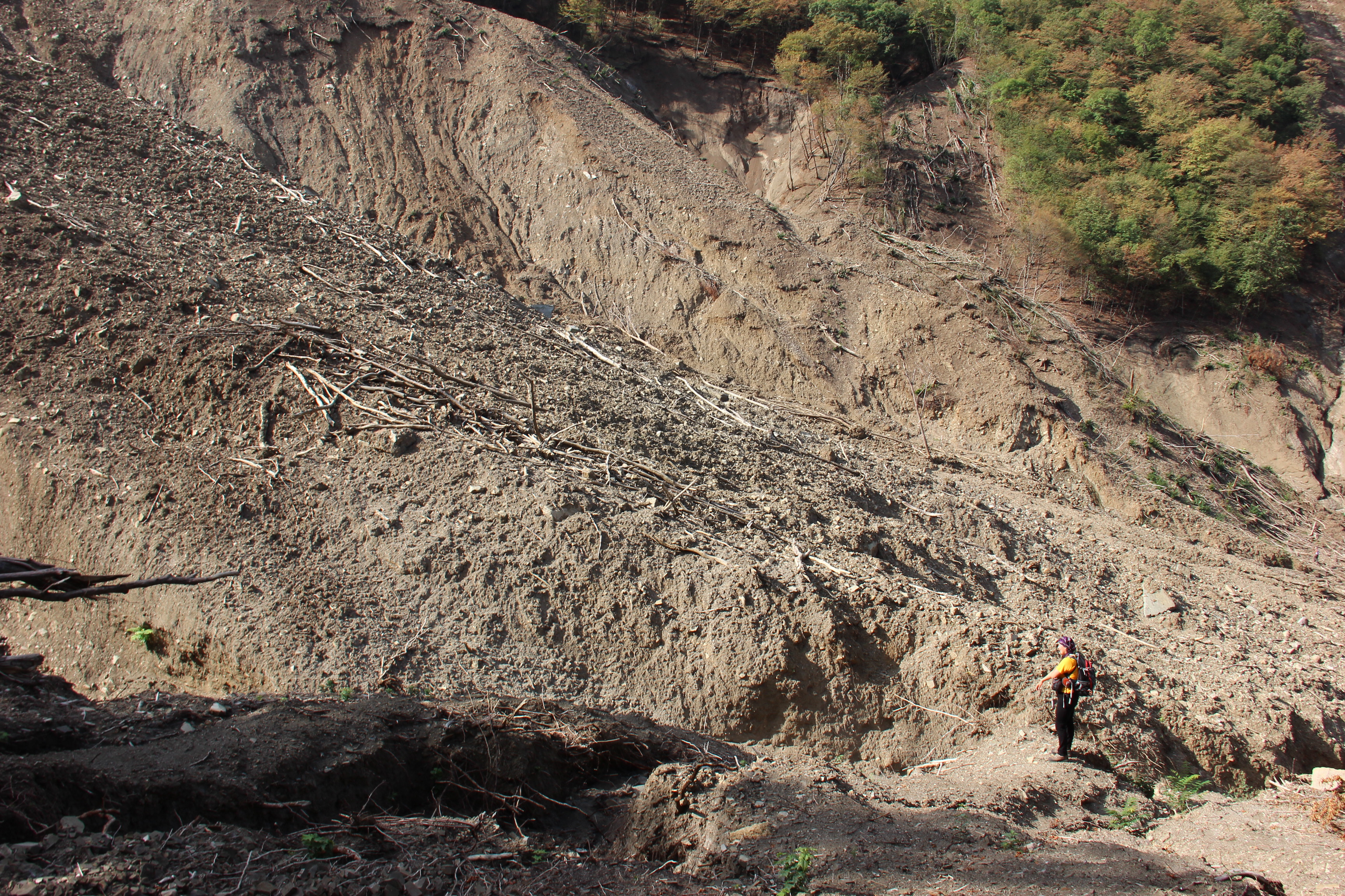
The Akhaldaba landslide courtesy of Dr Sergey Chernomorets
.
This is the road junction at Gmirta Moedani (Heroes Square) that dammed the flow and caused the terrible flooding that caused the loss of life the Tbilisi landslide and flood disaster:.
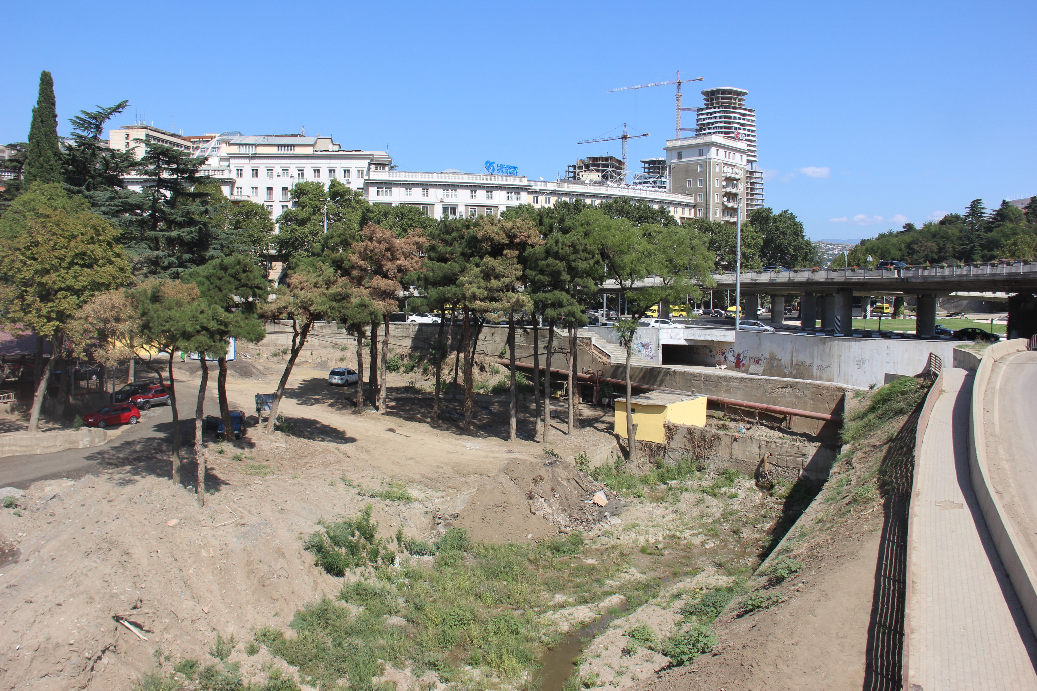
The new road junction at Gmirta Moedani (Heroes Square) that dammed the flow. Image courtesy of Dr Sergey Chernomorets
.
This is the site of the zoo that was so profoundly damaged:
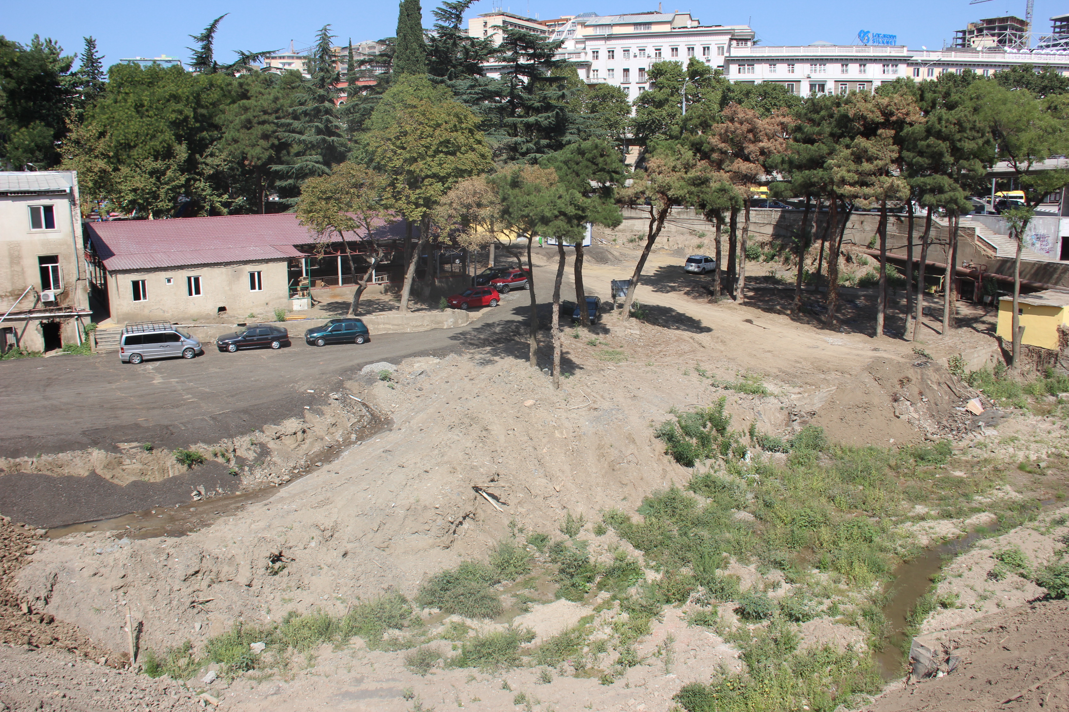
The site of Tbilisi Zoo courtesy of Dr Sergey Chernomorets
.
And this image is an example of the damage to the buildings in this area of Tbilisi. Note the height of the flood water and sediment on the walls:
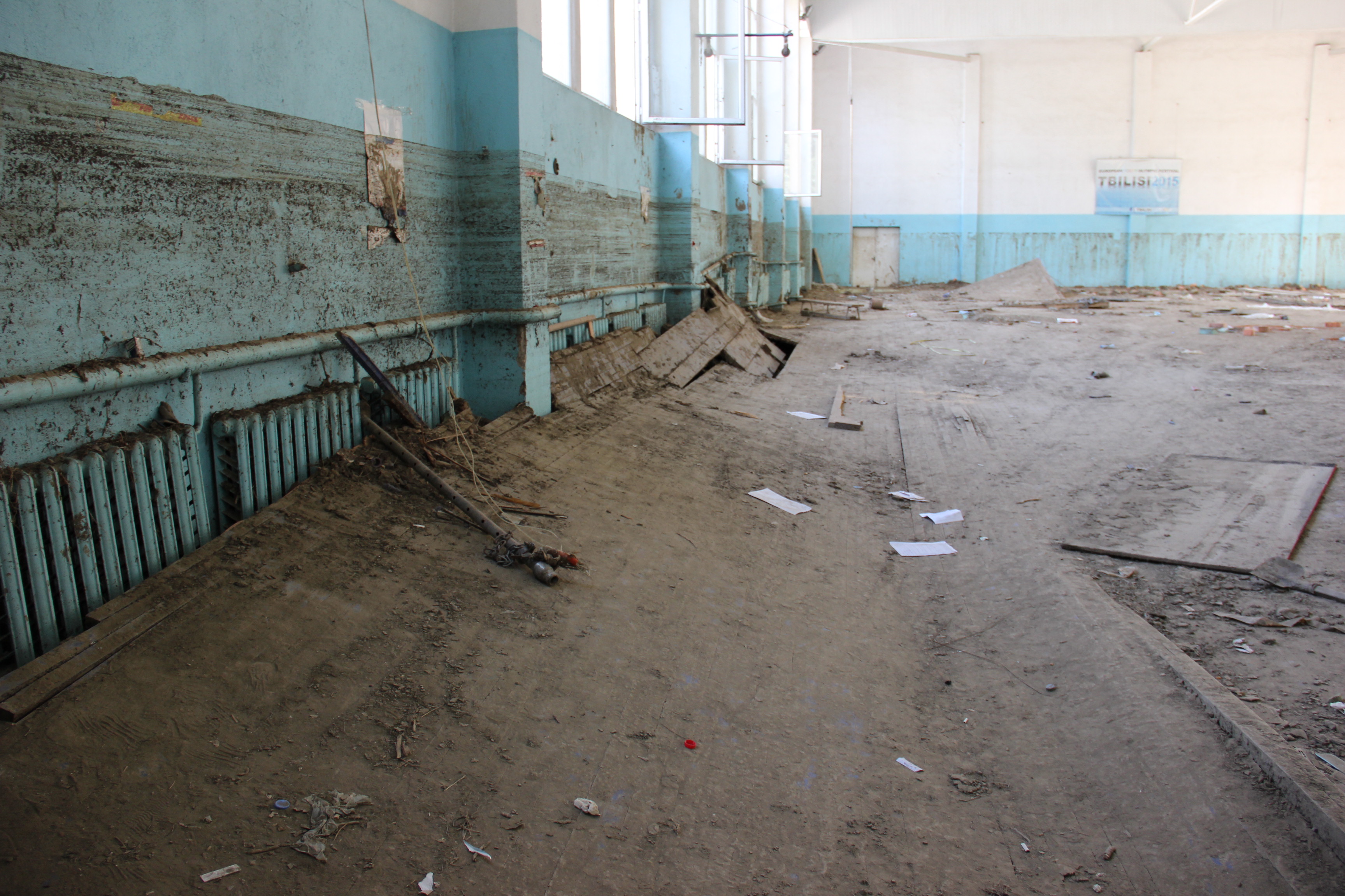
Building damage from the Tbilisi zoo landslide and flood disaster courtesy of Dr Sergey Chernomorets


 Dave Petley is the Vice-Chancellor of the University of Hull in the United Kingdom. His blog provides commentary and analysis of landslide events occurring worldwide, including the landslides themselves, latest research, and conferences and meetings.