
15 September 2015
Live landslide monitoring data from Nepal
Posted by Dave Petley
Live landslide monitoring data from Nepal
One of the great uncertainties in the aftermath of the April 2015 earthquake in Nepal was the likely behaviour of damaged slopes. It is well documented from other earthquakes, such as the 2005 Kashmir (Pakistan) earthquake and the 2008 Wenchuan (Sichuan) earthquake that many landslides occur after the main earthquake. Unfortunately our ability to forecast numbers of events and their locations is poor, mainly because of both a lack of understanding of the mechanics of these earthquake damaged slopes and of course the huge uncertainties about the likelihood of the meteorological events that trigger them. This is an image from after the 2005 Pakistan earthquake, showing just some of the cracked slopes:
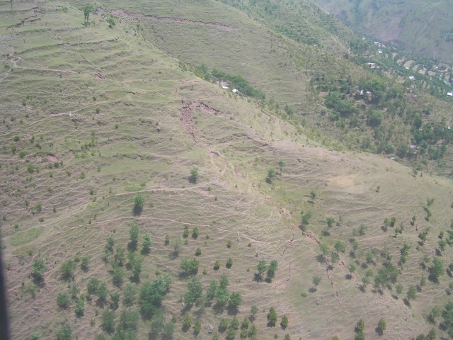
Cracked slopes in Kashmir after the 2005 earthquake
.
Amazingly, most of the slopes above have not failed since the earthquake and indeed most of the cracks have “healed” up and are now invisible.
My former colleagues at Durham, led by Dr Nick Rosser, have set up a project in Nepal to monitor slopes damaged by the 2015 earthquakes, funded by the UK research council NERC. Working with a range of partners in Nepal, they have installed landslide monitoring instruments in ten slopes in the earthquake affected areas. Interestingly, they are streaming the data live to the web via a graphing package. You can view the data on each of the instruments on their website. As the instruments are newly installed the data is mostly noise at present, though there are some interesting daily patterns that might or might not be important. It will be worth keeping an eye on this data in the coming months, especially if Nepal were to suffer a late monsoon rainfall event.
On their blog, the team have provided a description of the aims of the landslide monitoring project:
Our overall aim is to determine how hillslopes damaged during the 2015 Nepal EQS progressively deform in response to stress perturbations resulting from precipitation and continuing seismicity. Our proposed study site is the Upper Bhote Koshi (UBK), in Sindupalchowk District. The UBK was damaged during eqG, was < 10 km from eqK, and satellite and aerial imagery shows considerable widespread damage to slopes as a function of the close by (< 5 km) eqD. The critical Arniko Highway to Tibet, several major HEP plants, plus extensive roadside settlements, are all within the UBK. Our initial assessments from imagery indicate that EQ-triggered landsliding from eqK is characterised by small-scale but widespread rockfalls, and from eqD large-scale rockslope failures from ridgelines and reactivation of existing deeper-seated landslides, each with a clear directional tendency relative to the three epicentres). Colleagues in the UBK report extensively-cracked valley slopes, as seen in reconnaissance aerial photography from colleagues at USGS/USAID. Our data will most importantly quantify the relationship between stress perturbations and landsliding, but will also provide ground-truth for remotely-sensed deformation.
 Dave Petley is the Vice-Chancellor of the University of Hull in the United Kingdom. His blog provides commentary and analysis of landslide events occurring worldwide, including the landslides themselves, latest research, and conferences and meetings.
This is good. I think we saw a similar thing here on the North Coast of California after the 1992 cape Mendocino earthquake. Mountainous countryside near a triple junction was shaken violently during the 7+ quake and several large aftershocks. Ridgetop spreading and numerous rockfalls were reported near the epicenter, and three years later, a strong ENSO (El Nino) event occurred. Many large slides occurred throughout the region, particularly in the area closest to the epicenter.
People were injured, one small community was nearly wiped off the map by a large debris flow. Fisheries were heavily impacted. Modern forestry practices were changed forever as a result. Many of my professional colleagues up here probably wouldn’t be here if it wasn’t for that earthquake and the later regulatory oversight that built up.
[Good point – experience is that large numbers of landslides occur in the first unusually heavy rainfall event after the earthquake. Nepal won’t be out of the woods for some years yet. D]
In the photo those terracettes are man-made or are they natural from the creep process?
[Good question. I think they are semi-natural in that no-one has deliberately made them. However, human processes, in particular grazing of farm animals, may be a key factor in their development. D.]
New link to access the live monitoring data from 10 slope monitoring stations deployed in Nepal is here:
http://community.dur.ac.uk/nepal.2015eq/live-landslide-data/