24 August 2011
New satellite images of the Attabad landslide site
Posted by Dave Petley
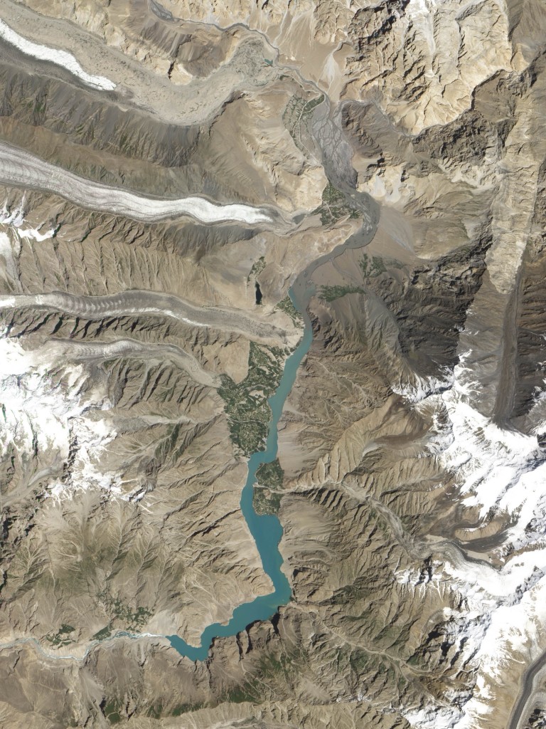
The NASA Earth Observatory, via the EO-1 satellite team, have kindly collected a new image of the Attabad dam site in northern Pakistan, and have made the images available. In the last few weeks there has been little solid information about the state of the dam, although in Pakistan the violent response by the authorities to a demonstration by displaced people, which resulted in the deaths of two men, has been a major news story.
This new image was collected early this month (3rd August) using the EO-1 satellite. The data have been processed into two products – a true colour composite (which resembles an aerial photograph):
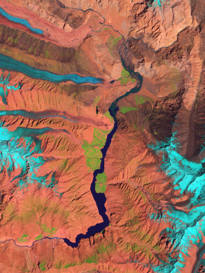
And second a SWIR image, which highlights the difference between land and water:
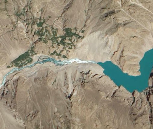
Of course the most interesting aspect is the evolution of the spillway. The image below shows this area on the TCC image:
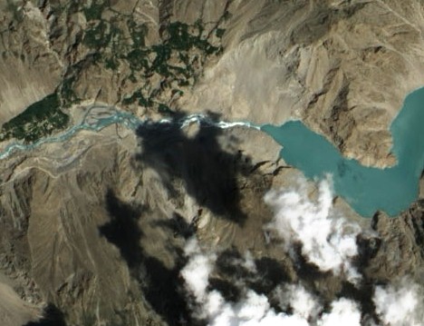
Compare this with an image collected by the same instrument in early June:
There is noticeably more flow through the spillway than in the earlier image, and there appears to have been some downstream erosion through widening of the channel. However the flow is still being controlled by the narrow section at the dam crest, which appears to have undergone little change.
Summer is now almost over in this part of northern Pakistan, such that flows will start to reduce again in the next few months. It will be interesting to see whether the government uses this coming winter to reduce the height of the dam.


 Dave Petley is the Vice-Chancellor of the University of Hull in the United Kingdom. His blog provides commentary and analysis of landslide events occurring worldwide, including the landslides themselves, latest research, and conferences and meetings.
The bottom of the upper spillway consists of extremely large slabs in a confined area. Something like a bridge crane will be needed to position a drilling rig over the slabs — if slant drilling from the banks will not suffice. Once the strata below the spillway are identified, charges could be placed in drilled holes to break up the slabs.
The problem with this approach is the demonstrated lack of available engineering resources with the necessary capabilities.
The US does have “bunker busting” munitions that could possibly break up the slabs, but how quickly the water will be released would be difficult to predict.
In either case downstream populations and property will have to be evacuated.
Failing that a sufficiently powerful earthquake will eventually drain the lake with catastrophic results for an unprepared downstream population.
[…] Geologist David Petley (International Landslide Centre at Durham University) has tracked the effects of the Hunza landslide since January 2010. He concluded that the Hunza lake levels probably stabilized by early July 2010, thanks to the spillway. Over the following 13 months, water flowing through the spillway eroded the landslide dam, widening the flow channel. Yet flow out of the lake and down the river valley remained constrained by the narrow inlet through the dam crest. Between July 2010 and August 2011, that crest changed little, Petley observed. […]
SWIR image, which highlights the difference between land and water really helpful understanding the situation
Very interesting image, but it would be very educational, have the same previous photo to landslip
[…] whether the dam failed catastrophically or incrementally, but it is interesting in the context of Attabad to note that some sort of breach event did occur even after this long period. This area is of […]
[…] lecture consists of a genral introduction to why I blog, a long and detailed case study of the Attabad landslide, and some reflections on the pros and cons of blogging, and potential problems and […]