
15 December 2016
Ancient monsoons helped prehistoric humans colonize Tibetan Plateau
Humans first colonized the Tibetan Plateau roughly 10,000 years ago when the climate warmed enough to bring heavy rains, new research finds.
Deposits discovered in Monterey Canyon’s mouth may cause marine landslides, study finds
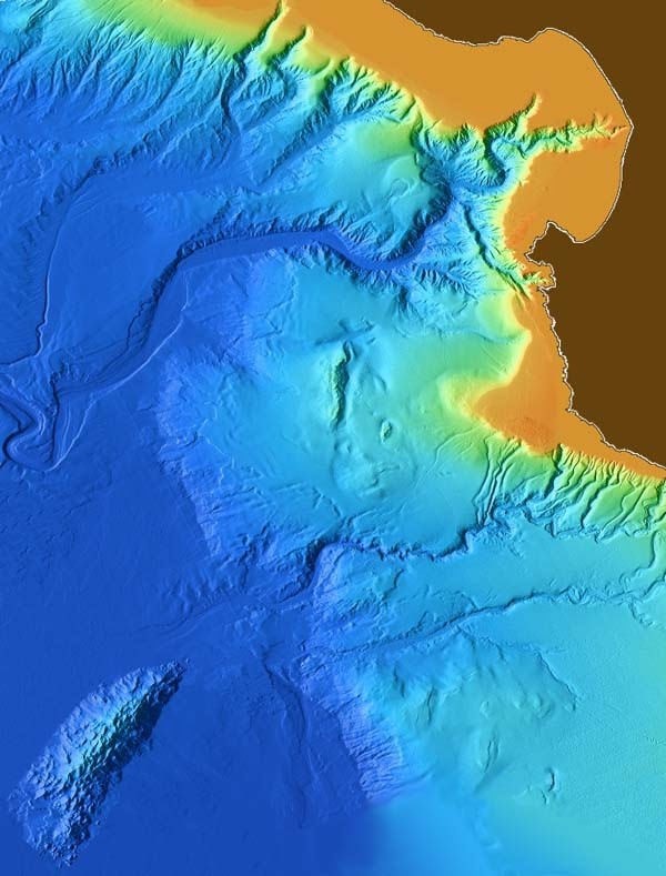
Researchers have discovered a large concentration of sediment deposits at the end of Monterey Canyon, an underwater chasm beneath Monterey Bay, California. The sediment deposits are relatively young and may be more likely to catalyze underwater landslides than other sections of the canyon, according to the researchers who presented their discovery at the 2016 American Geophysical Union Fall Meeting.
14 December 2016
Lake sediments may be key to predicting melting sea ice in Canadian Arctic
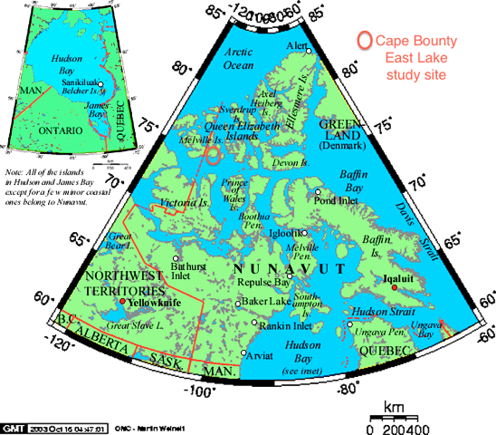
Sediment layers from a lake in the western Canadian Arctic may hold the key to predicting sea-ice loss and warming Arctic temperatures, new research finds.
Finger-like structures on Mars could be the result of ancient microbes
Finger-like rock structures on Mars could harbor potential evidence of past life on the Red Planet, according to new research. In 2007, NASA’s Spirit rover landed on Mars’ “Home Plate,” a flat 90-meter-long area within the Gusev crater. Since then, researchers have been trying to make sense of finger-like rock structures splayed across the landscape. The working hypothesis at the time was that these rocks started out as continuous layers but eroded into odd shapes by the touch of wind and sand over the years.
Magnetic fields help target buried mine waste for removal

Butte, Montana made national headlines last month after thousands of snow geese died in the toxic and acidic waters of the Berkeley Pit. The large, deep pool is the former site of a massive copper mine and is just one remnant of Butte’s extensive mining history. Over the past century and a half, heavy metals and acid from numerous local mines have seeped into the groundwater, forcing the city of Butte to rely on reservoirs for drinking water.
30 November 2016
Permafrost loss dramatically changes Yukon River chemistry

Permafrost loss due to a warming Alaska is leading to changes in the chemistry of the Yukon River Basin with potential global climate implications. This is the first time a Yukon River study has been able to use long-term continuous water chemistry data to document hydrological changes over such an enormous geographic area and long time span.
Little mine in Big Sur: Perpetuating mercury contamination in California’s Central Coast
Wildfires can perpetuate mercury contamination by releasing it from soil and plants and spreading it through smoke and ash. It doesn’t take much heat to convert mercury to a gas.
22 November 2016
Avalanches more complex than previously thought
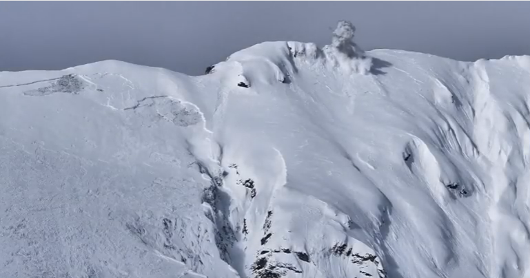
Avalanches can throw up a powdery cloud of snow as they violently charge down mountains, obscuring their inner workings from scientists. But new observations of artificially-triggered avalanches in Switzerland’s Vallée de la Sionne have penetrated this powdery veil.
18 November 2016
Older Mayan pyramid detected within Chichén Itzá
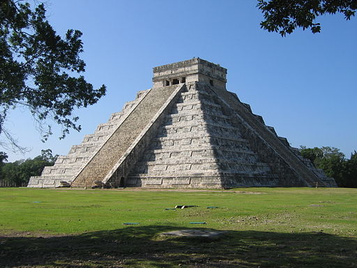
Scientists in Mexico have found evidence for a third and earlier—more purely Mayan—pyramid inside of the famous and iconic Pyramid of El Castillo at Chichén Itzá, in Yucatán. Using a non-destructive technique that employed hundred of electrodes deployed on the surface of the pyramid, the researchers also confirmed previous discoveries of a second pyramid, as well as their own 2014 discovery of a partially water-filled sinkhole beneath the pyramid.
17 November 2016
Study finds widespread land losses from Gulf oil spill
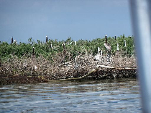
A new study shows dramatic, widespread shoreline loss in Louisiana marshlands most heavily coated with oil during the 2010 BP Deepwater Horizon oil spill in the Gulf of Mexico. Following the spill, the length of shoreline that receded more than 13 feet (4 meters) a year quadrupled compared to the year before the spill. The land losses occurred mainly in areas where oil had washed ashore during the spill.