
14 March 2017
Volcanic eruption expanded ozone hole to record size

On April 22, 2015, the Chilean volcano Calbuco erupted, spewing volcanic ash 10 kilometers (six miles) skyward. But Calbuco didn’t just tear a hole in the Earth that day. A new study suggests it also tore a hole in the sky.
13 March 2017
A perfect storm of fire and ice may have led to snowball Earth
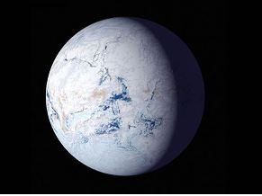
Harvard University researchers have a new hypothesis about what caused the runaway glaciation that covered the Earth pole-to-pole in ice.
9 March 2017
Climate change puts California’s snowpack under the weather
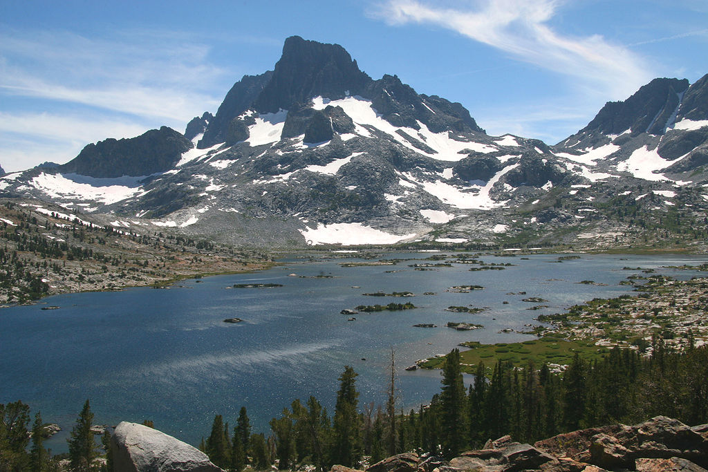
Skiing in July? It could happen this year, but California’s days of bountiful snow are numbered. The Sierra Nevada snowpack, which provides 60 percent of the state’s water via a vast network of dams and reservoirs, has already been diminished by human-induced climate change and if emissions levels aren’t reduced, the snowpack could largely disappear during droughts, a new study finds.
3 March 2017
New technique can improve particle warnings that protect astronauts

In a new study, scientists from NASA and the National Center for Atmospheric Research find the warning signs of one type of space weather event can be detected tens of minutes earlier than with current forecasting techniques – critical extra time that could help protect astronauts in space.
2 March 2017
Study improves forecasts of summer Arctic sea ice
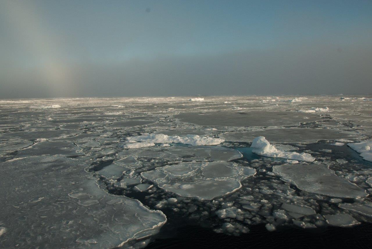
Each year, as sea ice starts to melt in the spring following its maximum wintertime extent, scientists still struggle to estimate exactly how much ice they expect will disappear through the melt season. Now, a new NASA forecasting model based on satellite measurements is allowing researchers to make better estimates.
Historic earthquakes discovered along San Andreas Fault
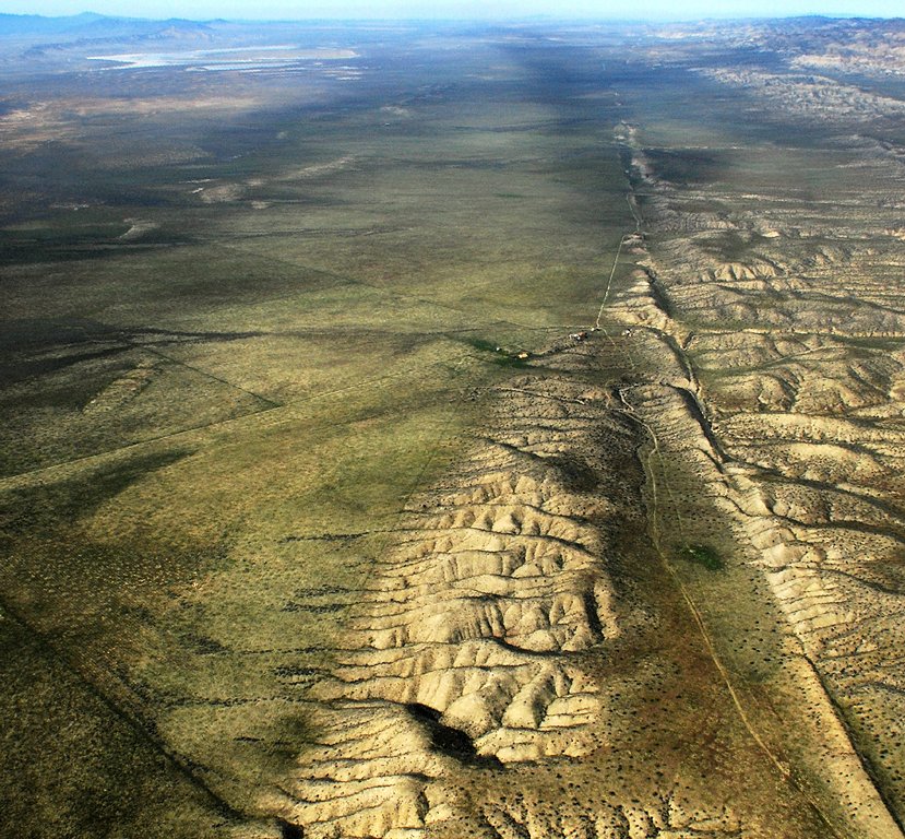
A new U.S. Geological Survey study offers a view into the past behavior of large earthquakes along the southern San Andreas Fault. In the study, USGS geologist Kate Scharer and her team excavated trenches across the fault near Frazier Mountain in northeastern Ventura County. This section of the San Andreas previously had no long paleoearthquake record. The researchers found evidence of 10 ground-rupturing earthquakes on this section of the fault between 800 A.D. and the last rupture in 1857.
1 March 2017
WMO verifies highest temperatures for Antarctic Region
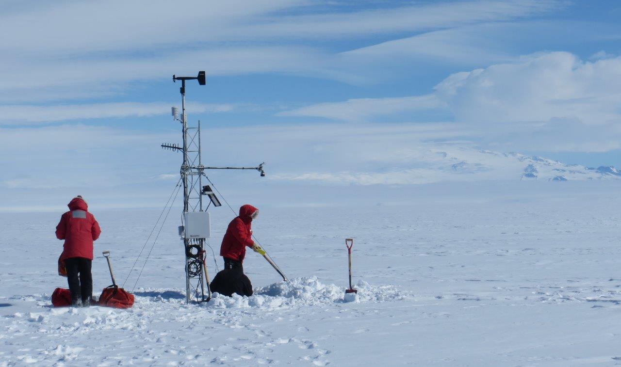
A World Meteorological Organization (WMO) committee of experts has announced new records for the highest temperatures recorded in the Antarctic Region as part of continuing efforts to expand a database of extreme weather and climate conditions throughout the world.
24 February 2017
Are we living in a warm peak between ice ages?

By Ned Rozell As another major rainstorm hit California in February, downtown San Francisco surpassed its normal rain total for an entire year. Reservoirs in the high country were spilling over. So ended a five-year drought in the state that some people attributed to human-caused climate change. Those pictures of dried-up California lakes bothered Syun-Ichi Akasofu, who recently gave a talk “The Forthcoming Ice Age” at the University of Alaska …
16 February 2017
Ancient cave reveals recent droughts in the Middle East were most severe for over a millennium

A stalagmite collected from a remote cave in the Middle East has revealed that recent droughts there were more severe than previously thought, and therefore possibly an important contributing factor for the turmoil in Syria. A research team traveled to Iraq to collect the stalagmite and used it to present the first ever detailed climate reconstruction of the Fertile Crescent extending back 2,400 years.
15 February 2017
Researchers catch extreme waves with higher resolution modeling
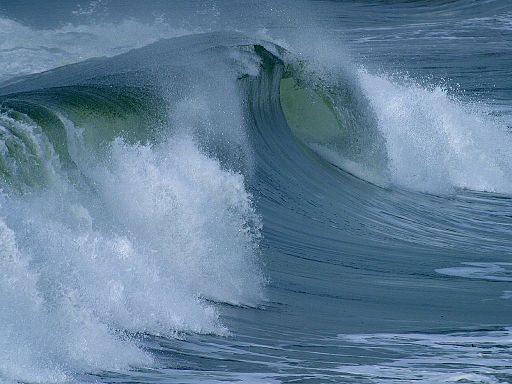
Surfers aren’t the only people trying to catch big waves. Using decades of global climate data generated at a spatial resolution of about 25 square kilometers (10 square miles), researchers were able to capture the formation of tropical cyclones and the extreme waves that they generate. Those same models, when run at resolutions of about 100 kilometers (60 miles), missed the tropical cyclones and the big waves up to 30 meters (100 feet) high.