
2 March 2017
Historic earthquakes discovered along San Andreas Fault
Posted by Lauren Lipuma
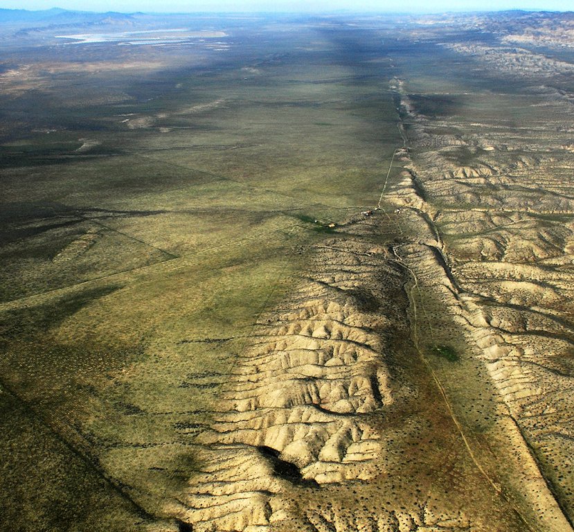
Aerial photo of San Andreas Fault looking northwest onto the Carrizo Plain with Soda Lake visible at the upper left.
Credit: John Wiley, own work, CC BY 3.0.
By Donyelle Davis
A new U.S. Geological Survey study offers a view into the past behavior of large earthquakes along the southern San Andreas Fault.
In the study, USGS geologist Kate Scharer and her team excavated trenches across the fault near Frazier Mountain in northeastern Ventura County. This section of the San Andreas previously had no long paleoearthquake record. The researchers found evidence of 10 ground-rupturing earthquakes on this section of the fault between 800 A.D. and the last rupture in 1857.
When combined with the other San Andreas Fault records, the new study represents one of the most significant records of Earth’s past earthquakes. The study is important for understanding both earthquake recurrence and earthquake hazards in California, according to the authors.
“In order to properly design infrastructure, like highways, water and power lines, so that it can survive the next earthquake, we study how often and how big prehistoric earthquakes were,” Scharer said. “This work provides a new long record where we previously had very little data. The record shows that large earthquakes occurred near Tejon Pass on average every 100 years. Most appear to be quite large, between magnitude 7.0 and magnitude 7.5.”
The new study has been accepted for publication in the Journal of Geophysical Research: Solid Earth, a journal of the American Geophysical Union.
The averege time between earthquakes in the record studied is about 100 years. Statistical evaluation of the timing between earthquakes reveals they are not random in time, but show a very weak periodicity. For example, some inter-earthquake periods are as short as 20 years, while at least one period was almost 200 years long. Such patterns are consistent with other locations along the San Andreas Fault where these prehistoric earthquake records are available.
The last earthquake to rupture the southern San Andreas Fault occurred in 1857. That earthquake ruptured a section of the fault that was about 340 kilometers (210) miles long, with an estimated magnitude of 7.9. Looking at the prehistoric record along the same stretch as the 1857 earthquake, Scharer and her colleagues find that since 1300 A.D. only one in eight of the past ruptures could have broken the same stretch of the fault. This suggests that most ruptures are slightly smaller than the 1857 event, about M7.5. Official USGS forecasts for California earthquakes, which included data from Frazier Mountain, forecast a 16 percent chance that a M7.5 or larger earthquake will occur on this section of the fault in the next 30 years.
— Donyelle Davis is a public affairs specialist at USGS. This post originally appeared as a press release on the USGS website.