
28 December 2015
Storm runoff could help replenish dwindling California aquifers
Posted by Lauren Lipuma
by Lindzi Wessel
Depleted groundwater supplies in the parched state of California have left many communities scrambling to secure water for the future. Now, researchers have a plan to recharge groundwater aquifers in Santa Cruz and Monterey counties with runoff captured from rainstorms. Using models that carefully characterize the region, they produced maps highlighting the best sites for stormwater capture in their own backyards.

An animated map of the progression of the historic 2012–2014 California drought, spanning from December 31, 2013, to July 29, 2014. The map highlights the rapid spread of Extreme and Exceptional Drought conditions across over 75% of California during 2014. This drought is officially the worst drought California has experienced in 1,200 years. Credit: National Drought Mitigation Center via Wikimedia Commons.
“Historically, stormwater has been seen as a nuisance, not as a resource,” said Andrew Fisher, a hydrogeologist at the University of California, Santa Cruz and the project’s principal investigator. Right now, most of that water is going straight into the ocean, but by strategically placing aquifer recharge sites, communities and farmers can put that runoff back into the ground to replenish depleted groundwater stores, he said.
The researchers are looking for sites where the right combinations of land features would enable high efficiency capture of runoff that would otherwise rush to the sea. These sites would funnel runoff to underground aquifers by allowing the water to seep through layers of sediment at the bottom of infiltration basins or by streaming it into dry wells drilled into the ground.
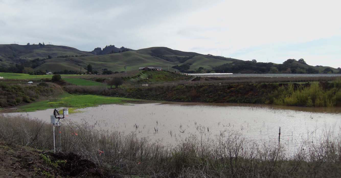
A two-acre infiltration basin functions to recharge groundwater stores in the Pajaro Valley of California. Water slowly permeates the layers of sediment at the bottom of the basin to reach the aquifer below.
Credit: Andrew Fisher.
The slope of the land, proximity to aquifers, and the type of sediment present are all factors that affect how easily water can flow into a recharge site and trickle into the underground streams below, Fisher said. His team integrated extensive data on such features into maps that enable users to pinpoint the best places in the region to establish aquifer recharge projects. The research team presented their maps, which will eventually be made available to the public, at the 2015 American Geophysical Union Fall Meeting in San Francisco.
“We want to give tools to people to make the best decisions,” Fisher said.
One of these projects can produce enough water to sustain two families for a year, he said. The team’s goal is to establish 10 to 12 projects scattered across the region, and Fisher said this approach could benefit other areas as well.
Solving California’s water troubles will require a “cornucopia” of solutions, said Elen Teo, a graduate student in Earth and planetary sciences at UC Santa Cruz who was part of the research team. But taking advantage of these inexpensive systems to redirect stormwater runoff into aquifers will be an important part, she said.
“This is the low-hanging fruit,” she said.
– Lindzi Wessel is a science communication graduate student at UC Santa Cruz. You can follow her on twitter at @LindziWessel.


