
28 December 2015
Parts of Sierra Nevada Mountains more susceptible to drought than previously thought, study finds
Posted by Lauren Lipuma
by Ramin Skibba
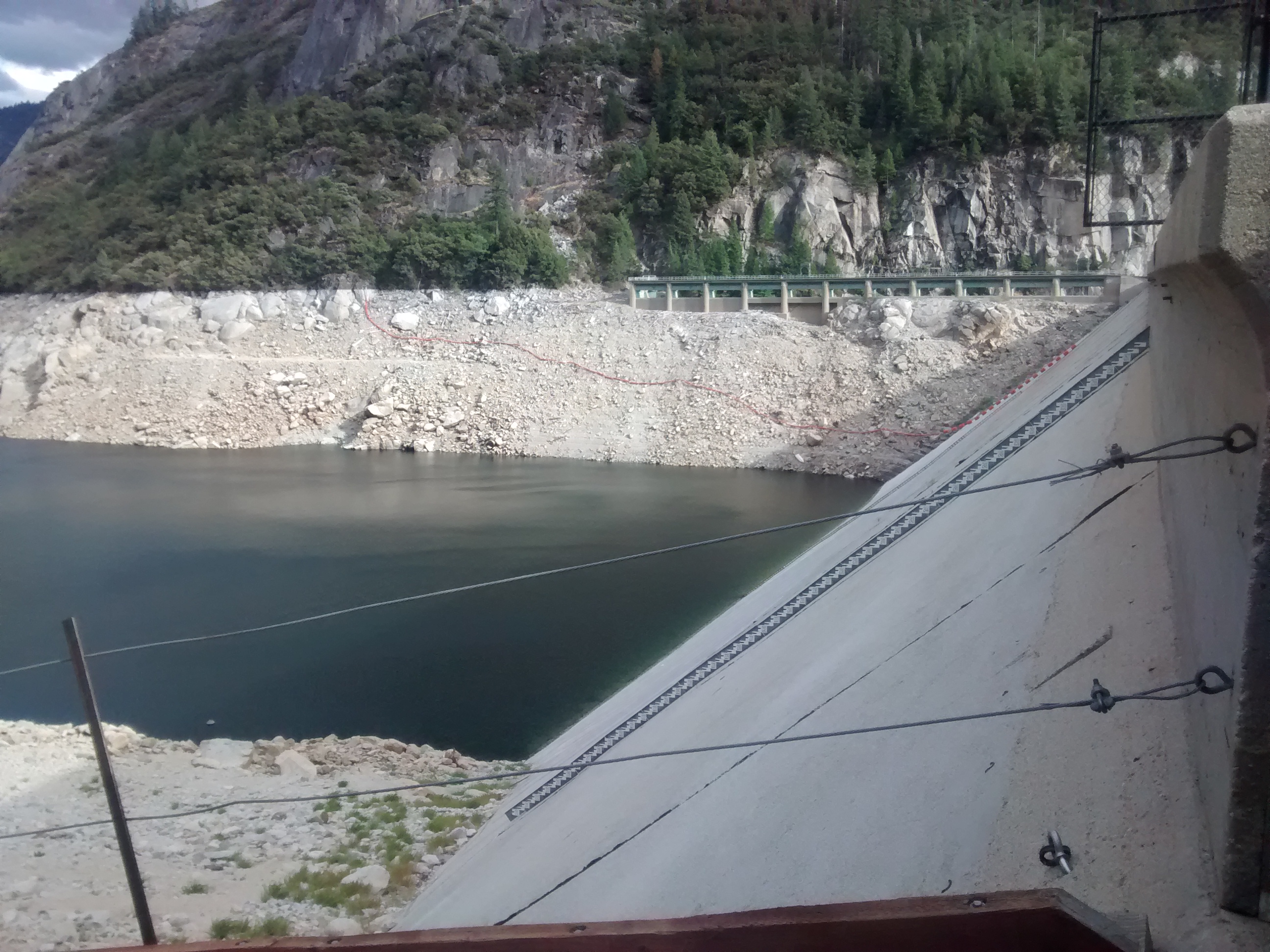
The Salt Springs Reservoir, in the Sierra Nevada Mountains east of Sacramento, has experienced dropping water levels, barely covering the lowest gauges installed by the U.S. Geological Survey.
Credit: Rowan Gaffney
Particular areas in California’s Sierra Nevada Mountains have a high capacity to store water but are more susceptible to droughts than previously thought, new research finds.
“The areas we think that are most resilient to drought are actually more vulnerable to the transition from historical droughts to more extreme ones, like the one happening now,” said Rowan Gaffney, a geoscientist at the University of Nevada, Reno, and lead author of the study.
Every year, accumulated snowpack in the region stores water, which melts during the summer and recharges groundwater that flows into river and stream areas. Ecosystems, communities and agricultural irrigation depend on that water downstream, Gaffney said.
In the new study, Gaffney and fellow University of Nevada geoscientist Scott Tyler investigated the relationship between groundwater and stream flow in 10 strategically chosen locations throughout the Sierra Nevada in eastern California. High groundwater storage areas are losing the most water during the current drought, Gaffney reported at the 2015 American Geophysical Union Fall Meeting.
NASA’s Gravity Recovery and Climate Experiment (GRACE) enabled the scientists to explore relationship between groundwater storage and rivers and streams. GRACE consists of two orbiting spacecraft flying in tandem and measuring minute variations in the Earth’s gravitational field. Water moisture, surface water and groundwater produce these variations. In the Sierra Nevada, where much of the snow melts and the soil dries throughout during summer, the satellites’ measurements primarily probe groundwater, making them a valuable resource, Gaffney explained.
Gaffney, Tyler and their colleagues also acquired hydro-climatic data from the U.S. Geological Survey, which employed gauges in areas embedded in different types of rock—with different water storage capacities—throughout the mountain range. These recorded stream flow on a daily basis over many decades, providing measurements that probed the regional variation during both high-water and drought years.
Over the past two years, the scientists observed a precipitous drop in both stream flow and groundwater storage, now both at historical lows, suggesting that the region is entering uncharted territory, Gaffney said. These two years have also been among the warmest and driest on record, according to the National Oceanic and Atmospheric Administration (NOAA).
For eight of the 10 sites they studied, Gaffney and his team observed a significant correlation between groundwater and stream flow: in dry years, when the mountains stored less water, the streams and rivers also delivered less. They found a particularly strong correlation in northern sites surrounded by porous volcanic rock known to have a high capacity for water storage.
Gaffney anticipates that his research could inform water management policy in the Southwest as severe droughts continue to plague the region.
– Ramin Skibba is a freelance science writer and a graduate student in the UC Santa Cruz science communication program. You can follow him on twitter at @raminskibba.