13 June 2012
Exploring where Earth’s crust rips apart
Posted by kramsayer

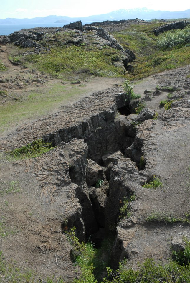
Almannagjá, the crack that marks the spot where the North American plate is pulling away from the Mid-Atlantic Ridge, and the destination for a Chapman Conference field trip Tuesday. (Credit: Ramsayer)
GeoSpace is in Selfoss, Iceland this week, reporting from AGU’s Chapman Conference on Volcanism and the Atmosphere. Check back for posts on the science presented at the meeting, as well as field trips to nearby volcanoes and geologic features.
Þingvellir, Iceland – There aren’t many places in the world where you can walk along a “mid-ocean ridge” and still keep your feet dry. But here the separation of two vast slabs of Earth’s crust—a slow-moving drama usually hidden far below the ocean waves at the bottom of the sea—takes place in plain view. The North American plate is pulling away from the European plate, creating spectacular cracks in the lava-covered landscape and a wide rift zone. As the continental plates move apart, lava fills the gap creating a bed of fresh crust between them.
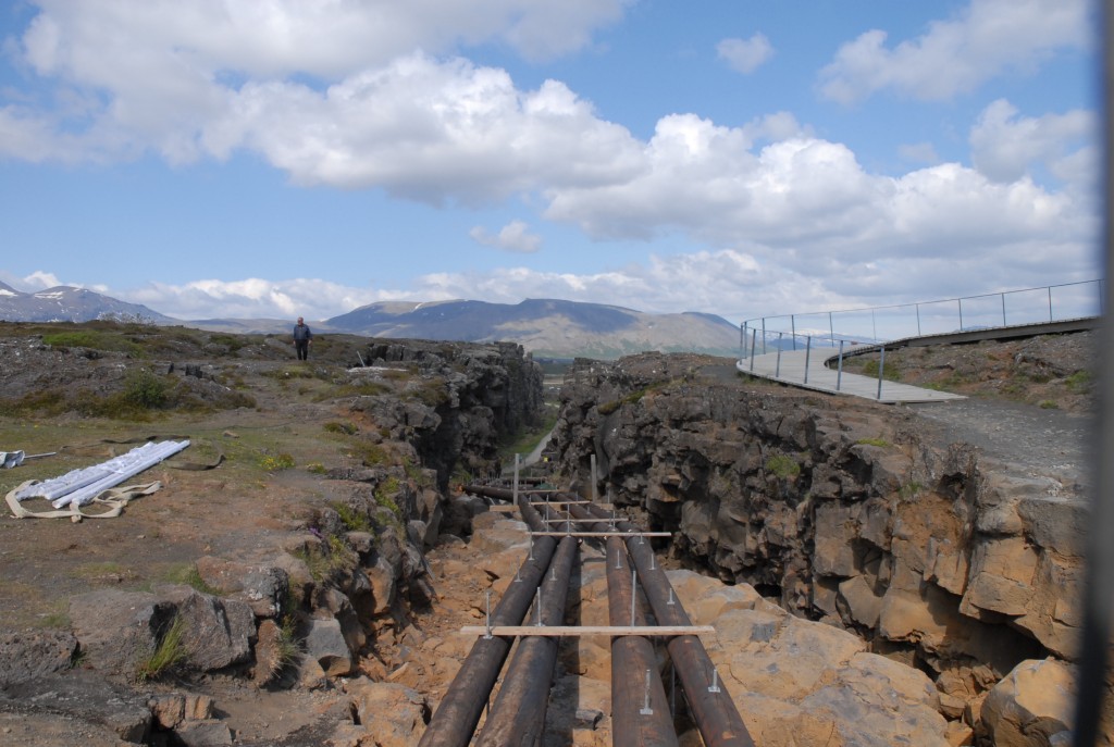
“What we’re seeing is the spreading of the mid-Atlantic ridge on land,” said Jónas Gudnason, a geology graduate student with the University of Iceland in Reykjavik, standing beneath the 40 meter (130 foot) cliffs that drop from the North American plate to the rift zone below. “Now we’re in no-man’s-land.”
Gudnason led a field trip Tuesday to this above-sea-level segment of the ridge, which continues for thousands of kilometers along the sea floor both north and south of Iceland. About three dozen volcanologists, climate scientists and others toured the Þingvellir area (the Icelandic ‘Þ’ letter makes a ‘th’ sound) as part of the week-long Chapman Conference on Volcanism and the Atmosphere, sponsored by the American Geophysical Union in nearby Selfoss.

Although the path into Almannagjá was closed -- it had collapsed the week before -- field trip participants got a glimpse of the scale of the ridge. (Credit: Ramsayer)
Gudnason pointed to the east, to a ridge about 7 km (4.4 miles) away, where the Eurasian plate creeps east. The plates spread apart at a rate that averages out at about 7 mm (roughly 1/3 inch) per year, but often happens suddenly. The historic Icelandic parliament – formed in 930 in Þingvellir so chieftains could settle differences and criminals could be punished – had to move in 1789 because the nearby land dropped several meters when the plates jerked apart.
The ground around Þingvellir is covered with hardened lava, likely the result of a single eruption of the Hengill volcanic system that endured over many years, Gudnason said. Marking the boundary of the North American plate, a crack called Almannagjá, stretches for more than 7 km (4.4 mi). It starts as a narrow fissure in the ground at the south end, and grows to towering canyon cliffs farther north.

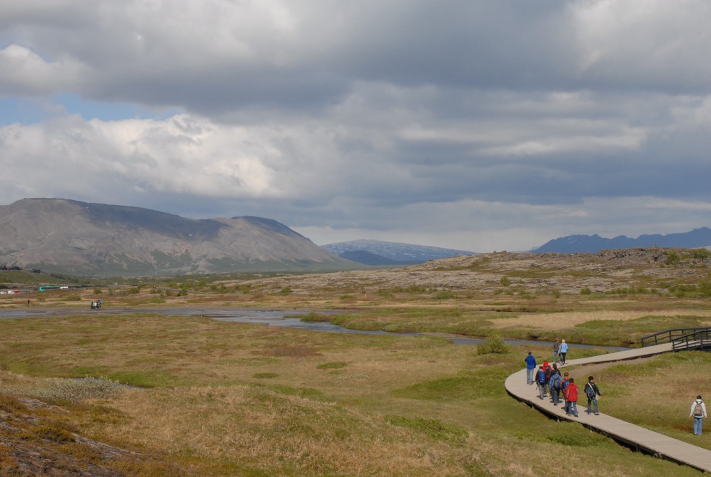
Geologists, climate scientists and others walk along a boardwalk over the graben - the place where the North American and Eurasian plates have spread apart, leaving the rift zone in the gap. (Credit: Ramsayer)
The rift area to the east of Almannagjá, called a graben, stretches up to 20 kilometers (12.5 miles) farther east before it reaches the cliffs marking the Eurasian plate. Deep, jagged fractures mark where plate movements have torn the graben apart.
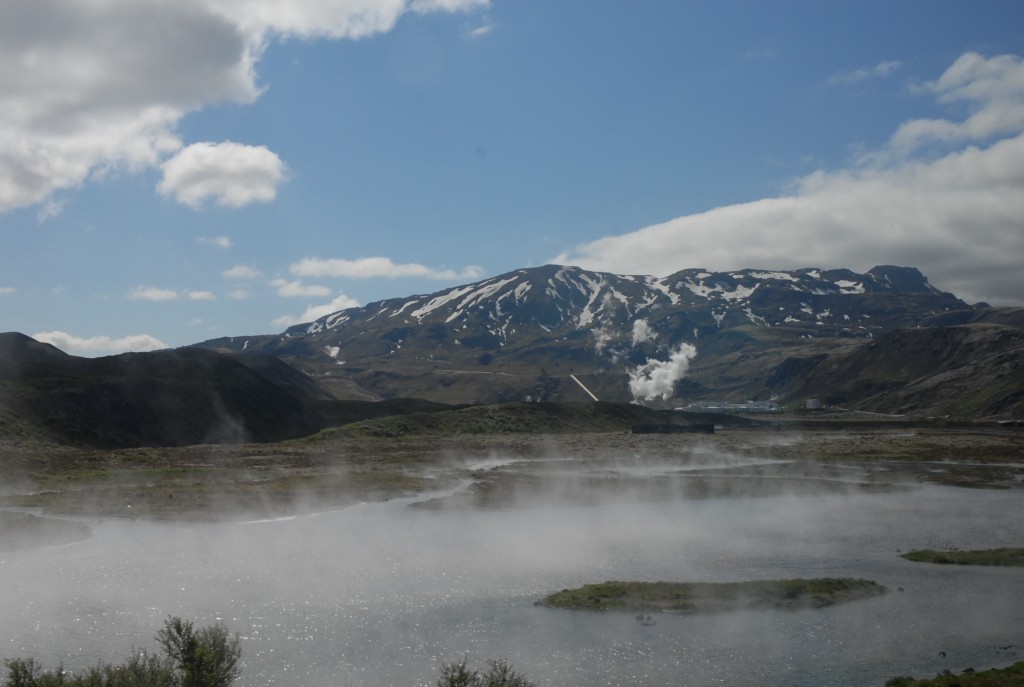
The field trip also stopped at an overlook of a geothermal plant, which taps into natural hot springs fueled by the Hengill volcano system. The plant sends hot water to Reykjavik, Gudnason said, losing only 1 degree Celsius (1.8 degrees Fahrenheit) between the facility and showers in Iceland’s capital.
–Kate Ramsayer, AGU Science Writer


 GeoSpace is a blog on Earth and space science, managed by AGU’s Public Information staff. The blog features posts by AGU writers and guest contributors on all sorts of relevant science topics, but with a focus on new research and geo and space sciences-related stories that are currently in the news.
present will always be key to the past. my regards to all the participants and the amazing crop of organisers, would definitely want to participate next time.