
15 November 2016
Kaikoura earthquake landslides: the picture slowly emerges
Posted by Dave Petley
Kaikoura earthquake landslides: the picture slowly emerges
As parts of New Zealand continue to reel under the combined effect of the ongoing aftershocks and the effects of very heavy rainfall, the effects and extent of the Kaikoura earthquake landslides are slowly emerging. Much of the focus has been on the coast, and in particular the major landslides that have blocked SH1 and left Kaikoura itself isolated. New images have appeared online of these landslides, which are undoubtedly dramatic. This image was collected by Sargeant Sam Shepherd of the Royal New Zealand Defence Force:
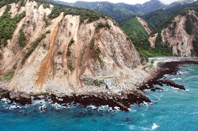
One of the Kaikoura earthquake landslides by Sgt Sam Shepherd of the Royal New Zealand Defence Force
.
Meanwhile some of the most impressive landsliding may well be inland in the Kaikoura Range of hills. The landslide on the Dart Stream that temporarily blocked the valley drew some attention, and this is the first image that I have seen that gives a wider perspective. It suggests extensive landsliding in the range:
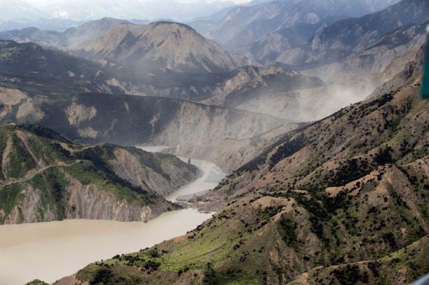
A first image of Kaikoura earthquake landslides in the Kaikoura range
.
I suspect that this is the location on Google Earth:
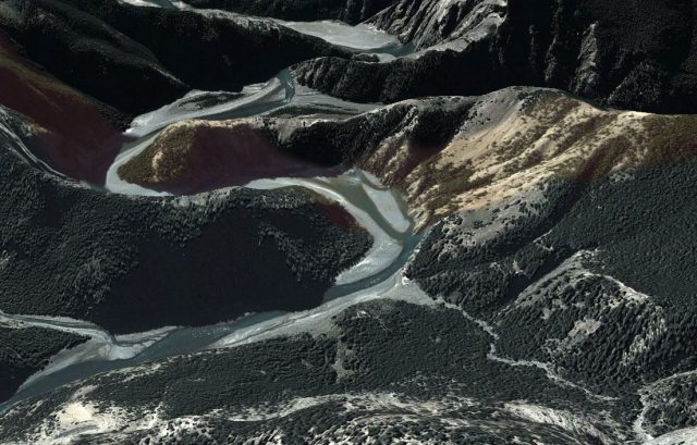
Google Earth image of one of the largest of the Kaikoura Earthquake landslides
.
There will now be a great deal of interest in the extent of the landslides triggered by this earthquake. You can get a reasonable first order estimate of this by comparing the location of the aftershocks to the topography. As a very approximate estimate, the area with steep topography within the area defined by the main aftershocks will have been at a high risk of significant landslides. This is GNS / Geonet aftershock data plotted on Google Earth, with the location of the valley-blocking landslide above shown:
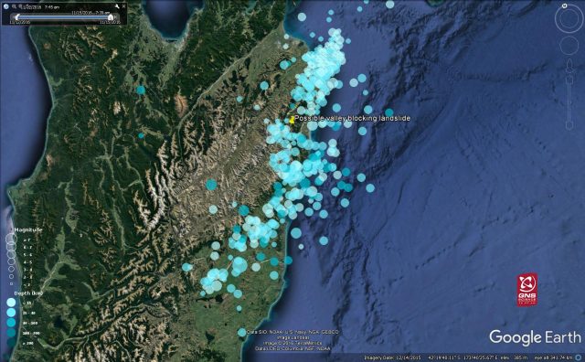
The location of Kaikoura earthquake aftershocks plotted on Google Earth
.
The map suggests that a substantial upland area may have been affected by landslides. Of course this sort of approach is extremely rough and ready, and needs to be replaced quickly with proper field data, but it does give an indication of the magnitude of the problem facing New Zealand.
 Dave Petley is the Vice-Chancellor of the University of Hull in the United Kingdom. His blog provides commentary and analysis of landslide events occurring worldwide, including the landslides themselves, latest research, and conferences and meetings.
Luckily the dam on the Clarence overtopped and gently breached by eroding itself a new channel, starting Monday afternoon. (I flew over that on Wednesday morning).
We’re working as rapidly as we can with both helicopter recce and satellite data as it comes to hand.