
5 June 2015
Malaysia earthquake: early reports of seismically-triggered landslides
Posted by Dave Petley
Malaysia earthquake
Early on Friday morning (local time) a shallow (depth = 10 km) M=6.0 earthquake struck the west coast of Sabah in Malaysia:
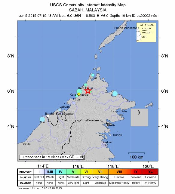
.
Whilst not being large, this earthquake appears to have been responsible for at least some landslide activity. The clearest reports at the moment at from Mount Kinabalu, which is a popular trekking/climbing route. IBT Times is reporting that at least five climbers were killed close to the summit of the mountain:
The quake caused huge boulders and rocks to roll down the mountain as the climbers were descending at about 7.17 am, the report said.
Interestingly, The Star has an image that suggests that there has been a major rockfall at the summit of the mountain that has profoundly changed the geomorphology of the peak, known as the Donkey’s ears:
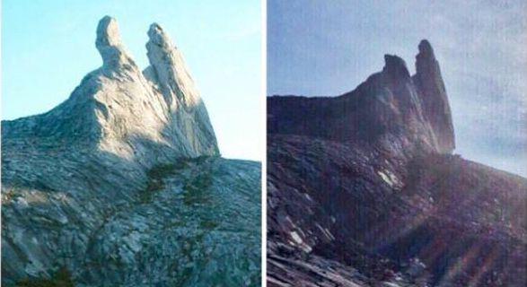
.
This would be a very substantive rockfall. There is also some early footage from the foot of the mountain that appears to show dust plumes created by the rockfalls:
.
Some early reports suggest landslides away from the mountain as well – this image possibly shows a lateral spread or fill slope failure; there are similar images from elsewhere on Twitter:
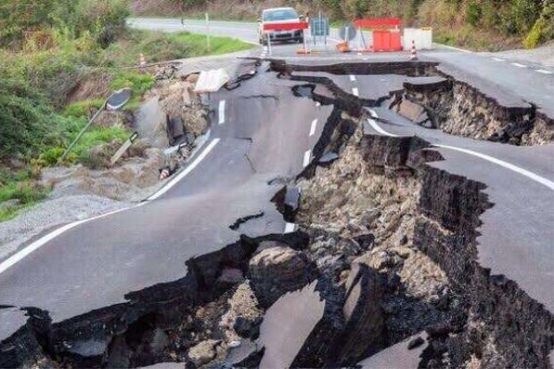
.
Hopefully more information will emerge in the coming hours. This earthquake should not have been responsible for large-scale loss of life, but there could be at least some infrastructure damage in a smallish area close to the epicentre.
 Dave Petley is the Vice-Chancellor of the University of Hull in the United Kingdom. His blog provides commentary and analysis of landslide events occurring worldwide, including the landslides themselves, latest research, and conferences and meetings.
Note how thick the asphalt is in the roadway photo. This is an existing slide that has been creeping for a long time.