
7 August 2013
Of Stars and Stripes: Satellites Used to Predict Zebra Migrations
By Lisa-Natalie Anjozian
One of the world’s longest migrations of zebras occurs in the African nation of Botswana, but predicting when and where zebras will move has not been possible until now. Using NASA rain and vegetation data, researchers can track when and where arid lands begin to green, and for the first time anticipate if zebras will make the trek or, if the animals find poor conditions en route, understand why they will turn back.
Covering an area of approximately 22,000 square kilometers (8,500 square miles), Botswana’s Okavango Delta is one end of the second longest zebra migration on Earth, a 580-kilometer (360-mile) round trip to the Makgadikgadi Salt Pans—the largest salt pan system on the planet. Zebras walk an unmarked route that takes them to the next best place for grazing, while overhead thundering cloudbursts of late October rains drive new plant growth, filling pockmarks across this largest inland delta in the world.
High above, Earth-orbiting satellites capture images of the zebras’ movements on this epic trek, as well as the daily change in environmental conditions. Zebras don’t need data to know when it’s time to find better forage: the surge of rain-coaxed grasses greening is their prompt to depart. But now, researchers are able to take that data and predict when the zebras will move.
Pieter Beck, research associate with the Woods Hole Research Center in Falmouth, Mass., and three collaborators studied animal migration in a novel way, which they described in a paper to be published in the Journal of Geophysical Research–Biogeoscences, a publication of the American Geophysical Union. While tracking animal movement with satellites has been accomplished many times, Beck said, he and his team also used a series of satellite images of vegetation growth and rainfall to shed unprecedented light on what cues animals use and how their migrations respond to environmental change.
Zebra Mind: A Band of Scientists Earn Their Stripes
The Zebra Migration Research Project began in 2008 after Hattie Bartlam-Brooks, a research associate in biological sciences at the University of Bristol, in the U.K., and her team discovered the migration during field work for the Okavango Herbivore Research Project, a collaboration between Bristol and the University of Botswana. Anecdotal evidence prior to the 1970s described a zebra migration from the Okavango Delta to the Makgadikgadi Salt Pans at the start of the rainy season in September and continuing through April. But from 1968 to 2004, veterinary fences prevented zebra from making the migration. The veterinary fences—which had been built to keep wild buffalo from transferring diseases to cattle—were taken down in 2004. Within three years of the removal of the veterinary fences, zebra began making movements on the migration path toward the salt pans. These movements were accurately recorded with the help of global positioning system (GPS) collars fitted to zebra mares.
Zebras in the wild live about 12 years, so the migration path could not have been learned from previous generations, said Bartlam-Brooks. She and her team observed that zebras begin their migration at the onset of the rains so she joined forces with Beck to see how extensively the environment influences the journey’s timing.
Beck combined this GPS movement data with satellite imagery taken from the months of migration to see how environmental conditions changed over time and across the landscape. The researchers tracked greening of leaves with the data acquired by the Moderate Resolution Imaging Spectroradiometer (MODIS) on board NASA’s Terra and Aqua satellites.
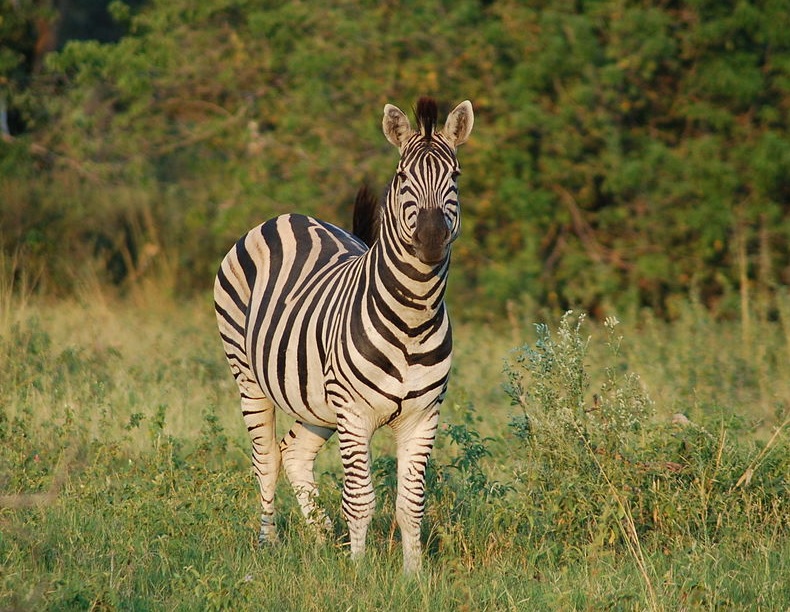
A zebra in Okavango Delta, Botswana, Africa. Credit: Joachim Huber
The team also used NASA’s Tropical Rainfall Measuring Mission (TRMM) data to map daily rainfall in 3-hour intervals. The scientists converted those measurements to daily rates and cumulative weekly amounts, checking the accuracy against ground-based rain gauges.
Beck and his team learned that zebra do not follow an internal clock, nor do they migrate at a steady pace. They were amazed at how well they could predict the migration’s start and rate by plugging daily rainfall and weekly vegetation data into migration models.
“By comparing the results of the models, it was possible to determine which environmental variables are the most effective in predicting zebra movement, and then use this knowledge to try and infer as to how the zebra make their decisions,” said Gil Bohrer, assistant professor in the Department of Civil, Environmental, and Geodetic Engineering at The Ohio State University who collaborated on the project.
Bill Fagan, professor of biology at the University of Maryland, in College Park, finds hope in the team’s discoveries. It may be possible for species that have had their migration patterns disrupted to relearn them from “exploratory walks” driven by environmental cues, he said. “With so many ungulate migrations declining worldwide, it is nice to have an optimistic result about migration for a change.”
Satellite Safari: Guiding Light Among the Stars
Beck sees the capability of using the team’s research in the future to design models to help game managers, conservation managers, farmers, and tour operators predict migrations of zebras or other animals. Understanding mechanisms driving migratory behavior is increasingly important, Beck said, in terms of climate change, as migrating animals rely on multiple habitats.
If timing of migrating animals’ food—insect hatches, greening plants, for example—no longer coincides with their travel, their continued survival could be at risk. Under climate change, things are likely to accelerate, Beck said. Many of the major migrations on Earth, especially on land, have already been lost, he explained, and few landscapes are left on Earth that migratory animals don’t have to share with agriculture and other human activities.
“We need to know what the fate of those migrations is under climate change. Understanding when animals might come through, what drives them, what they’re looking for sometimes,” Beck said. “Being able to predict that into the future is very useful information to managing those landscapes so that migratory animals and humans can coexist.”
The satellite data sets will continue into the next decade with data from follow-on missions: the Global Precipitation Measurement mission to launch in early 2014, and the Visible Infrared Imaging Radiometer Suite on the Suomi National Polar-orbiting Partnership satellite currently in orbit.
– Guest Blogger Lisa-Natalie Anjozian is a Vancouver, Washington-based writer and essayist who reported on this research for NASA’s Goddard Space Flight Center. See the full NASA story here.


