8 December 2011
Drilling to tell a tsunami tale
Posted by kramsayer

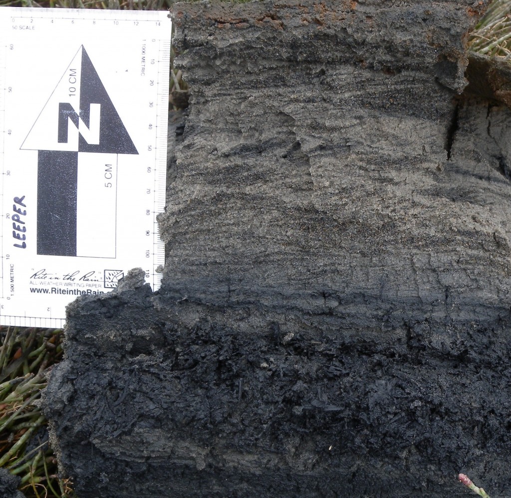
What layers of sediment can reveal: ash from a fire lies under compressed layers from tidal movements. (Credit: Rob Leeper, USGS)
With several talks at the American Geophysical Union’s Fall Meeting focused on recent tsunamis and earthquakes, it’s easy to believe the next big one is headed towards the California coast RIGHT NOW – even though it probably isn’t.
But according to models, an earthquake originating within Alaska’s Aleutian island chain could propel 7-10 meter (20-30 feet) tsunami waves to the California coast. With that possibility looming, a collaborative team is working to unearth prehistoric records of tsunamis along the Golden State’s coast. They’re looking for evidence of past tsunamis, to help update hazard maps. The U.S. Geological Survey’s Multi-Hazards Demonstration Project rounded up forces from the California Geological Survey, Humboldt State University, and California State University, Fullerton. Eileen Hemphill-Haley from Humboldt State presented a poster Tuesday morning at the Fall Meeting on their team’s search for past tsunami activity.
Her team explored wetlands and salt marshes to collect layers of tsunami-churned sediment. When past tsunamis slammed the California coast, they overturned clods of dirt, plants and ocean sediment, transplanting them further inland in layers. Tsunami-generated layers are identifiable to scientists amongst the other layers that build up over time.
In search of tsunami evidence, the scientists hand-drilled cores of sediment from 10 high-risk locations along a stretch of California coast. In Half Moon Bay, south of San Francisco, an October sample – a large, continuous layer of coarse-grained sand – turned up evidence of a tsunami.
California records of tsunami damage span the last 200 years, and the most notable – triggered by a 1946 earthquake of magnitude 7.8 – caused significant damage to this coastal town.
“We thought we should see evidence of this event,” Hemphill-Haley said, and the researchers have linked the 1946 quake to the sandy layer.
Predicted tsunami wave heights reach over 7 meters (21 feet) in Half Moon Bay – where large waves are nothing new. The region attracts big wave surfers from around the world– it sits directly in front of Mavericks, a well-known surf spot. However, it’s a whole different beast when a wave rides all the way into town.
Data on historical tsunami deposits are rare and the recent Japan earthquake reveals an even greater need for California to reevaluate the hazard maps, Hemphill-Haley said. The team will sample the rest of the southern California coastline in 2012, and also return to to determine the ages of sediment layers at tsunami-inundated sites.
-Amy West is a science communication graduate student at UC Santa Cruz


 GeoSpace is a blog on Earth and space science, managed by AGU’s Public Information staff. The blog features posts by AGU writers and guest contributors on all sorts of relevant science topics, but with a focus on new research and geo and space sciences-related stories that are currently in the news.