7 December 2012
Aerial surveys make light work of snow-depth measurements
Posted by kramsayer

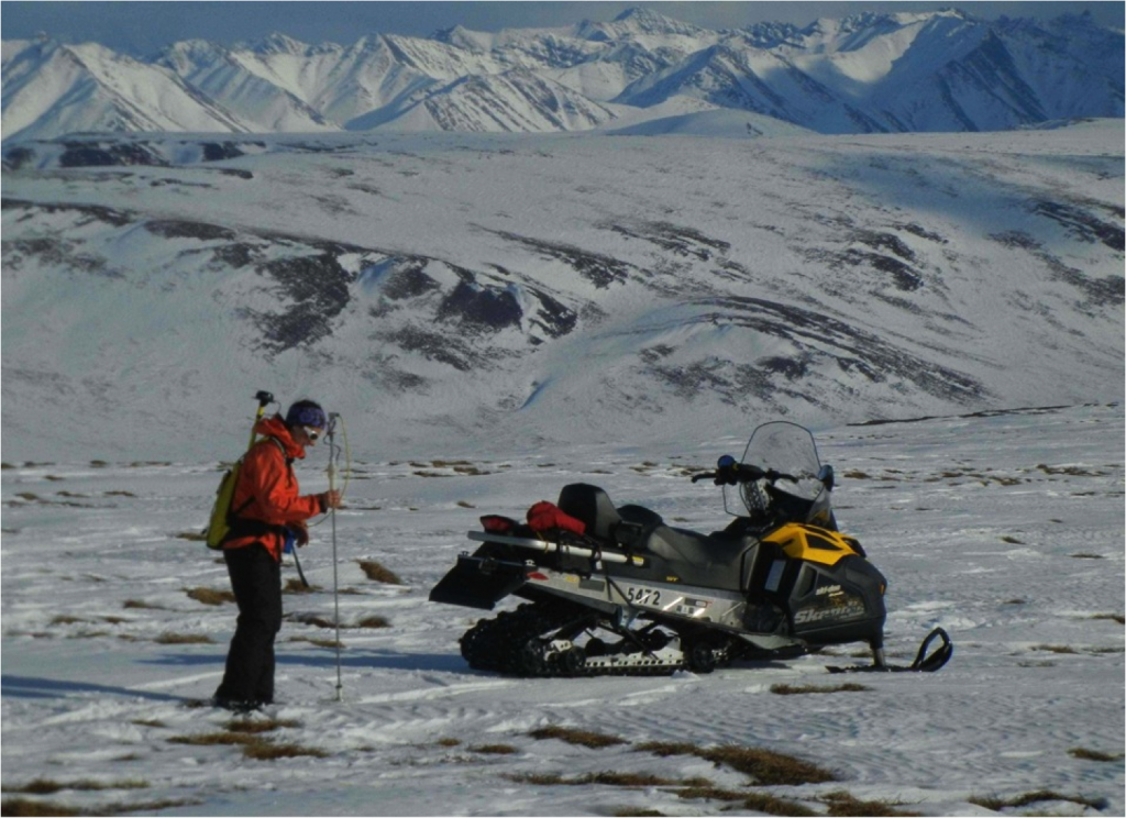
Geophysicist Sveta Stuefer of the University of Alaska-Fairbanks takes one of over 15,000 depth measurements used to validate airborne LiDAR estimates of snow depth near the north-central coast of Alaska. (Credit: Mark Parsons, National Snow and Ice Data Center)
Scientists have recently developed a technique for sharpening the accuracy of detailed tundra snow-depth maps critical to issues ranging from climate modeling to figuring out where to herd grazing caribou.
“Budgets for observing the snow are comparatively small, and the area to observe is comparatively large,” said geophysicist Chris Polashenski with the U.S. Army Corps of Engineers. “So, efficiency is key.”
One innovation in snow-depth measurements has been the use of airborne light detection and ranging, or LiDAR, devices. LiDAR creates 3-D maps of the environment – in a fraction of the time it would take traditional survey methods.
Researchers have used airborne LiDAR to measure everything from forest canopy thickness to beach erosion. However, the data it produces can be off by dozens of centimeters, which has limited its use in measuring snow depth in areas with shallow snowpack.
In his Wednesday morning talk at the fall meeting of the American Geophysical Union in San Francisco, Polashenski discussed how he and his colleagues increased the accuracy of airborne LiDAR, which they then field-tested with a variety of low-tech approaches.
Strapped to the underside of a plane, LiDAR scanners sweep the ground with 100,000 laser beam pulses per second to record every contour of the snow-encrusted surface. Each laser pulse strikes a precise location on the surface, then ricochets back to the scanner’s detectors. The time it takes for the laser pulse to travel back indicates the location’s distance from the scanner. Computers convert these laser measurement points into digital 3-D maps.
“It would take nine guys out in the field a week to collect the number of data points the scanner can take in one second,” said Polashenski.
Polashenski’s team can use LiDAR to scan snowy surfaces in the winter and again when the snow has melted in the summer. Subtracting the summer maps from the winter maps produces estimates of the snow depth in the area.
Errors in previous airborne LiDAR measurements of snow depth have been greater than 30 cm. When snowpack is meters thick like it is in the Alps, that error is acceptable. However, it is intolerably large in comparison to the relatively shallow 15 to 100 cm snowpack seen in some parts of northern Alaska.
To reduce this error, Polashenski’s team tweaked the formula for processing their LiDAR data. Also, because airborne LiDAR surveys depend on GPS measurements as a reference, the team added additional GPS sensors in the wings, nose, and tail to increase accuracy.
The researchers tested their improved system on a 1-kilometer-square site near the north-central coast of Alaska. Their adjustments brought the measurement error down to a more reasonable 5-6 cm, which they validated with ground-based surveys.
The team is still pouring through their data. Polashenski thinks it will reveal ways to bring the error down to 3 cm with further refinements, which they will test with a second series of aerial and ground-based surveys in Alaska and Canada in 2013.
It may not sound like much, but for herders of tundra grazers like caribou that dig through snow to find moss and lichen, knowing where the snow is a few centimeters thinner could mean the difference between their animals finding lunch or going hungry.
– Chris Palmer is a science communication graduate student at UC Santa Cruz


 GeoSpace is a blog on Earth and space science, managed by AGU’s Public Information staff. The blog features posts by AGU writers and guest contributors on all sorts of relevant science topics, but with a focus on new research and geo and space sciences-related stories that are currently in the news.