3 January 2013
The 800 Kilometer Long Shadow
Posted by Dan Satterfield

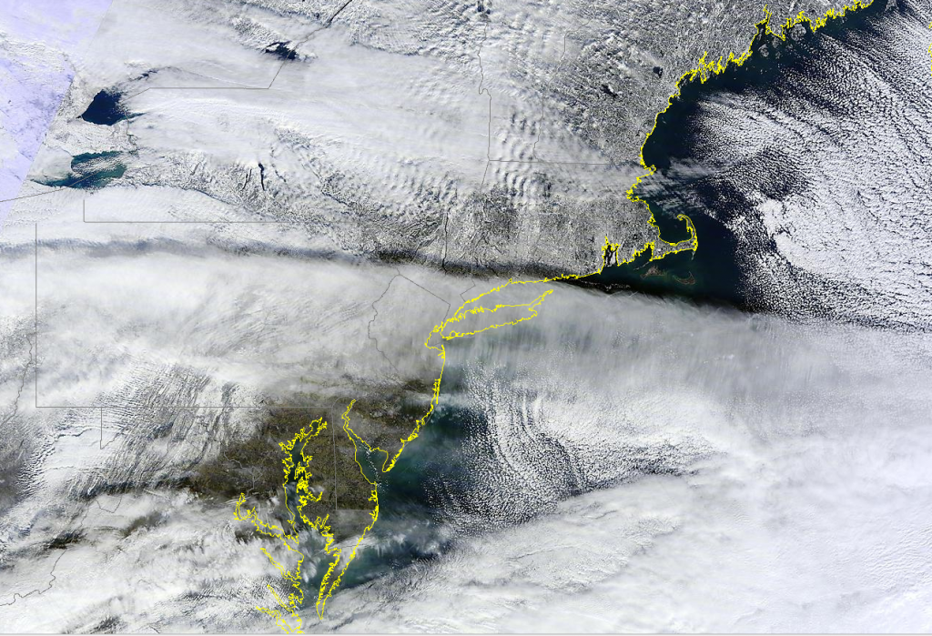
From the NASA Terra satellite on Wednesday Jan. 2, 2013. Click image for a much larger high res version.
This true colour image from the NASA Terra satellite today shows an 800 km long shadow stretching from NE Ohio into the Atlantic. The shadow was the result of the low early January sun angle, and a deck of cirrus clouds at around 10km above the surface. Plenty of other things to notice as well.
What a meteorologist sees in this image:
1. Strong winds over the mountains of New York and Vermont are producing gravity wave clouds over NY and New England.
2. Low level stratocumulus clouds are indicating a north to northwest surface wind flow east of Delmarva before they disappear underneath a high cirrus deck which is moving east-northeast.
3. Snow cover surrounds the finger lakes area of New York, and there is also good snow cover over Western Maryland and much of Pennsylvania.
4. A deck of thin high clouds is on top of the gravity wave clouds over upstate New York.


 Dan Satterfield has worked as an on air meteorologist for 32 years in Oklahoma, Florida and Alabama. Forecasting weather is Dan's job, but all of Earth Science is his passion. This journal is where Dan writes about things he has too little time for on air. Dan blogs about peer-reviewed Earth science for Junior High level audiences and up.