
3 September 2018
The Tropical Atlantic is Starting To Bubble
Posted by Dan Satterfield

Tropical Storm Florence is in the far east Atlantic but the strong high-pressure ridge over the U.S. may steer it in our direction. It will need to be watched. The system near Florida may approach the Central Gulf Coast in a few days and a Tropical Storm Watch has now been posted.
The tropics are getting more active now.
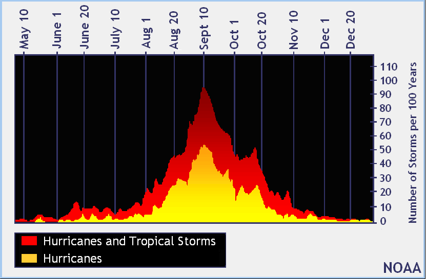
An old forecaster saying is “there’s almost always a hurricane on Atlantic weather map on Labor Day. We have Tropical Storm Florence in the far west Atlantic and a possible developing depression near Florida on this Labor day 2018. Both of which will need to be watched. It looks like the switch has been turned on in the Atlantic Basin as a more favorable MJO pattern arrives.
Florence looks healthy in the Atlantic but it will soon run into a lot of wind shear in spite of finding warmer water underneath it. The waters in the main development region (MDR) have been cool all summer (and still are) but any storm that gets close to the U.S. or Carribean will find very warm waters.

The September heat wave on the East Coast will continue this week and that strong high pressure could keep Florence from recurving and it MIGHT be a threat in around 8-9 days. The hurricane season peaks on September 10th. Right on time.
One last thing: If you see raw model guidance being shared online showing doom and gloom. Ignore it. It’s way too soon and all models are WRONG. Sometimes though, they provide useful information.
 Dan Satterfield has worked as an on air meteorologist for 32 years in Oklahoma, Florida and Alabama. Forecasting weather is Dan's job, but all of Earth Science is his passion. This journal is where Dan writes about things he has too little time for on air. Dan blogs about peer-reviewed Earth science for Junior High level audiences and up.