
14 February 2017
We Call This a Bomb
Posted by Dan Satterfield
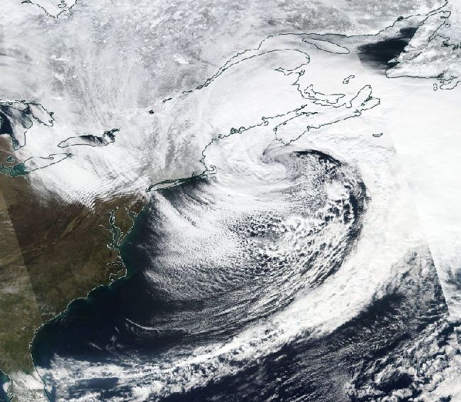
True colour image from the Suomi satellite today of the intense low south of Halifax, in Nova Scotia. This storm produced high winds across the Mid-Atlantic today.
When a weak low-pressure system suddenly intensifies and becomes an intense storm, we call the low “a bomb”, because the storm suddenly explodes. Meteorologists have actually defined “a bomb” as explosive cyclogenesis with a pressure drop of 24 millibars or more in 24 hours. This storm easily made the cut, and the image above is a classic example of one. This low passed over Maryland Sunday afternoon, and brought sunshine and light winds, with highs 20 degrees above normal! The pressure then was a little above 1000 mb, but It now has a pressure of 968 mb.
Then the bomb went off!
The winds at Andrew’s AFB reached 72 just before 12 AM and here on the Eastern Shore of Maryland, my place started shaking by 1 AM. Winds gusted to over 40 through much of the day and the temperature stayed in the mid 40’s. That’s not that cold for this time of year but the wind made it feel much worse. If you are a mariner in the North Atlantic tonight, it is MUCH worse. The Ocean prediction Center surface map is below. Note the words “HURCN FORCE”.
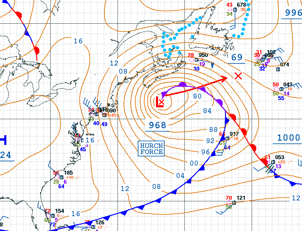
From NOAA/Ocean Prediction Center
A pressure of 968 millibars. That is a mean storm, stronger than many hurricanes.A data buoy is near the storm and here is its current report as I type this at 10:30 PM EST (0330 GMT 14 Febr.) Monday, Feb. 13:
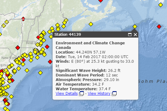
Yes, that is 26 feet on the wave height report. It’s definitely not a good night to be on the Boston to Liverpool run. As Gordon Lightfoot put it: “Does anyone know where the love of God goes when the waves turn the minutes to hours.”
 Dan Satterfield has worked as an on air meteorologist for 32 years in Oklahoma, Florida and Alabama. Forecasting weather is Dan's job, but all of Earth Science is his passion. This journal is where Dan writes about things he has too little time for on air. Dan blogs about peer-reviewed Earth science for Junior High level audiences and up.