
23 January 2017
GOES-R First Image Will Be Released Tomorrow
Posted by Dan Satterfield
The first image from GOES-R will be out tomorrow.The “first light” image will be released in Seattle tomorrow at the AMS Annual Meeting, and we will start to see irregular imagery in May as testing continues. From what I am hearing, the instruments have so far all come online working as expected. Oh, and. GOES-R is now GOES 16 by the way. Once operational they take on a number. To give you an idea, the Images will look similar to this from Meteosat today.
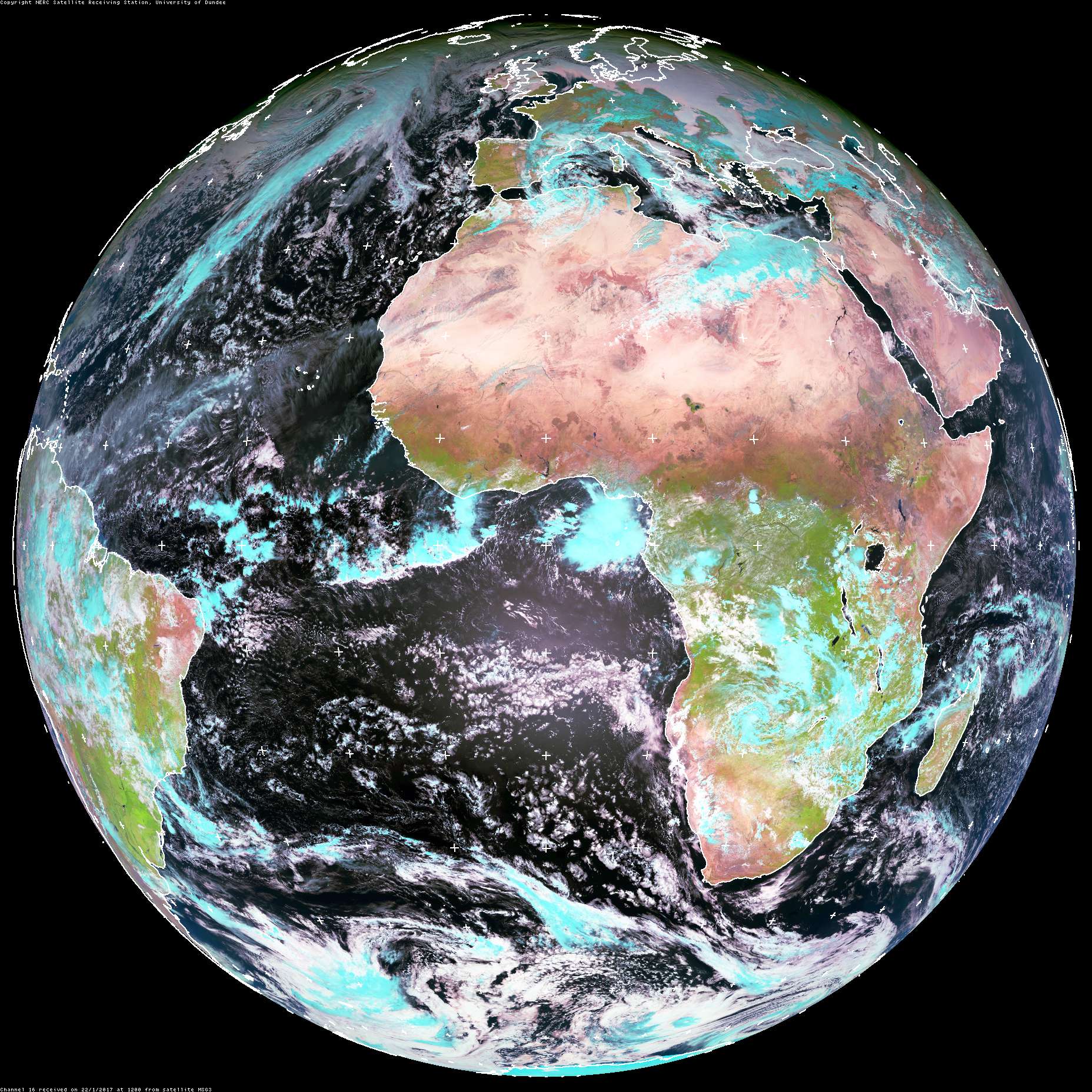
Courtesy of Univ. of Dundee. Click for much larger version.
Besides having much higher resolution both spatially and temporally, we will be able to see Earth in many more wavelengths of light than before.

Click image for larger version. Imae from NOAA/NASA.
The European Meteosat can take an image every 2.5 minutes. GOES-R (16) can take one every 30 seconds. Look at the video below and compare to what you see now on TV weathercasts.
Only the Himawari geostationary satellite will have sensors for red, blue, green, light and thus be able to send true colour images, but GOES-R will have a near-IR window that will allow an almost true colour image to be made. Keep in mind, the visible channels are worthless at night and we actually get much more info from the thermal IR data. Nothing excites me more in operational meteorology than satellite data. It’s made that 7-day forecast you see on TV every day possible.
 Dan Satterfield has worked as an on air meteorologist for 32 years in Oklahoma, Florida and Alabama. Forecasting weather is Dan's job, but all of Earth Science is his passion. This journal is where Dan writes about things he has too little time for on air. Dan blogs about peer-reviewed Earth science for Junior High level audiences and up.
.jpg)