
28 June 2016
Using Satellite Data to Forecast Flooding
Posted by Dan Satterfield
A lot of folks have a vague idea of how valuable satellite data is for forecasting severe weather. With the launch of GOES R this fall, the data will be nearly real-time, like radar is now, and it will revolutionize forecasting. That said, we already have satellite products that (using the different IR and visible channels) can detect and track water vapor in the atmosphere.
I chair the NWA Committee on Remote Sensing (I’m the dumbest person on it- which just goes to show you!), and one of our members (Sheldon Kusselson who is retired from NOAA/NESDIS) actually played a major role in the development of tracking the rivers of moisture in the atmosphere. He sent me some links and images today concerning the flooding in West Virginia that caused great loss of life and severe damage. Here’s what he sent with some links to the loops. This is mainly for meteorologists, but it is really worth sharing and you can google what you may not understand, or make a comment!
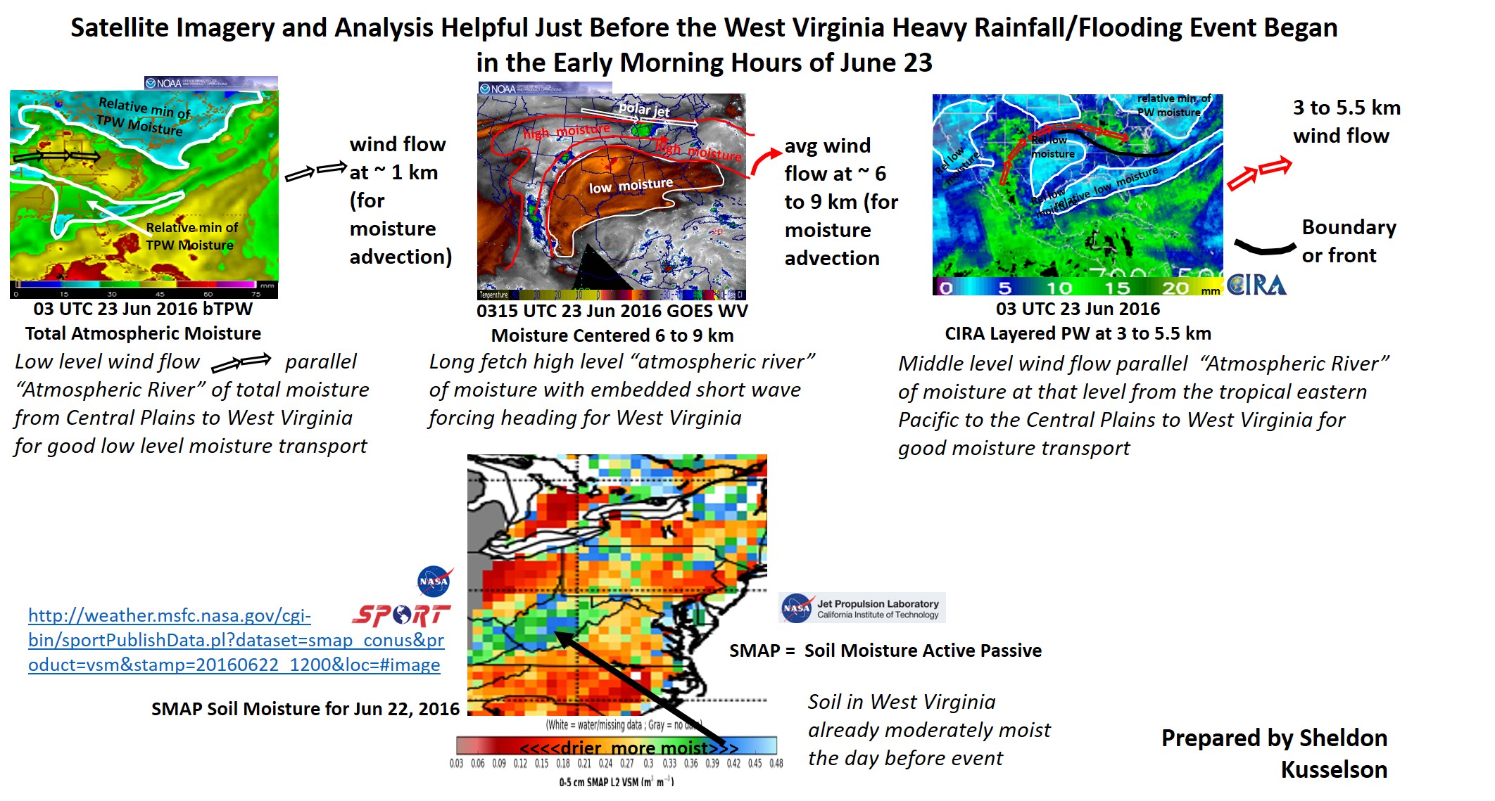
Click for much larger version
Click image for large version. The link will not work. I have them below.
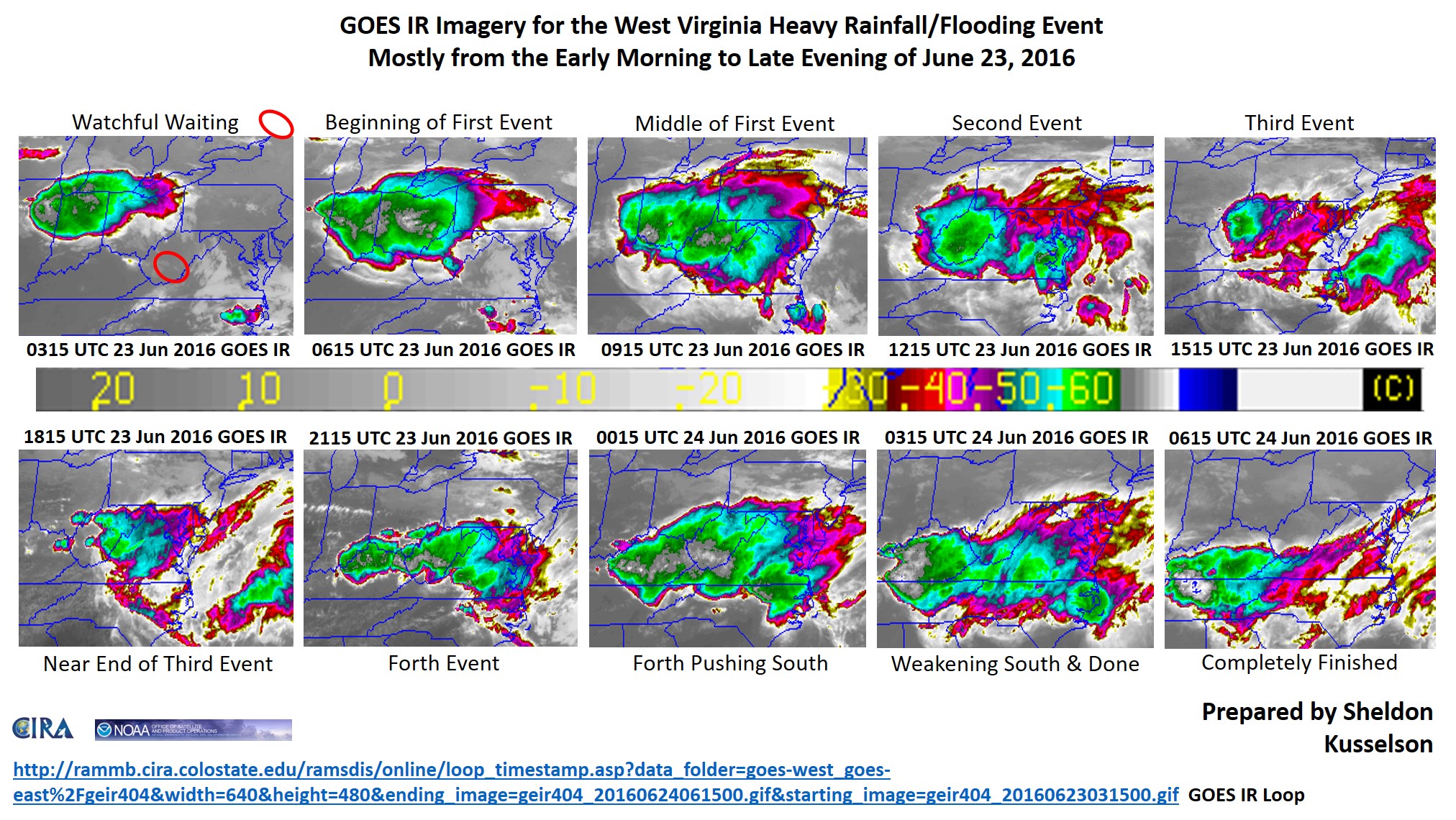
Loop of the above imagery is here.
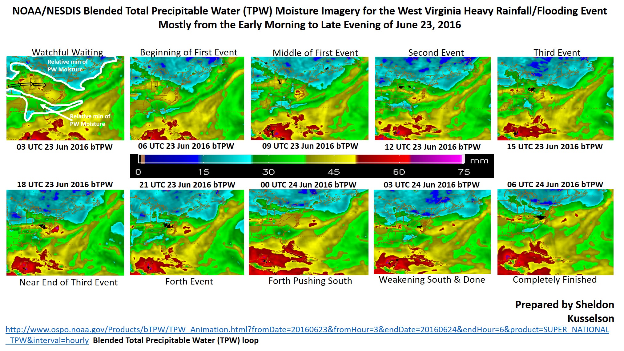
Again, click image for larger version. More on Total Precipitable Water here.
You can see the loop of the blended total precipitable water here.
More from Sheldon Kusselson
http://weather.msfc.nasa.gov/cgi-bin/sportPublishData.pl?dataset=smap_conus&product=vsm&stamp=20160622_1200&loc=#image
They only keep a month of data, so the main web site for the latest soil moisture is at: http://weather.msfc.nasa.gov/cgi-bin/sportPublishData.pl?dataset=smap_conus
One last thing. If there is one fact that every meteorologist would like you to know, it’s this: Quit worrying so much about tornadoes, and worry about water and lightning. Those are the big killers in storms. Same with hurricanes. The winds do not kill people in a hurricane. The water does.
Big thanks to
Retired NOAA/NESDIS
NWA Remote Sensing Committee Member
twitter: @wxman27
 Dan Satterfield has worked as an on air meteorologist for 32 years in Oklahoma, Florida and Alabama. Forecasting weather is Dan's job, but all of Earth Science is his passion. This journal is where Dan writes about things he has too little time for on air. Dan blogs about peer-reviewed Earth science for Junior High level audiences and up.