
22 July 2015
Why Using El Nino to Forecast the Winter is Risky
Posted by Dan Satterfield
From the NOAA Env. Vis. Lab.
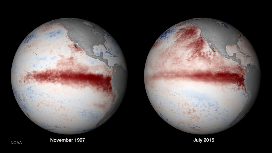
The image above shows how very strong the developing El Nino in the Pacific, is compared to the 1997 event (which is the strongest on record). Since El Nino events usually peak in the later fall/winter, it sure looks like we are in for one of the strongest ever, if not perhaps a record breaker, but look closer at those two images. They are different. Notice the very warm water in the northeast Pacific ocean this July versus what we saw with the big El Nino in 97.
Make no mistake about it, the oceans control our weather. They hold far more heat than the atmosphere and cover around 70% of the planet. As a matter of fact, most of the extra heat from increasing greenhouse gases is going into the oceans, and will then eventually warm the atmosphere, but we need to be very careful about using El Nino to predict the upcoming winter.
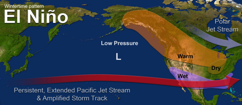
Yes, the El Nino years tend to have some very common types of weather, and this is most noticed in the lack of hurricanes in the Atlantic, while the Pacific sees many more than normal. This is already happening, and yes most strong El Nino’s bring wet winters to California, and flooding rains on the Gulf Coast of the U.S. Australia sees drought in El Nino years, but this is ON AVERAGE, and every El Nino is a bit different.
If you just look at really strong El Nino’s then we really only have a sample size of two to base a forecast on, 1982-83 and 1997-98. A sample size of two is just not enough to base a forecast on, and just look at the image above, this one is already different from 1997! The waters of the Northeast Pacific are also very warm, and this likely has a LOT to do with the unprecedented drought in California.
The warm ocean waters warm the air, and cause a change in the normal winter storm track, but this El Nino is almost certainly going to be different from 1997 and 1982, with the oceans world-wide at record warmth, and that large region of very warm water in the Eastern Pacific. How will this change our El Nino winter? Will California get rain anyhow?
It would be interesting to see how things turn out from an ensemble of runs from global climate models, (coupled to ocean and atmosphere) and we can get that from the Climate Forecast System. The images below show the most recent average of model runs for the coming winter. A caveat though: the model though tends to have rather poor skill and a wet bias in California and a warm bias over much of the Eastern U.S. If it gets the El Nino pattern wrong then, the rest of the forecast is likely to be bad as well. So, what I’m saying here is take it with a real dose of skepticism!
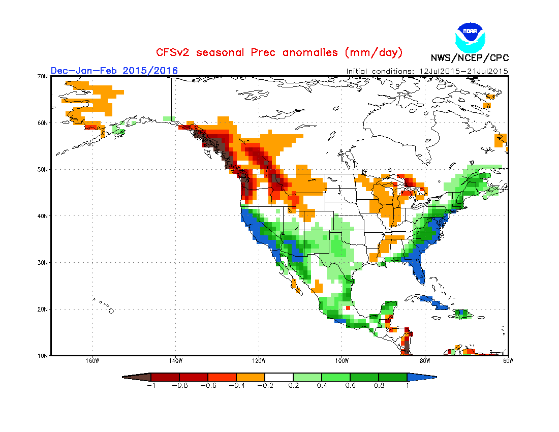
 This is actually a very typical looking El Nino pattern, (see below) but with that warm water off the West Coast, I’m not sold yet. While there is definitely some real hope for California, I’d say to prepare for a winter of extremes and some real surprises.
I can give you one rather easy prediction thanks to El Nino, and this is a forecast that 2015 will be the hottest year on record globally. 2014 is the current record holder, but with all that warm water releasing heat to the atmosphere, this year is likely to beat it. So far this year, the first 6 months are the warmest Jan.-June on record and June was the hottest on record. The greenhouse gases keep pushing up the temperature, and when you combine that with an El Nino, you get a record (Science deniers still use this to assert that the planet is cooling, with no idea of how ridiculous they look to those who know what is really happening.)
Note: I’ll keep track of the CFS runs, and how they’re changing as we head into late summer and fall. It should be interesting to see if they change and if that warm water anomaly off California continues. It shows no signs of weakening yet.
 Dan Satterfield has worked as an on air meteorologist for 32 years in Oklahoma, Florida and Alabama. Forecasting weather is Dan's job, but all of Earth Science is his passion. This journal is where Dan writes about things he has too little time for on air. Dan blogs about peer-reviewed Earth science for Junior High level audiences and up.