
10 July 2015
Super Typhoon Headed Toward 23 Million People in Shanghai
Posted by Dan Satterfield
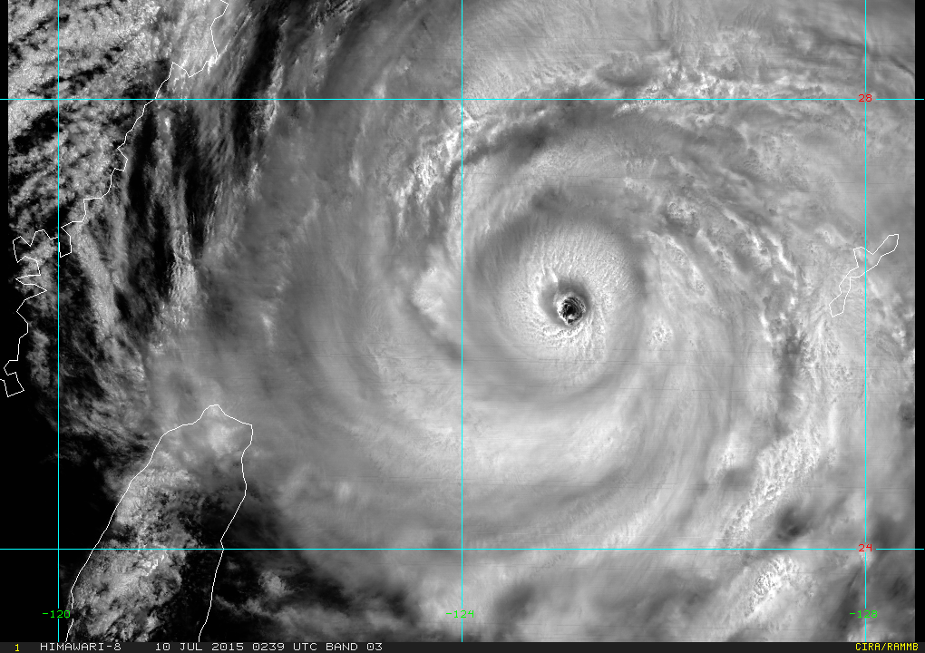
Super Typhoon Chan-Hom, from the Japanese Weather Satellite Himawari 8.
The latest track from the Joint Typhoon Warning Center shows Super Typhoon Chan-Hom passing very near Shanghai, and landfall will likely be south of the city, putting Shanghai in the path of the highest storm surge. Winds are estimated at 120 knots, and while it will weaken some before landfall, it will still likely produce a major storm surge. This storm looks very healthy on satellite images tonight, and it may still be producing winds over 110 mph at landfall, putting it close to Category 3 strength.
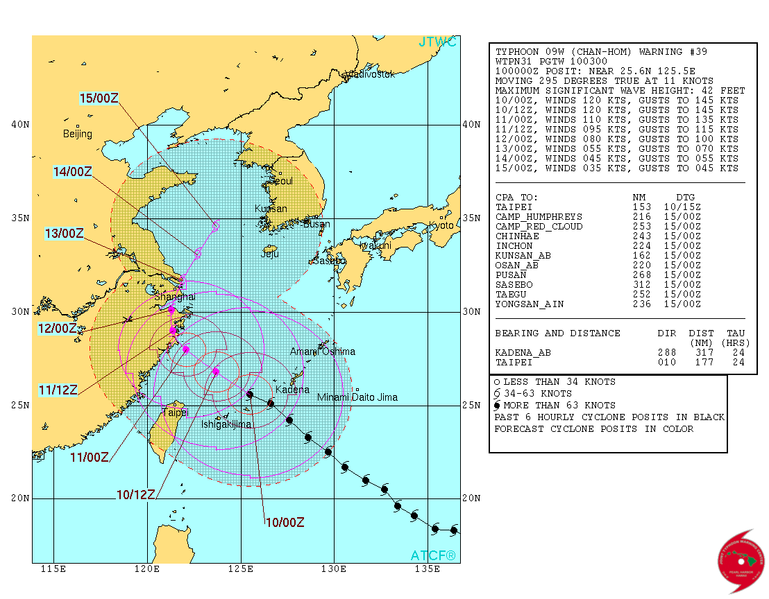 The typhoon will likely make landfall late Friday evening U.S. East Coast time, or midday Saturday in China.
The image below is the surface pressure and 850 hPa wind speed forecast by the NOAA GFS model for Friday Evening U.S Time. These winds are around 1500 meters above the surface and will give a good idea of wind gusts. Looks like 110 knot gusts at least.

GFS forecast model for Friday evening U.S time. Image ctsy. WX Bell
 Dan Satterfield has worked as an on air meteorologist for 32 years in Oklahoma, Florida and Alabama. Forecasting weather is Dan's job, but all of Earth Science is his passion. This journal is where Dan writes about things he has too little time for on air. Dan blogs about peer-reviewed Earth science for Junior High level audiences and up.