
7 November 2014
El Nino Threat Diminishing?? Modoki El Nino Coming?
Posted by Dan Satterfield
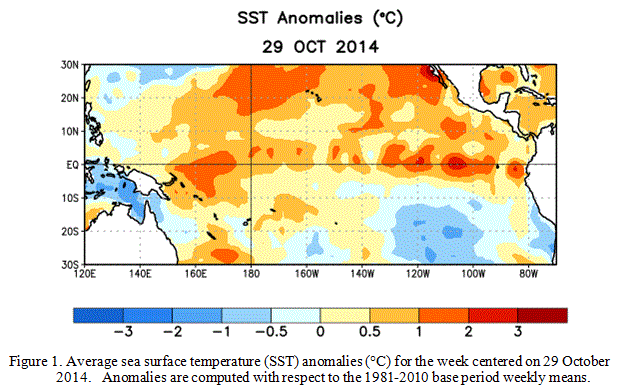
Sea surface temp. anomalies in the Pacific at the end of October look more Modoki like, than a regular El Nino. Modoki El Nino’s are weaker, with the warm water anomalies more in the Central Pacific.
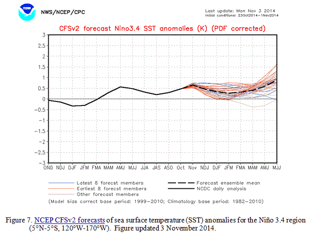
The Climate Forecast System models are now indicating a weak El Nino episode.
NOAA released an update on the El Nino Southern Oscillation this week, and the odds of an El Nino are down to 58%. One of the main reasons for this is that the atmosphere has not responded to the rather weak warming in the Eastern Pacific. El Nino is not just an ocean warming, it is an ocean atmosphere interaction and so far the atmosphere has just not picked up the Ocean’s phone call.
It looks more likely to me that we may be seeing a rarer type of El Nino this winter. It’s called a Modoki and it means “same but different” in Japanese. Modoki El Nino’s are characterized by a warming pattern that favors the Central Pacific rather than the equatorial East Pacific.
Modoki winters can often be much different from typical El Nino winters, and in some places they are colder and snowier. I am planning a future blog post that will go into more detail on this and the long-range forecast for the coming winter.
The map below shows the average temperatures for “Modoki” type winters, but each one is different and there is no guarantee this year will be one. and other factors, like Atlantic water temperatures, and the snowfall in Siberia will likely play a role. I’ll have more about this very soon.
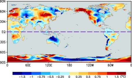
Temperature averages in Modoki winters.
I can give you a long-range forecast for next week that I am rather confident in! The remains of Typhoon Nuri is in the Western Pacific is going to push a lot of warm air into the Gulf of Alaska, and this will be at least partly responsible for a blast of cold air into Eastern North America later next week. The jet stream acts a bit like a water-bed, you push down in one area, it rises up in another. In this case the warm air will push it up in the Pacific and it will dip down in the Eastern portion of North America. The map below shows the low-level temperatures forecasted by the ECMWF model (From London) for late next week. While I am careful here to post long-range model data that may be wrong, I think this is basically going to verify.
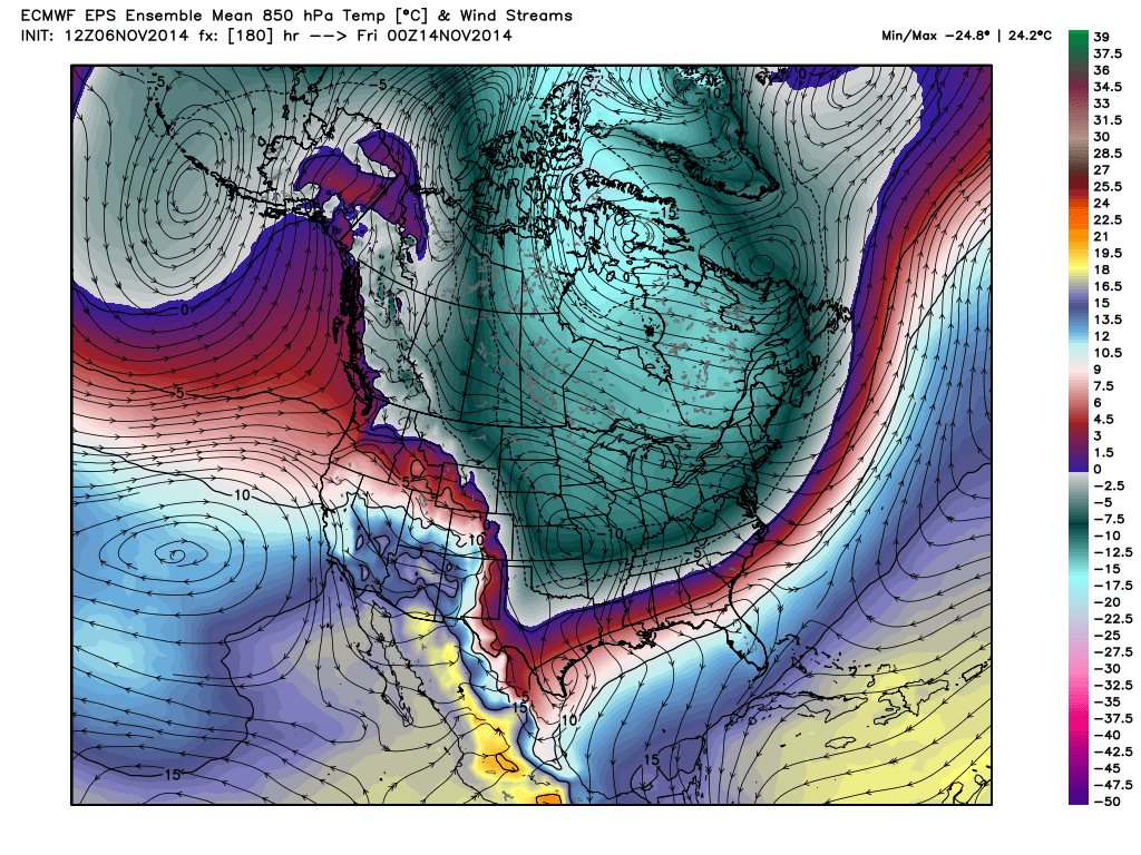
This is an average of several different model runs and they are all in good agreement. This increases confidence in a long-range forecast. Hat tip to WX Bell which we forecasters rely on for great model data!
Yea, it’s in Celsius, because that’s what science and the rest of the world uses. Can you say hard freeze??
 Dan Satterfield has worked as an on air meteorologist for 32 years in Oklahoma, Florida and Alabama. Forecasting weather is Dan's job, but all of Earth Science is his passion. This journal is where Dan writes about things he has too little time for on air. Dan blogs about peer-reviewed Earth science for Junior High level audiences and up.
Great post, Dan.