
13 August 2014
Crazy Summer Weather pattern Is About To Flip
Posted by Dan Satterfield
The summer of 2014 has been unusually mild in the Midwest and portions of the East, and brutally hot and dry in the West. The heat and drought in the NW corner of North America has led to raging forest fires that have spread dense smoke over the northeast and across the Atlantic to France, and the drought in California has reached the worst possible level: exceptional drought. Mother Nature is about to change all that, at least for a short while.
The weather pattern is about to make a dramatic change, and while it may not help the drought in California, the west of Canada will see cooler weather, while the East gets a prolonged visit by August heat and humidity. The two graphics below show the temps. compared to normal at the 850 millibar level (this is about 3 1.5 km above sea level).The first graphic shows the well below normal weather over the Eastern Seaboard, and in the NW and Western Canada, the heat is continuing.
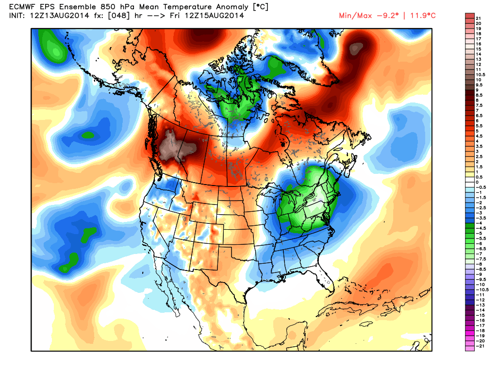
ECMWF Ensembles from WX BELL.
Now look at the temperature pattern 11 days from today. Everything is reversed!
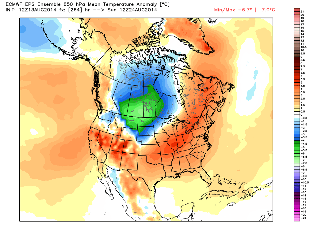
Temperature anomalies in the lower atmosphere on Sunday 24 August.
There are some hints that this pattern will last about two weeks, and then begin to turn into a less amplified “zonal flow” that’s very typical of September. At this kind of long-range, all we can do is give averages and there is a great deal of uncertainty, but I’m fairly confident that the pattern flip will occur. This pattern is also one that can steer a tropical system into the Gulf or up the East Coast of the U.S. as well.
Oh, and by the way, the peak of the hurricane season starts this weekend.
 Dan Satterfield has worked as an on air meteorologist for 32 years in Oklahoma, Florida and Alabama. Forecasting weather is Dan's job, but all of Earth Science is his passion. This journal is where Dan writes about things he has too little time for on air. Dan blogs about peer-reviewed Earth science for Junior High level audiences and up.
Just a minor quibble – the 850mb surface is usually only about 1500m above sea level, isn’t it? (not 3km)
Indeed it is! Will correct that to 1.5KM.