
12 June 2014
This Research May Give You Better Warning Of A Dangerous Storm
Posted by Dan Satterfield
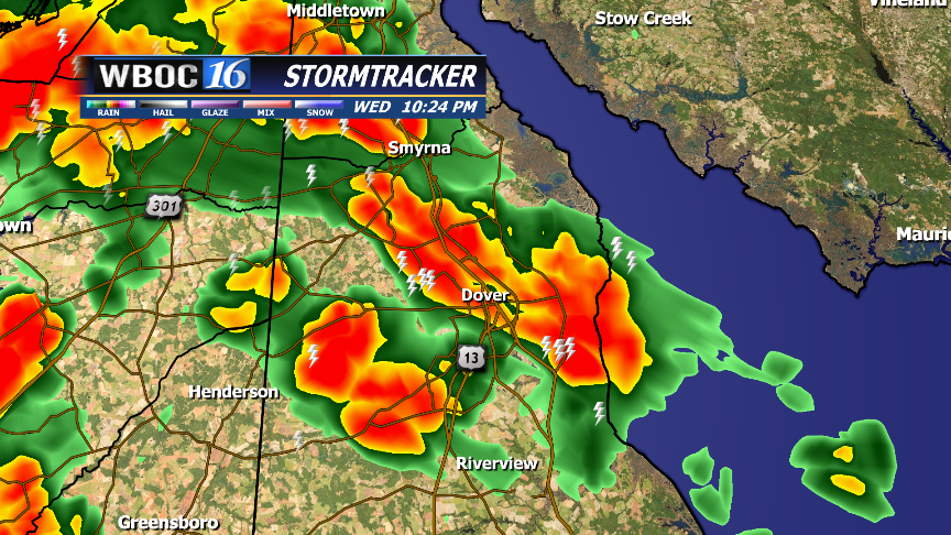
I showed this radar display with lightning on air at 11 PM on June 11,2014.
TV Viewers are quite familiar with seeing lightning on radar displays these days, and knowing a storm is producing a lot of lightning as it approaches a large metropolitan area, is vital information for everyone from a power company to a baseball coach. Many times I can almost guess at how many power outages will develop based on the lightning I see with a storm. It’s a simple function of flashes and population density.
Now, here is something you probably DON’T KNOW: The lightning displays on TV are ONLY cloud to ground strikes.
Yes, I know YOU only care about bolts that touch the ground, because they may fry your microwave, or even you, but it turns out that knowing the total storm lightning flash rate is very important. Most NWS forecast offices and TV broadcast weather offices do not get this total data, because you need what’s called a lightning mapping array (LMA) and they are not cheap. There are a few LMA’s around and are used for research in Oklahoma, Colorado, Washington DC, and North Alabama. There’s one in Central Florida as well (guess why!).
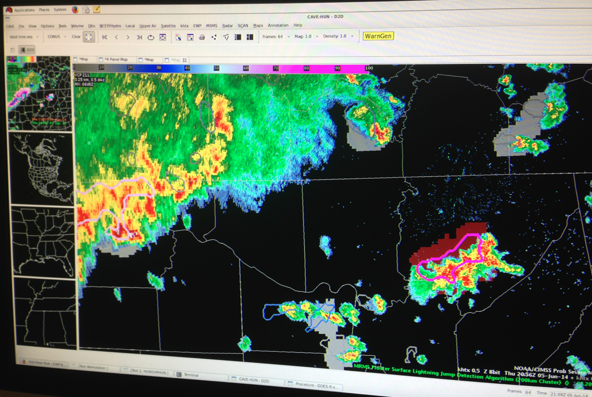
The RED blob underneath the storm in NE Alabama is a large lightning jump indicated on that storm. It became much stronger a few minutes later. Dan’s pic
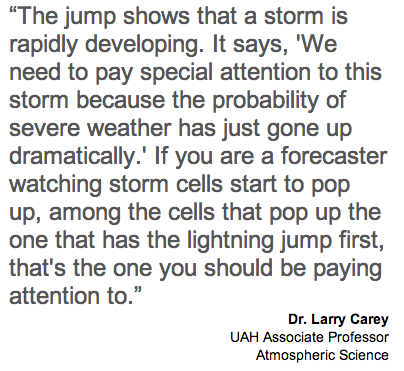
Last week, at the Hazardous Weather Test Bed in Norman, three NWS Forecasters and I evaluated a new tool developed in part by a friend of mine, Elise Schultz, an atmospheric scientist at UAH in Huntsville AL. It’s called a lightning jump algorithm and the basics are pretty simple. Research shows that when the total lightning in a storm jumps by at least one standard deviation in a short time, the thunderstorm will soon get much stronger. There is good science on why this happens, and I saw it in action several times last week.
From UAH press release.
So, should we build LMA’s across the country? No, we do not have to because in two years, the GOES-R weather satellite will launch and it will carry the GLM-Geostationary Lightning Mapper. It will give us lightning data across North America in real-time. Hopefully the budget will allow for the production of data to show these lightning jumps, because it just may make the difference in a 5 minute warning and 20 minute warning for a million people in the patch of a dangerous storm.
A paper published about this by Chris Schultz and another friend NASA scientist Walt Petersen is here: https://ams.confex.com/ams/pdfpapers/133634.pdf
GOES R will change forecasting as much or even more than the addition of Doppler and Dual Polarimetric radar has over the past 20 years. There is talk of keeping GOES- R in standby mode until one of the older satellites fails, but this new technology is so much better than what we have now, it should (IMHO) be put to work as soon as possible.
 Dan Satterfield has worked as an on air meteorologist for 32 years in Oklahoma, Florida and Alabama. Forecasting weather is Dan's job, but all of Earth Science is his passion. This journal is where Dan writes about things he has too little time for on air. Dan blogs about peer-reviewed Earth science for Junior High level audiences and up.
Thank you for sharing a very interesting post Dan. It will really be a huge advantage if people can prepare before a dangerous storm. This is a development that is very timely especially now that we are experiencing climate change.
I recall that “many” years ago I saw an internet display that purported to show lightning strikes, or at least lightning storms all over the globe. Possibly from satellites, but possibly based by triangulating on am radio static. I’ve no idea but I’d like to know if something like that really did exist. Thanks.