
17 January 2014
Premiering Next Week- Revenge of The Polar Vortex (Starring the Dogs of Winter)
Posted by Dan Satterfield
It’s coming back. Will it be as cold as the last one at the beginning of the year? Too soon to say but there are growing signs it will last longer and may come in several waves. Numerical weather ensembles (See last two blog posts) are in remarkable agreement that the cold will return.
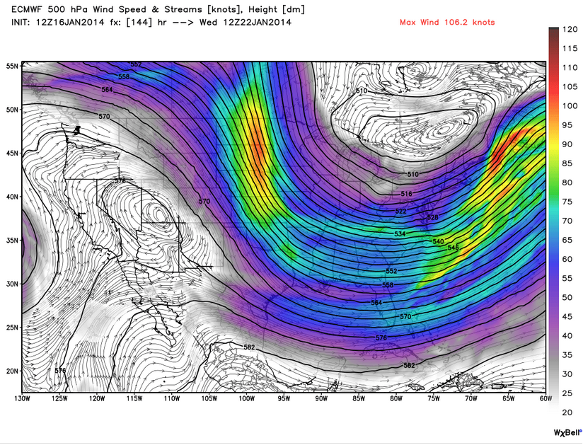
The upper level wind flow by the middle of next week will allow the frigid air at the Pole to flow into the northeastern third of the U.S.
Model guidance is indicating temperatures as much as 40 degrees below normal by later next week!

European model guidance showing temperature anomalies for late next week.
This is also bad news for California which continues to deal with an unprecedented drought. It will stay unusually warm and dry, and more fires like the one near Los Angeles today are likely. The image below is from the NASA Aqua satellite and clearly shows the fire at midday Thursday.
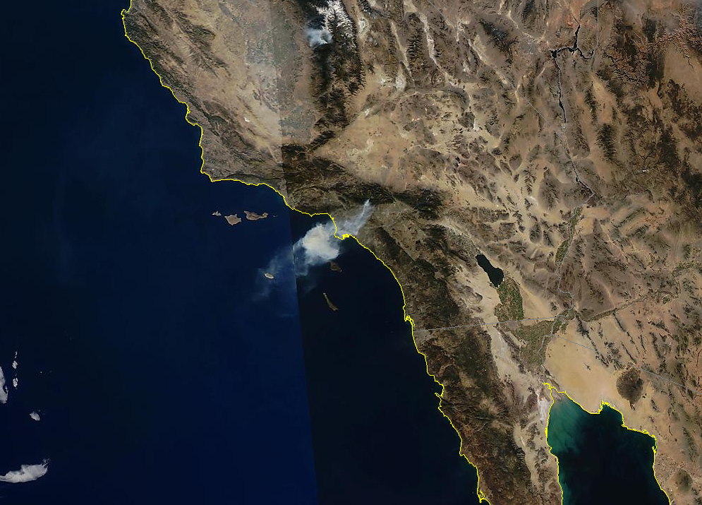
NASA Aqua Satellite true colour image of the Southern California fire today. Click to magnify.
 Dan Satterfield has worked as an on air meteorologist for 32 years in Oklahoma, Florida and Alabama. Forecasting weather is Dan's job, but all of Earth Science is his passion. This journal is where Dan writes about things he has too little time for on air. Dan blogs about peer-reviewed Earth science for Junior High level audiences and up.