
9 September 2013
Are Hurricane Season Forecasts Ready For Prime Time??
Posted by Dan Satterfield
Weather and climate forecasts have value because decisions and plans can be made that save money, and (more importantly) lives. This is why so much research is underway into making an accurate prediction of what the rate of sea level rise will be in the coming decades, and how precipitation patterns will change as the planet gets warmer (from increasing greenhouse gases). Shorter predictions for a few months ahead can be even more valuable, and this is why NOAA and another group at Colorado State University have been attempting to forecast the number of hurricanes each season in the Atlantic Basin.
This year’s forecast has (so far at least) been a bust. August saw no hurricanes in the Atlantic for the first time since 2002 and the overall tropical storm activity was at its lowest in nearly 50 years! Dr. Jeff Masters has a good post here on just how this is measured. The official NOAA forecast this year was for an above normal season, and the reasons were clear. A strong African monsoon, no El Nino (which causes decreased activity in the Atlantic Basin), and very warm sea water in the forming regions.
What went wrong?? The answer is at least partially seen in this incredible image from the Suomi NPP satellite.
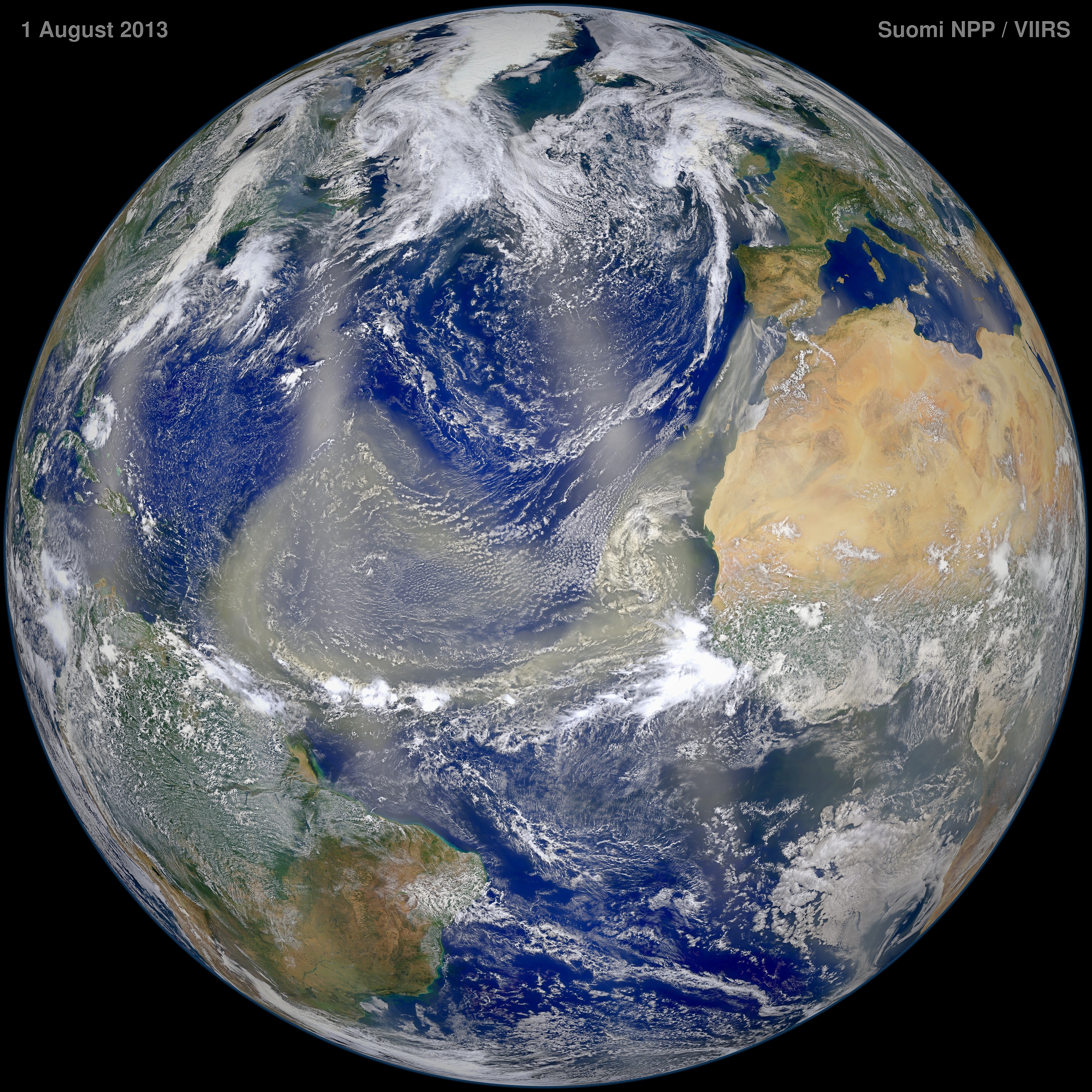
True colour image from the Suomi satellite showing Saharan dust covering a large area of the Tropical Atlantic. Click the image for a much larger version. Want a version that will make your video card roll over and play dead? Go here:
The image above was the result of 7 orbits of Suomi NPP from Pole to Pole. Look at the incredible amount of dust coming off Africa. (The north south stripes are not dust by the way, they are sun-glint off the ocean.) Dust plumes off Africa are normal, but there has been an exceptional amount this year, and the dry dusty air is not conducive to tropical development. A bouncing baby hurricane needs no wind shear, high instability, and warm water below.
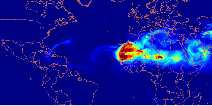
NASA GEOS 5 model for mid-week showing much less dust over the Tropical Atlantic.
NASA’s GEOS 5 model shows the dust plumes have quieted down in the last few days, so we may be about to see the tropics get much more active. The peak day of hurricane season is this Tuesday, 10 September.
It seems unlikely however that we will end up with an above normal season, and this begs the question the title of this post asks. Are these attempts at forecasting the number of hurricanes ready for wide-spread public dissemination?? I think the answer is maybe not unless we make changes, and here’s why.
First of all, science moves forward by making predictions based on observations and then testing them. In this case, Mother Nature does the testing and we get the answer on November 30th each year when the storm season officially ends. This must continue if we are to make progress in predicting weather and climate. With this in mind, many of my fellow forecasters have the same reservations about the accuracy of these forecasts that I do. It’s actually a major topic of discussion in the meteorology community right now. The problem is that local and state governments, as well as insurance companies, may start to make regulations/laws, policy adjustments etc. based on these forecasts.
It seems to me that they are not good enough for that by any stretch of the imagination. Remember too, that it only takes one bad storm to make a very bad hurricane season. Hurricane Andrew was one of only 4 Atlantic hurricanes in 1992. The other three stayed well out to see, but Andrew became only the third category 5 storm in the 20th century to strike the U.S. (The Labor Day storm in 1935 and Camille in 1969 are the others).
In most scientific predictions like this the result would be included in the published paper months later (after it went through the peer-review process), but these hurricane season forecasts are getting loads of media attention. I’m not saying they should be kept secret so that only the forecasters (and the NSA of course) know, but putting a bright red stamp on them that says HIGHLY EXPERIMENTAL is probably a good idea.
 Dan Satterfield has worked as an on air meteorologist for 32 years in Oklahoma, Florida and Alabama. Forecasting weather is Dan's job, but all of Earth Science is his passion. This journal is where Dan writes about things he has too little time for on air. Dan blogs about peer-reviewed Earth science for Junior High level audiences and up.
The hurricane season forecasts are little more than the predictions we see in the Farmer’s Almanac, something to maybe turn a little coin. Now- after they have formed, you weather people have gotten pretty good at tracking those beasts.