26 January 2013
When The Donut Hole Gets Smaller, It’s About To Snow!
Posted by Dan Satterfield
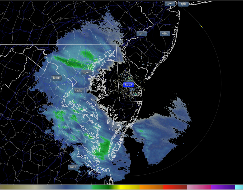
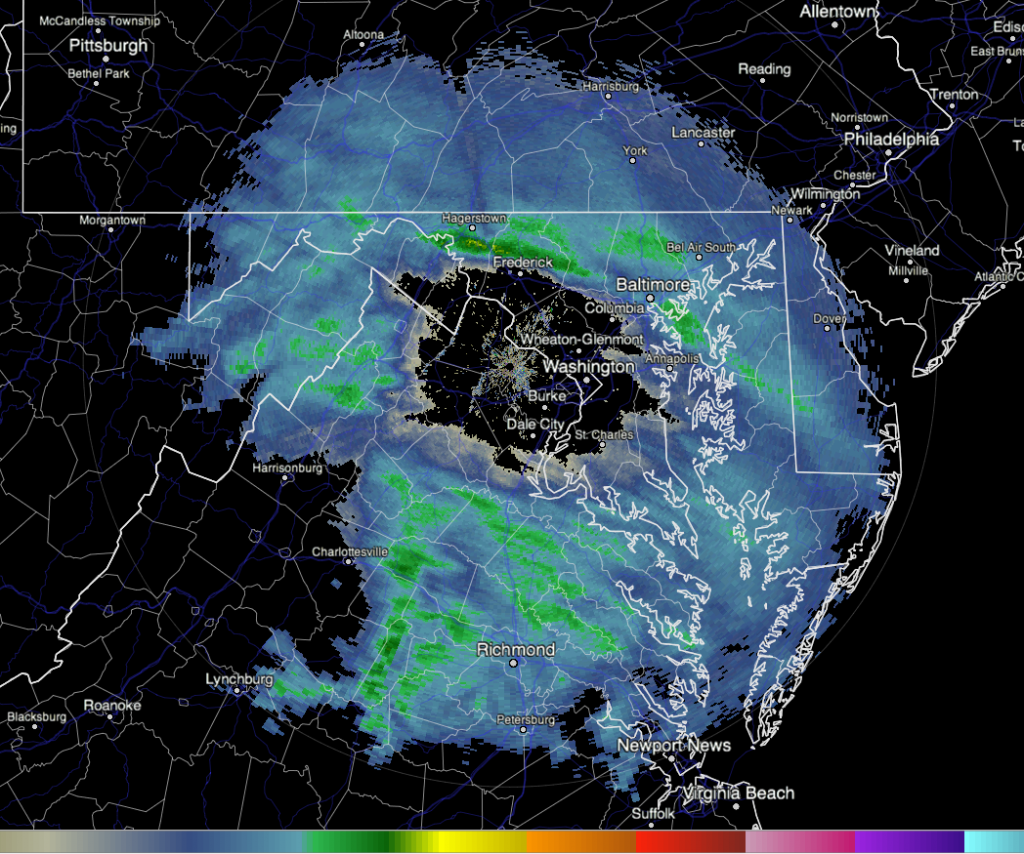
Around midday Friday I looked at the Doppler Radar images from Dover in Delaware, and from Wakefield Virginia and saw the images below. They are a classic case of impending snow, and something you might find interesting (and want to remember)!
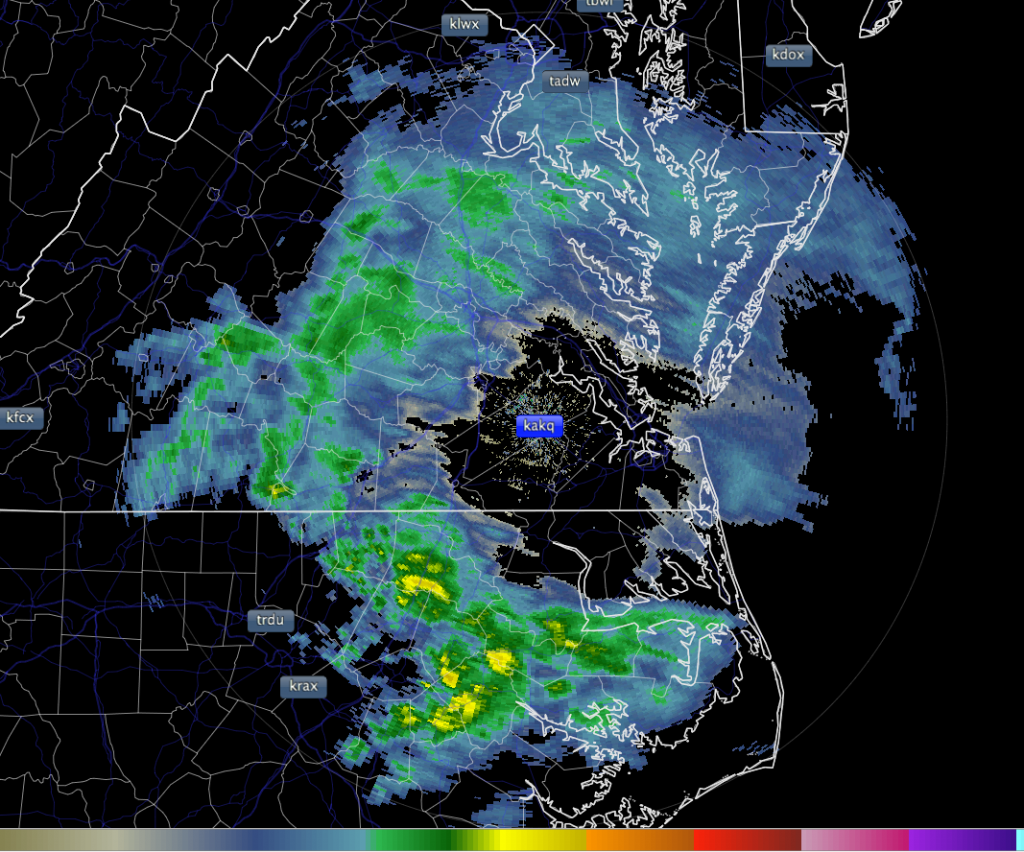
If you think that this image shows snow all around the radar but none within 40 km or so then you are wrong. Read on to understand what this image is really telling a forecaster.
Here is the Dover,DE NEXRAD radar at the same time (KDOX).
..and so does the NEXRAD at Sterling in Virginia!
So here is what we are really looking at:
The Earth is round, and radar beams go in a straight line, so as the radar beam gets farther away from the radar site, the ground curves away and the radar beam gets higher. The radar beam is also usually pointed at about 0.5 degrees above the horizon, so by the time the beam is 100 km away the beam is about 1500 meters above the surface. The image below shows the height vs range in the old english measurements.

NOAA Doppler radars change their pointing angle with each revolution. There are several different scan strategies, and they are called a Volume Coverage Pattern.
On Friday, the air was very dry over the Mid Atlantic and Delmarva Peninsula, and when the snow began it was not reaching the surface. It was likely sublimating (going from ice straight to vapor) in the dry air. The radar beam reached the areas where it was snowing a few thousand feet off the ground and then it passed above the falling snow several thousand feet higher up. A forecaster can look at the radar images, and by knowing the tilt angle and where the snow is first encountered (and where the beam rises above it) determine what layer the snow i sin and how close to the ground the snow is.
My friend Walt Petersen runs the research dual polarimetric radar at NASA’s Wallops Island facility, and sent me a shot of what is called an RHI. This is a look of what the NASA radar sees at all elevations in one direction. You can clearly see the snow layer in that image (below).
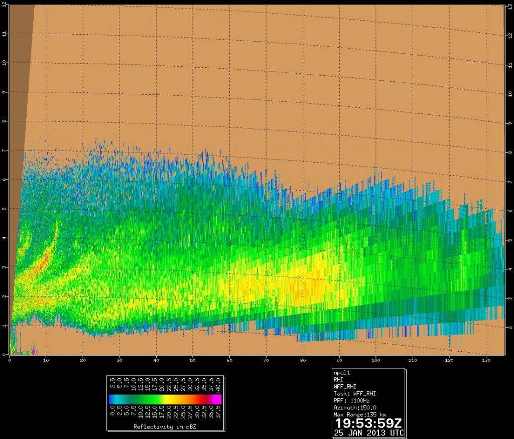
Range height (RHI) image from the Dual Pole NASA radar at Wallops Island in Va. Image courtesy NASA Scientist Walt Petersen.
As the snow saturated the dry air,it finally began to reach the surface and on radar, we saw the donut hole get smaller and smaller as the radar beam ran into the snow (ever closer to the surface). When the donut hole disappears, the snow starts!
The NASA Dual Pole radar has the ability to dectect the shape of the hydrometeors, and the image below shows what is falling at the different levels…mainly dry snow!



 Dan Satterfield has worked as an on air meteorologist for 32 years in Oklahoma, Florida and Alabama. Forecasting weather is Dan's job, but all of Earth Science is his passion. This journal is where Dan writes about things he has too little time for on air. Dan blogs about peer-reviewed Earth science for Junior High level audiences and up.
Awesome! Thanks for the Info!
Musically and Snowily –
Cory Pesaturo “The Snowman”