4 November 2012
Odds Increase of Post Election Day Nor’easter In Areas Hardest Hit by Sandy
Posted by Dan Satterfield

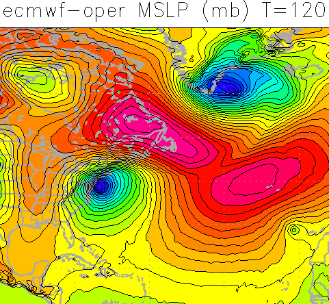
The European ECM Model is showing a strong Nor'easter Wednesday night. This model handled Sandy the best.
It’s not a certainty..yet, but the risk of a significant Nor’easter bringing wind, rain and snow to the areas hardest hit by Sandy is increasing tonight. If the overnight model runs come up with nearly the same solution then folks up here will need to prepare for winds over 50 mph. Snow is possible on the inland side of the storm as well as cold air flows into the storm. With damaged dunes along the shore, even a moderate onshore flow will cause some high waters and delay the restoration of power.
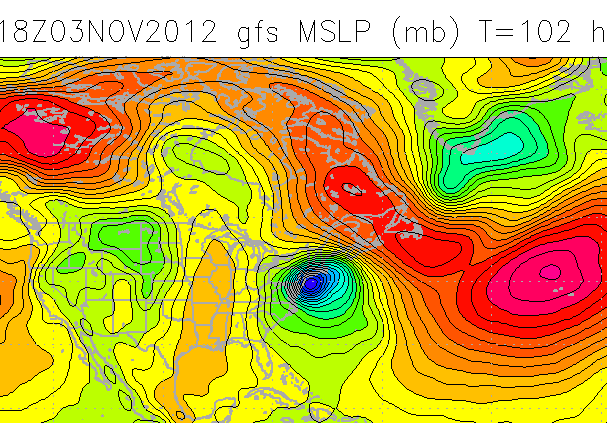
The U.S. Global model is also hinting strongly at a strong low developing. See below:


 Dan Satterfield has worked as an on air meteorologist for 32 years in Oklahoma, Florida and Alabama. Forecasting weather is Dan's job, but all of Earth Science is his passion. This journal is where Dan writes about things he has too little time for on air. Dan blogs about peer-reviewed Earth science for Junior High level audiences and up.