26 September 2012
Suomi Satellite Sees Storms and Street Lights
Posted by Dan Satterfield

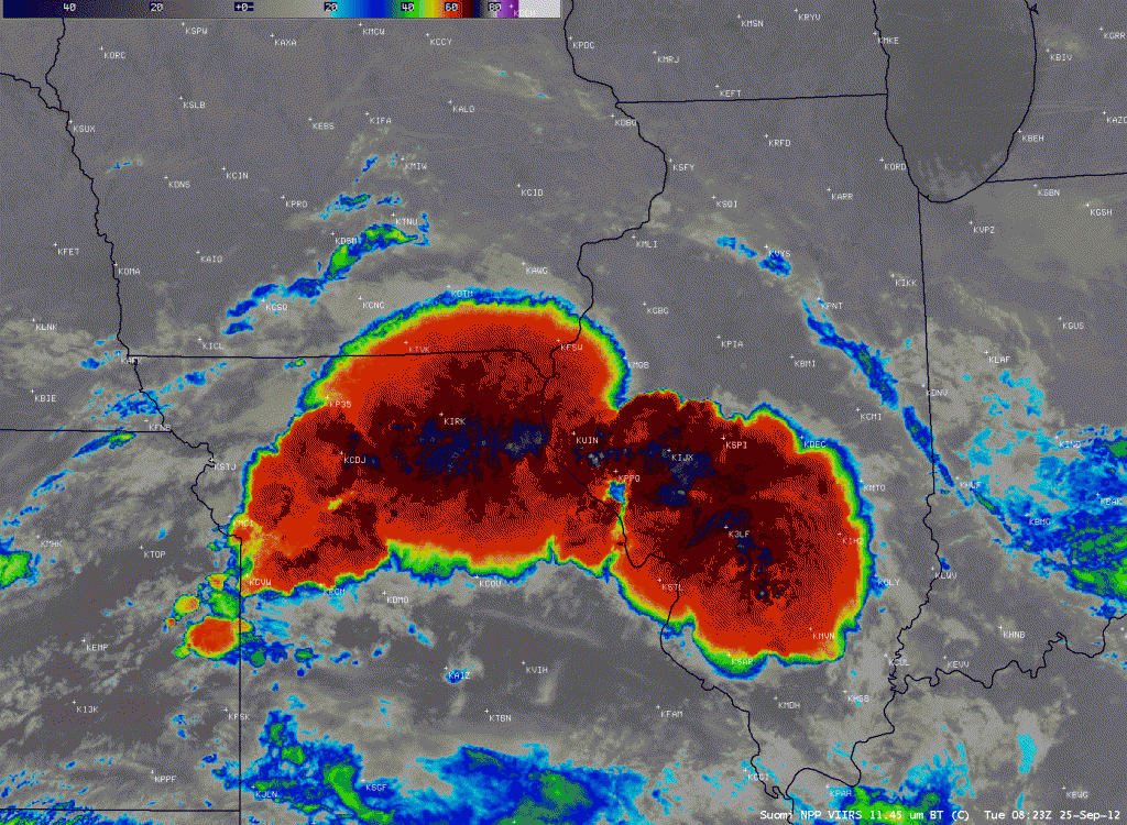
Image courtesy CIMMS Satellite Blog. Click this image to see the animated GIF between visible and IR.
The new Suomi satellite, with its night-time visible sensor and 1km resolution IR imagery, continues to send back some amazing views. This mesoscale convective system (MCS) developed late Monday night. Once we get something like this in geostationary orbit it will revolutionize satellite meteorology. Actually it already is.
A real problem with night-time IR images is that many times you cannot tell the difference between cold ground and cloud. Fog is especially difficult to spot. With a combination of night-time visible and IR, you can easily see where the city lights are blocked out or smudged. Algorithms can be developed to automatically plot where low clouds and fog are with high precision. Imagine you’re a pilot making a night flight…get the idea?


 Dan Satterfield has worked as an on air meteorologist for 32 years in Oklahoma, Florida and Alabama. Forecasting weather is Dan's job, but all of Earth Science is his passion. This journal is where Dan writes about things he has too little time for on air. Dan blogs about peer-reviewed Earth science for Junior High level audiences and up.