18 July 2012
Death Valley Low of 107 (41.7ºC) Sets Record For The Planet!
Posted by Dan Satterfield
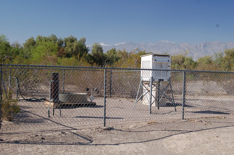
The temperature at sunrise in Death Valley on July 12 was 107 degrees. This ties the warmest overnight temperature ever recorded on Earth. Death Valley also holds the record for the hottest ever in America at 134 degrees, just two behind the planet record of 136 (58ºC) in Libya (but far below the 180 degrees last August, in the queue for Dumbo at Disney World ;).)
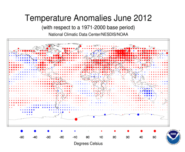
The heat this summer has been nothing less than amazing and it is going to hit us all in the pocket-book as well. Corn prices are rising rapidly because of the drought in the midwest and long-range model data shows the heat will likely continue another 10 days at least. The last 6 months were the warmest on record in the U.S. and June was the warmest EVER recorded for the Northern Hemisphere. The National Climate Data Center (NCDC) released some more eye-opening data this week:
- The average combined global land and ocean surface temperature for June 2012 was 0.63°C (1.13°F) above the 20th century average of 15.5°C (59.9°F). This is the fourth warmest June since records began in 1880.
- The Northern Hemisphere land and ocean average surface temperature for June 2012 was the all-time warmest June on record, at 1.30°C (2.34°F) above average.
The globally-averaged land surface temperature for June 2012 was also the all-time warmest June on record, at 1.07°C (1.93°F) above average.
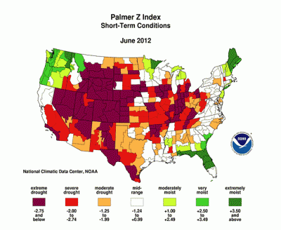
This is why corn prices are about to go through the roof. The knock on effect will raise food prices across the board as well.
Here is another illustration of the drought. The image below shows rainfall as a percentage of normal over the past 60 days. Red areas have had less than 25% of normal rain.
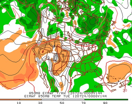
Last, but not least, the image on right is a forecast for next Tuesday evening from the European Center for Medium Range Weather Forecasting (ECMWF). It shows lower atmospheric temperatures and humidity at 700 millibars (around 3km). It indicates that the heat will continue in the Plains and Midwest through next Tuesday at least. A weak front this weekend may bring some scattered storms to Indiana and Illinois, but likely not enough to really help much.
Steve Scolnik at Capital Climate has been keeping track of the weekly U.S. temps and reports that this past week was the 31st week in a row that the national average temp. has been above average. Get this: In the past year only 4 weeks have been below average.
My friend Heidi Cullen at Climate Central was on MSNBC talking about the heat and drought today. It is WELL worth a watch.



 Dan Satterfield has worked as an on air meteorologist for 32 years in Oklahoma, Florida and Alabama. Forecasting weather is Dan's job, but all of Earth Science is his passion. This journal is where Dan writes about things he has too little time for on air. Dan blogs about peer-reviewed Earth science for Junior High level audiences and up.