27 May 2012
Smoke From New Mexico Fire Reaches East Coast; Beryl Approaches Florida
Posted by Dan Satterfield
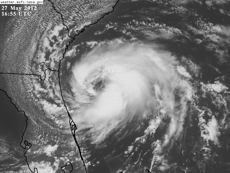
Update 1930 GMT Sunday: Beryl is now a full fledged Tropical Storm.
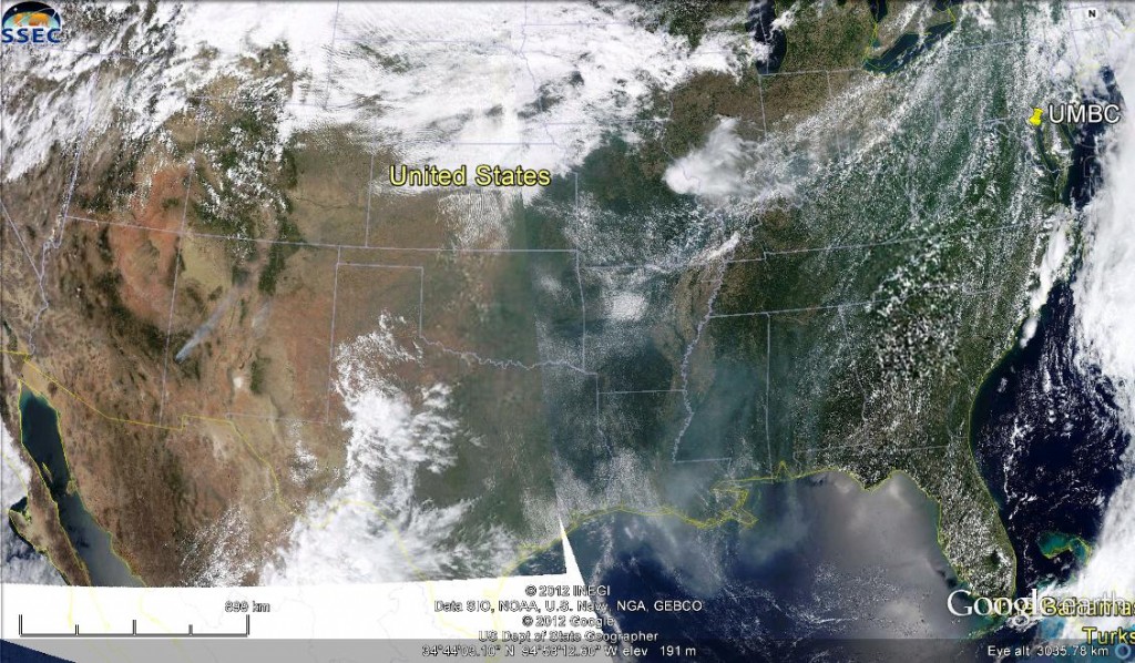
The huge wildfire fire in SW New Mexico Friday has produced smoke that covers much of Texas and Louisiana today, and the latest Terra satellite image from NASA shows the smoke over Western Maryland and much of Southern Pennsylvania. The image above was taken yesterday and if you look closely you can still see the smoke plume in SW New Mexico. I spotted it on the GOES images on Friday night just before the 11 PM newscast, and managed to get the image on during my weathercast.
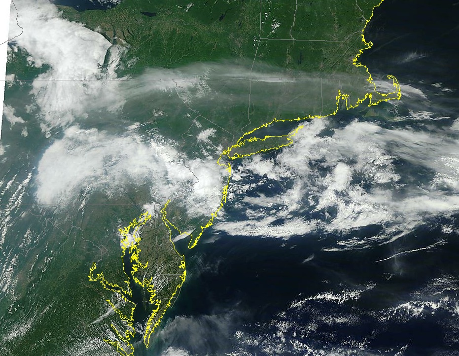
Here in Salisbury, on Maryland’s Eastern Shore, we still have a nice blue sky, but not far to our North and west the smoke clearly shows up on the latest MODIS image. (see below and click for full 1 km resolution)
On Friday night I could see a stream of smoke from SW NM all the way to Nebraska!
Update on Subtropical Storm Beryl:
 Beryl is approaching NE Florida and looking more tropical by the hour. A subtropical storm does not have convection around the center but we are seeing convection fire much closer to the center of circulation at midday and Beryl may become a fully fledged tropical system by landfall. The differences between a sub-tropical storm and regular tropical system have to do with the way the storm gets it’s energy. If it’s running partially on heat from condensation and from temperature differences in the atmosphere then it is sub-tropical.
Dr. Jeff Master’s has a very good summary on his blog about the difference between what we call a warm core and a cold core system. A Nor-easter in winter is a cold core low. A warm core system is using the heat produced when water condenses to maintain the low pressure. Hurricanes are ALWAYS warm core systems. A bit more technical explanation for fellow geeks is here.


 Dan Satterfield has worked as an on air meteorologist for 32 years in Oklahoma, Florida and Alabama. Forecasting weather is Dan's job, but all of Earth Science is his passion. This journal is where Dan writes about things he has too little time for on air. Dan blogs about peer-reviewed Earth science for Junior High level audiences and up.