23 March 2012
GOES West Satellite Stops Sending Images
Posted by Dan Satterfield

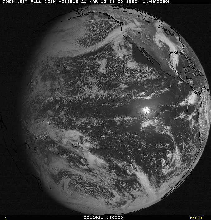
The last full disk image from GOES West taken 18 GMT Wednesday. Technicians think they have isolated the problem.
One of the two main geostationary weather satellites (GOES 15) stopped sending images yesterday and caused NOAA satellite technicians to scramble to troubleshoot. Late word this evening is that progress was being made, but images will likely not resume until Friday at the earliest. This GOES was launched in March of 2010, so it is still quite new.
The GOES EAST satellite was put into a mode to take frequent full-disk images, but forecasters on the west coast of North America have lost their normally good view of weather systems in the Pacific. Geostationary satellites are in a very high orbit at 35,000 km. This is about a tenth of the way to the Moon. If one fails, there is no human repair possible except from the ground. Even the Shuttle could not get close to this height.
There is a backup GOES in orbit now. GOES 14 was launched in 2009. GOES 13 is the current GOES East.
The latest from NESDIS:
Update: #6 GOES-15 (GOES-West) recovery is underway.
The problem has been isolated; however,the estimated return to service will occur no
earlier than 1600 UTC on Friday, March 23, 2012. Inaddition, a comprehensive list of
products impacts is provided in this message.
Lastly, we arecurrently experiencing some challenges that are impacting our
group e-mail notificationdistribution. We will return to normal operations as
soon as possible, and regret any inconvenience this outage may cause.


 Dan Satterfield has worked as an on air meteorologist for 32 years in Oklahoma, Florida and Alabama. Forecasting weather is Dan's job, but all of Earth Science is his passion. This journal is where Dan writes about things he has too little time for on air. Dan blogs about peer-reviewed Earth science for Junior High level audiences and up.
Successfully done Goes-15 recovery?
GOES WEST is back!