20 January 2012
La Nina Alone Is A Bad Predictor of Winter Weather
Posted by Dan Satterfield
I spent last week at probably the most informative weather seminar I’ve ever attended. The Glen Gerberg Weather and Climate Summit was at Breckenridge,Colorado this year and everyday was packed with great material for weather and climate geeks.
Dan Leonard of WSI Corp. did an in-depth talk about long-range weather prediction, and the techniques they use to make these forecasts for their clients. You can see all of Dan’s presentation on the video here, but I am going to give you a summary of the gist of it along with a few of his graphics. His entire powerpoint presentation along with many others, and videos from the summit are here.
Ocean Temperatures Steer The Storms and Cold.
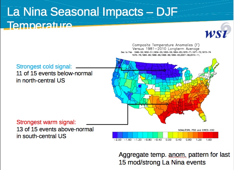
You’ve probably heard El Nino or La Nina mentioned when someone talks about the kind of winter weather to expect. There’s no doubt that the warming and cooling of the Pacific equatorial waters have a large impact on winter over North America and Europe (and elsewhere). Rarely, however, does Mother Nature make it so easy to guess her plans, and this is another example of just that. If you average up a bunch of cold water La Nina years you will see a temperature pattern like that below.

Average winter temps. during modt. to strong La Nina events- from Dan Leonard WSI Corp. Leonard makes a good case that using this alone to predict winter temps. is likely to be quite inaccurate.
Unfortunately, when you look at the individual La Nina or El Nino winters, you see a great deal of variation and this year is a prime example. The reason is that there are other ocean/atmosphere patterns, and sometimes they align so that you get an average La Nina pattern, and other times it can be far different. Take a look at the graphic below (All are from Dan Leonard’s presentation).
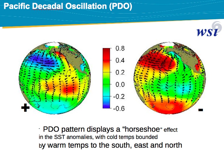
The Pacific Decadal Oscillation plays a big role in temperatures over North America. The negative phase has colder than normal water in the Pacific, similar to a La Nina year, but you can actually have a La Nina pattern with a PDO that is in the positive phase. When this happens the La Nina winter weather can be very surprising! The same can be said for El Nino events.
The NAO, PDO and I Don’t Know!
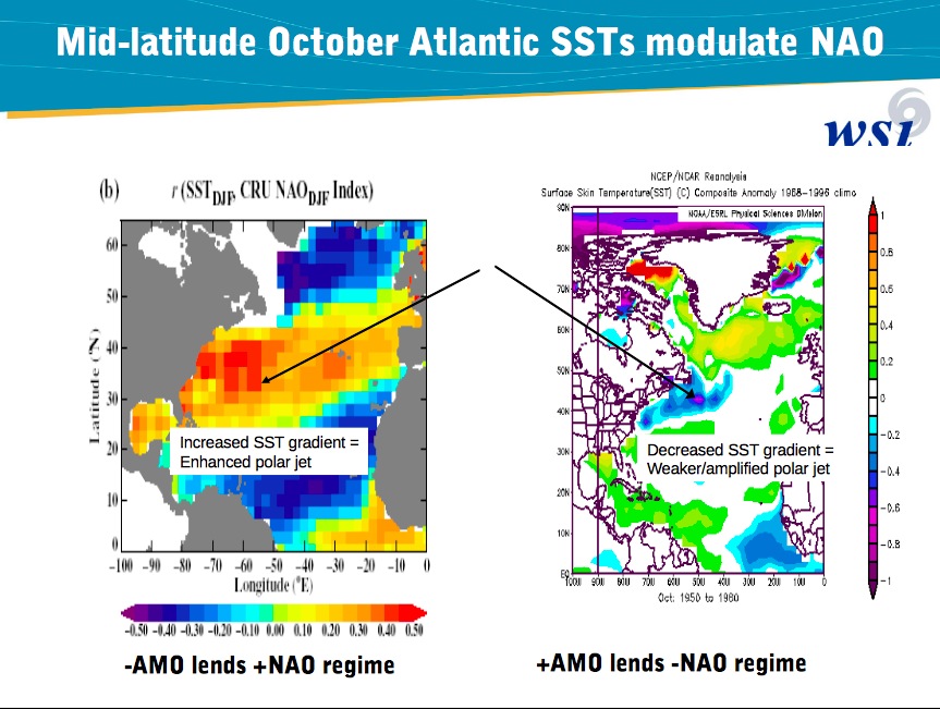
Besides the PDO we have to ask about ocean temps. in the Atlantic and these seem to have a big impact on what is called the North Atlantic Oscc. (NAO). The NAO is a pressure pattern in the Atlantic and when it is in the negative phase, you can count on big time winter weather over the Eastern USA. It usually brings the same to Western Europe as well, and unlike the last two years, it has been strongly positive this year.

Yet another ocean temperature pattern is important. It's called the Atlantic Multidecadal Osc. (AMO). Warmer than normal waters off of Greenland and colder waters off of the NE Coast of N. America tend to push the NAO into the cold negative phase.
Hopefully, you can see that getting an idea of what the winter will be like depends heavily on ocean temps. Not just those in the Equatorial Pacific, but in the Atlantic and globally. A positive AMO, along with a positive PDO, can lead to a very cold winter in the east, even if the El Nino or La Nina pattern argues against it. Still, the good news is that these patterns do give us the ability to make ever better predictions about the kind of winter we will see. Just keep in mind that what the average shows, and what people perceive are sometimes quite different. A big snowstorm (or two) will get the label of a “bad” winter, even if (on the whole) it was milder and drier than normal!

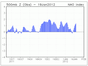
The NAO pattern is continuing to stay very positive and until it changes, winter will be very weak over the eastern portions of N. America.
The TLDR Version
If all the acronyms are starting to make you feel like a NASA administrator then relax. The take away point here is that looking at the average winter weather during an El Nino or la Nina event (see the top image in this post) can be very deceiving. It’s only a starting point. We call our planet Earth, but it should be named OCEAN! The waters that cover most of this planet, control everything about our weather and climate.
The winter, so far, has been far different from an average La Nina year. Normally it would be frigid in the Northern Plains, and all time record highs were set in December there! Dan Leonard discusses what might have gone wrong in the video I linked above, and hopefully, I’ve made all of those letters make more sense for you non weather geeks out there!
One last thing to consider. Climate change has caused the oceans to warm but they have not warmed equally everywhere. The higher latitude seas are warming much more quickly, and I think you can now see how a warming planet could cause a cold hard winter! The dramatic loss of sea ice over the Arctic is likely already having a significant effect and that was the subject of another session.
More on that soon!
Note: If there are some things in his talk that are greek to you, I would be glad to translate. Just leave me a comment! The last few days have shown signs of a more typical La Nina pattern emerging. La Nina winters tend to bring rare heavy snow to the Pacific Northwest. Seen some pics of Seattle lately!!


 Dan Satterfield has worked as an on air meteorologist for 32 years in Oklahoma, Florida and Alabama. Forecasting weather is Dan's job, but all of Earth Science is his passion. This journal is where Dan writes about things he has too little time for on air. Dan blogs about peer-reviewed Earth science for Junior High level audiences and up.
Dan,
Keep the NAO positive. I am getting great PaleoIndian archaeology done this winter in upland creeks with a far lower threat of Cottonmouths than I face each spring and summer. I can’t believe I am wading the creeks and getting good data on Paleo sites in late January. Usually I break ice and see little.
[…] and this brings far different conditions to North america than an El Nino. In general, the La Nina impacts are not as severe, but a La Nina does increase the risk of an active hurricane season. Just how […]