
25 September 2011
La Nina Is Back- What it means for the upcoming winter.
Posted by Dan Satterfield
Colder Than Normal
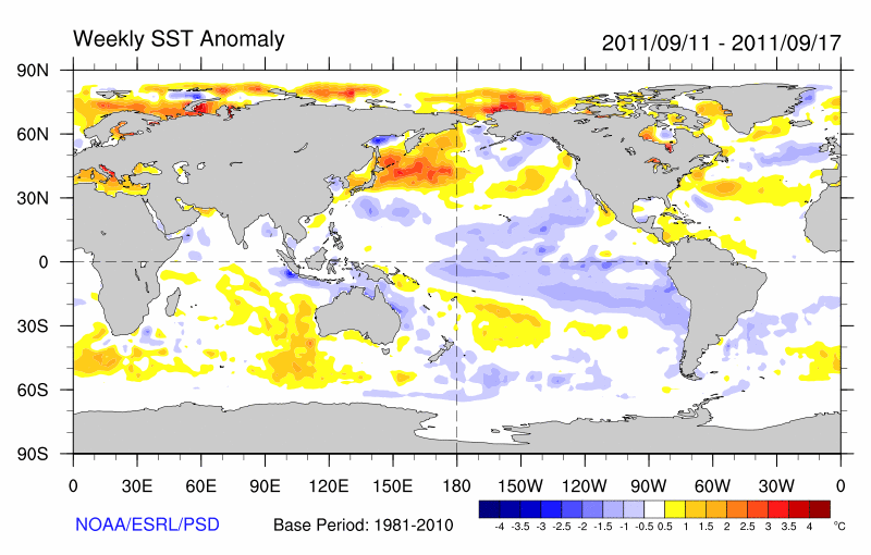
The temperature anomalies in the equatorial Pacific have reached -0.7C in the Nina 3.4 region, and anything below -0.5 C is considered La Nina conditions. There seems little doubt now that La Nina conditions will prevail over the upcoming NH winter, and the signature of La Nina is very evident in the weekly sea surface temp. anomalies. The large area of cooler than normal water stretching westward away from the coast of S. America is very noticeable.
La Nina and its sister El Nino are different phases of what meteorologists call the Walker circulation. A nice concise summary/history is here and here. When the Walker circulation reverses we have an El Nino as warm water from the W. Pacific moves eastward. La Nina is actually a super strong normal Walker circulation with stronger than normal trade winds blowing cool water that is upwelling off the coast of S. America westward across the equatorial pacific.
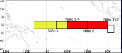
El Nino and La Nina episodes are determined by the SST's in the Nino 3.4 region.
We Remember Extremes
In general, long-term seasonal forecasts have horrible skill but an El Nino or La Nina makes it possible to give more information than normal about the type of winter that can be expected. That said, every ENSO (El Nino-Southern Oscillation) episode is different, and La Nina’s especially seem to vary widely from event to event in many areas. Furthermore, we are talking long-term averages and people do not remember weather that way!
Instead, they remember the extremes and not the averages, with events like cold outbreaks and snow storms defining the winter. Here in the south, a heavy snow event and a couple of arctic blasts, and everyone talks about how bad the winter was, even if the overall average turns out to be above normal! Something to keep in mind as you look at the maps on this post and any long-range forecast.
The reason that winters are more predictable during ENSO events is because of the tight connection between the ocean and the atmosphere. Most of the Earth’s heat is stored in the oceans, (not the atmosphere) and when a large part of the world’s largest ocean cools down or warms up for a few months, then the storm tracks can make some dramatic changes. Since this winter is going to be a La Nina winter, I’ll focus on that for the rest of this post.

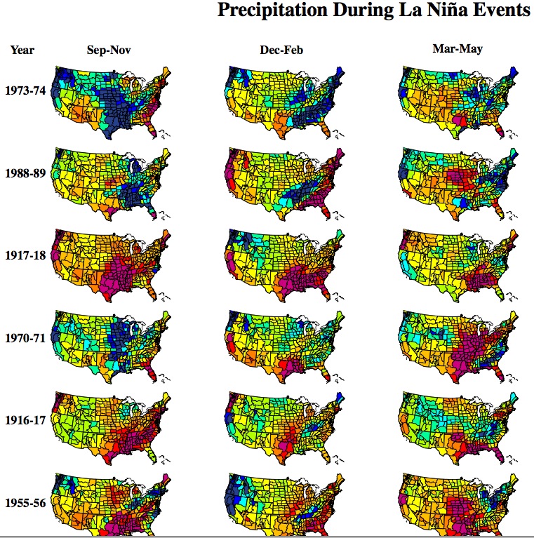
Average La Nina winters- from NOAA-CPC
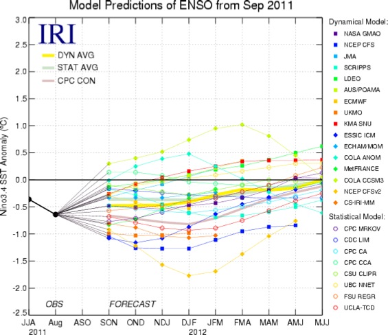
Dynamical and statistical models are not unanimous in forecasting a La Nina winter but almost so.
Bad News For Texas
The developing La Nina, means the all time worst drought on record in Texas may not be over and it may even linger into next summer as well. Most La Nina events are marked by rather dry weather for Texas (there are notable exceptions) through the winter and especially in the critical planting season of April and May. If you have to make a forecast for Texas rainfall knowing a La Nina is coming- it will not be one that gives comfort to those in agriculture.
Click for larger version. Blue is wetter than normal and red is just the opposite. From NOAA CPC.
Here in the Southeast U.S. we usually see a winter that is a bit milder than normal, but last year was a La Nina winter and I woke up to half a foot of snow on Christmas morning! Snow lovers in the Canadian Rockies can rejoice because a cold and snowy winter is an almost sure bet in a La Nina winter! The Pacific Northwest also has a cold wet winter as well with Seattle/Vancouver sometimes getting heavy snowfalls.
Climate Change Connections
It’s natural to ask if there is a connection between rising greenhouse gases and the Walker circulation, but so far this is an open question. There have been some suggestions in the journals of El Nino’s becoming more likely but it’s by no means certain. The growing certainty that the summer-time Arctic sea ice is in its last few decades is also a factor, and it might have a bearing on La Nina and El Nino (in the much warmer world that’s coming just a few decades from now).
 Dan Satterfield has worked as an on air meteorologist for 32 years in Oklahoma, Florida and Alabama. Forecasting weather is Dan's job, but all of Earth Science is his passion. This journal is where Dan writes about things he has too little time for on air. Dan blogs about peer-reviewed Earth science for Junior High level audiences and up.
IHa, I could have told you that without the scientific reasoning. My Walnut tree has no Walnuts this year. Always a certifiable predictor. Love ya Dan. Miss you terribly in Tn since the switch to Digital.
I really don’t get what biological mechanism would cause a walnut tree to “predict” future weather. My colleague here in Connecticut said the same thing. I have read that the weather in the spring when the tree is flowering would be the driving factor in acorn production.
As for the northeast I have also read that it is difficult to predict the weather in the northeast during a La Nina year. It can be affected by oscillations in the Atlantic as it was last year which certainly wasn’t mild.
what does this mean for northeast ala weather for this winter.
So, the real question is:
Is this the first El Nina without having a sub-tropical jet stream.?
We got rains from arctic storms all summer down to AZ !
Have never seen more than one dip down in summer before.
Is the subtropical jet gone for good?
Sub tropical jets tend to be a big component of El Nino events. This is why the rains are so heavy in the southern states in El Nino years.
As i understand it, the southern jet typically pushes the pacific jet to the north.
This year it is gone completely, with only the trade winds pushing the La Nina cold water onshore in North America.
Have heard that the cold upwelling there is not specifically related to the La Nina event, it is a different cycle, and is likely to stay for 7-8 years?
Can we expect the missing subtrop jet to re-appear at the end of the La Nina cycle ?
Is the sub trop jet JUST the tropics trade winds roaming north?
Thanks,