
12 September 2011
Remains of Katia Hit Ireland and UK
Posted by Dan Satterfield
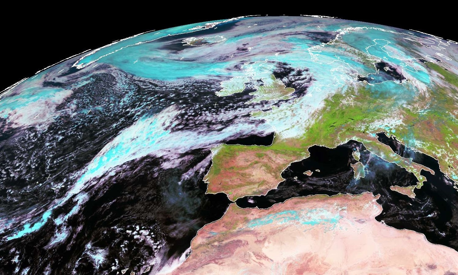
Meteosat at Noon GMT (ctsy Univ. of Dundee Scotland). Click for much larger image.
The remains of Hurricane Katia have brought gales gusting to near hurricane force across the northern areas of the UK today. The UK Met Office has several severe weather warnings up. A close friend in Wales reports a very windy and wet day. The BBC has more here. In spite of the cold water that Katia passed over, it takes awhile for these systems to spin down and it long ago turned extra-tropical. You might be surprised to know that this is not that unusual an event for the UK in the early autumn.
Note: The Meteosat has more channels than the U.S. GOES weather satellites and it is possible to make a semi-true colour (See the comment below from Robert Simmon at NASA) visible image like that above. They use two visible channels (actually one visible, one near IR and one short wave IR) at wavelengths of .6,.8 and 1.6 microns. GOES R (scheduled to be launched in 2015) will have similar channels and some new ones as well.
 Dan Satterfield has worked as an on air meteorologist for 32 years in Oklahoma, Florida and Alabama. Forecasting weather is Dan's job, but all of Earth Science is his passion. This journal is where Dan writes about things he has too little time for on air. Dan blogs about peer-reviewed Earth science for Junior High level audiences and up.
Thanks for the info. Jeff Masters has additional background on previous extratropical storms hitting the British Isles and Europe: http://www.wunderground.com/blog/JeffMasters/comment.html?entrynum=1927 . Regards, Tom
Thnx for heads up Tom!
My pleasure. I’m enjoying your posts & tweets.
Dan: 0.6, 0.8 and 1.6 microns is red, near infrared, and shortwave infrared. It’s a bit misleading to call it semi true-color, because vegetation is much, much brighter in these types of images than it would be in a photograph.
Good point- I paused while writing that but went ahead in the aim of simplification. Thanks!