
5 September 2011
Out of Control Texas Wildfire from Space
Posted by Dan Satterfield
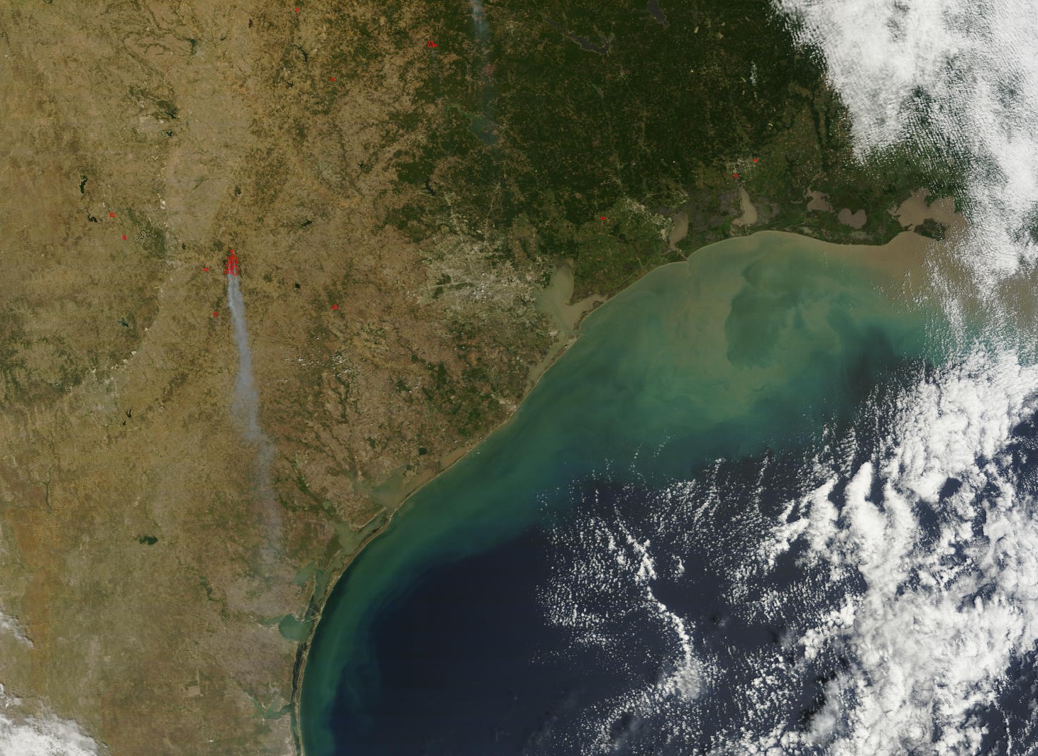
From NASA Terra satellite using the MODIS sensor. Image taken at 17 GMT (11:05 AM CDT). Click to see a MUCH bigger image.

From NCAR- surface pressure map at 20Z (3 PM CDT). Click for full size.
The wildfire to the SE of Austin remains out of control and has burned 300 homes according to press reports. The wildfire is also visible on GOES images as well. The weather could not be possibly any worse in this situation. A summer of the worst drought in history and now a strong cool front has brought gusty northerly winds with dewpoints in the 30’s, giving very low relative humidities. The winds are likely to stay up through the night as well and this is going to get a lot worse before it gets better.
To get an idea of just how bad the Texas drought is, check out the graph in yesterday’s post. The good news is that the pattern seems to be finally changing, and wetter and cooler weather may be on the way to Texas and Oklahoma. However, any strong cool front before significant rains fall, will bring a very high threat of more out of control wildfires.
 Dan Satterfield has worked as an on air meteorologist for 32 years in Oklahoma, Florida and Alabama. Forecasting weather is Dan's job, but all of Earth Science is his passion. This journal is where Dan writes about things he has too little time for on air. Dan blogs about peer-reviewed Earth science for Junior High level audiences and up.