
21 August 2011
Irene Getting Stronger- Heads Up To East Coast Residents
Posted by Dan Satterfield

Goes image of Irene from NASA GHCC here in Huntsville.
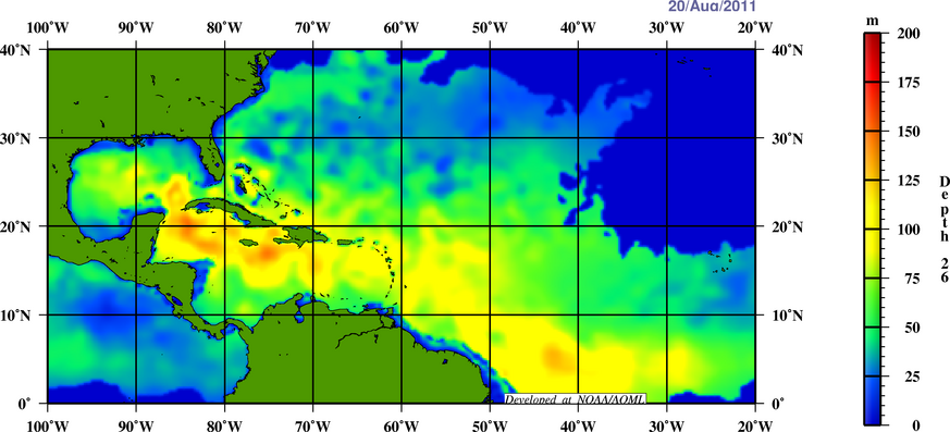
Depth of the warm water over the Caribbean Sea. NOAA image
Irene is now packing winds of 50 mph, and has become much better organized during the afternoon hours on Sunday. There has been a significant shift in the track guidance overnight with almost all of the NWP models and statistical models are trending toward an east coast threat. A tropical storm watch is now posted for the SE Bahamas and I suspect the government there will raise this to a Hurricane Watch tomorrow.
The satellite image above shows a well-defined high pressure system on top of Irene and this is an indication that it is becoming more organized. Hurricanes need a high pressure system on top of them to ventilate the storm, and with very little wind shear in its path and a deep layer of very warm water under it, this system will likely reach hurricane strength.
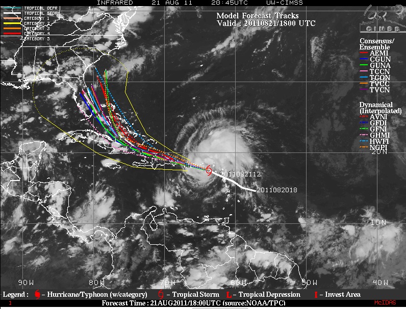
Forecast model tracks ctsy CIMMS at Univ. Wisconsin.

Data from NCAR's Res. Application Lab. Notice the wide range of intensity forecasts. Use the NHC forecast guidance instead of this if you live on the coast, and I put it here to illustrate the difficulty of intensity forecasts only.
The reason for the shift in track is a cool front that is sagging down into the southeastern U.S. beginning late Monday. This front will actually bring some drier air into the region, and this trough will present a weakness in the strong tropical high pressure ridge that has been keeping Irene from turning north. Keep in mind when looking at the NHC forecast track that the AVERAGE 5 day forecast error is 250 miles. If you’re in the uncertainty cone, you have just as much a chance of being hit as areas near the forecast position.
The main factor that will inhibit strengthening over the next few days is proximity land. This makes forecasting intensity very difficult ,and there is actually very limited skill at this, and it remains one of the most difficult of forecast problems with very little progress over the last 25 years.
 Dan Satterfield has worked as an on air meteorologist for 32 years in Oklahoma, Florida and Alabama. Forecasting weather is Dan's job, but all of Earth Science is his passion. This journal is where Dan writes about things he has too little time for on air. Dan blogs about peer-reviewed Earth science for Junior High level audiences and up.