
1 February 2011
Historic Blizzard Pounds Plains/Midwest; Aussies Brace for Yasi
Posted by Dan Satterfield
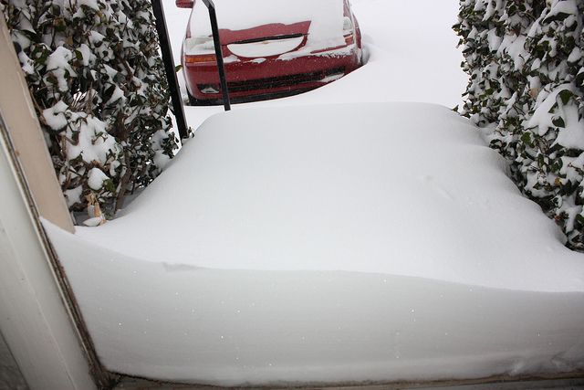
Paul McCord Jr. of Midwest City, Oklahoma uploaded this picture to FLICKR. It is restricted to non-commercial use with credit. Please abide by his restriction.
From Oklahoma to Illinois a blizzard is raging this evening. Tulsa broke it’s one day snow record with 13.2 inches and Chicago, at 4 PM CST, was reporting blinding snow and winds near gale force. Winds are likely near 50, in gusts along Michigan Avenue, near the lake front.
Here is the official NWS Chicago forecast for tonight:
Tonight: Snow and widespread blowing snow. The snow could be heavy at times. Some thunder is also possible. Low around 18. Windy, with a northeast wind between 25 and 30 mph, with gusts as high as 45 mph. Chance of precipitation is 100%. Total nighttime snow accumulation of 10 to 16 inches possible.
Wednesday: Snow and widespread blowing snow before 3pm, then areas of blowing snow and a chance of snow after 3pm. Temperature falling to around 19 by 8am. Wind chill values as low as 1. Blustery, with a north northwest wind between 15 and 25 mph, with gusts as high as 35 mph. Chance of precipitation is 90%. New snow accumulation of 3 to 7 inches possible.
My sister lives in Tulsa, and says travel is at a standstill over much of Oklahoma.
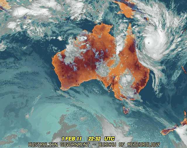
Meanwhile in Australia, Yasi is now a Severe Tropical Cyclone with winds gusting to 160 knots.

Cyclone Yasi is headed for North Queensland. The flooding rains over the region in January have soaked the ground and another catastrophic flood cannot be ruled out after Yasi makes landfall.
Below, is a late satellite image of Yasi from the Aus. Bur. of Meteorology.
 More soon!
Update: NASA has just released an incredible image from the MODIS sensor on the Aqua Satellite:
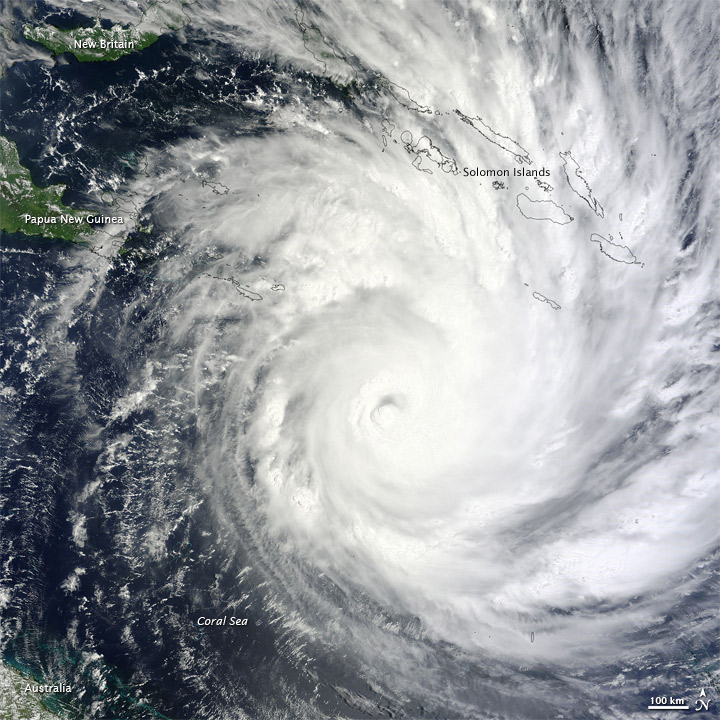
Click image to see full resolution. From NASA.
 Dan Satterfield has worked as an on air meteorologist for 32 years in Oklahoma, Florida and Alabama. Forecasting weather is Dan's job, but all of Earth Science is his passion. This journal is where Dan writes about things he has too little time for on air. Dan blogs about peer-reviewed Earth science for Junior High level audiences and up.