
10 May 2010
Oil, Ash and Deadly Tornadoes
Posted by Dan Satterfield
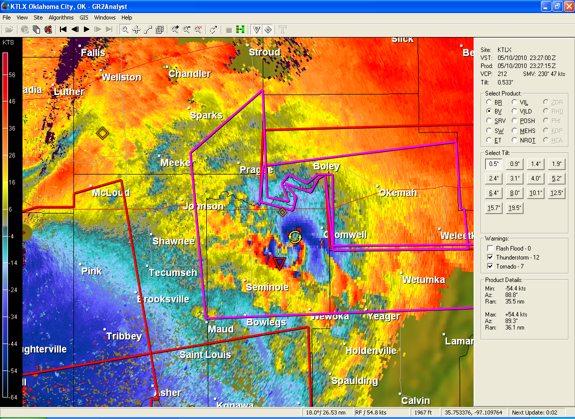
Doppler Velocity image of a deadly tornado in Oklahoma this afternoon. The storm was repsonsible for at least three deaths and millions in damage. The triangle is the location of the strongest wind shear. Blue is wind toward the radar and red is wind away from the radar. One of the most incredible velocity images of a tornado I have seen. Click for full res. WSR88D Doppler Radar at Tinker AFB near OKC,OK.
It’s been a busy month for those of us who forecast weather. Tracking volcanic ash using upper level wind forecast and using ocean current models to track the growing oil slick in the Gulf. Today it was a little of all three.
Oklahoma was hit by a swarm of tornadoes today. At least 4 are dead. Many people have lost there homes. Cars and large trucks were flipped in the air along I-35 and I-40. With modern technology, I could watch the same radar images that forecasters in Oklahoma were looking at. Large tornadoes show up very well on Doppler radar. Today they were very easy to spot.
In the Hollywood movie “TWISTER” the town of Wakita, Oklahoma is hit by a big tornado. Today, Wakita really WAS hit by a large tornado. See the radar image below.
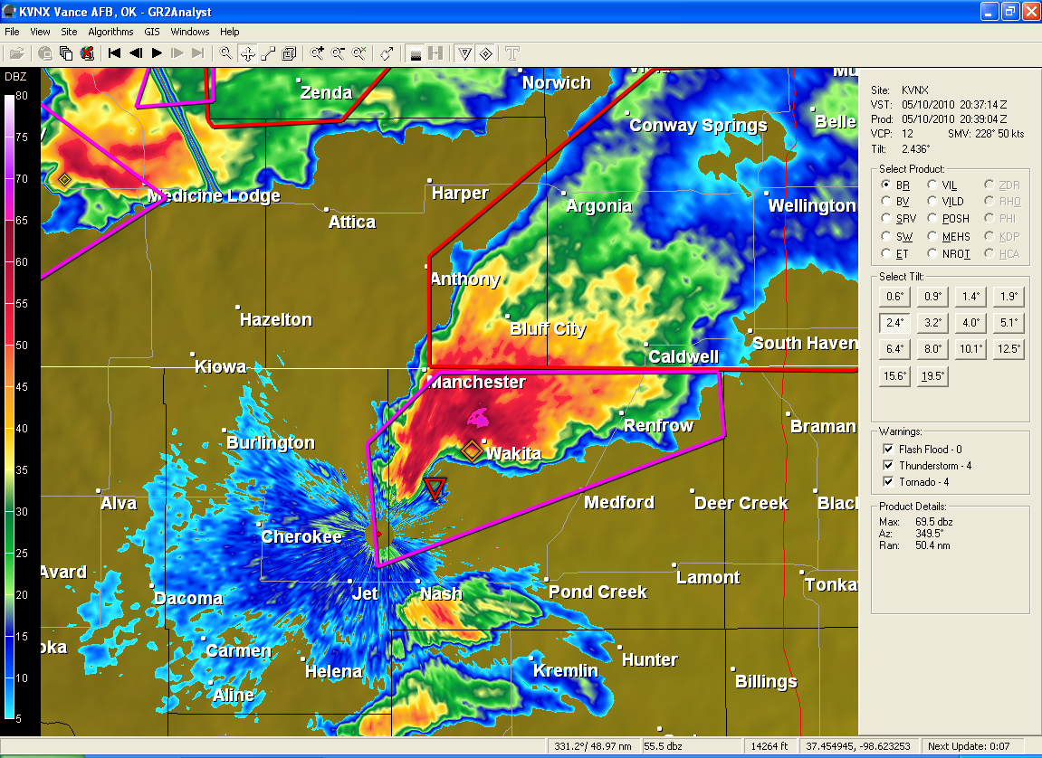
Hook echo approaching the town of Wakita, Oklahoma. Fortunately, it appears there were no deaths. Warnings DO make a difference!
As for the oil in the Gulf…

NASA Modis view of the oil slick in the Gulf. Taken Monday 10 May.
The slick is noticeably bigger on the NASA Terra satellite images today.
Ocean current models continue to indicate the oil will spread toward Louisiana. There is already oil spreading westward of the Mouth of the Mississippi and Northward onto Dauphin Island in Alabama.
The oil is showing up as gray and a dark color surrounding it in the middle right of the image to the left.
You can click the image and see a much larger version.
Now for the Volcano in Iceland…
It’s still erupting and the only reason air traffic is not snarled, is the upper level winds are blowing it south into the mid Atlantic. If the winds change and start blowing the ash toward Europe again…
Here is a pic from the NASA Terra satellite today.
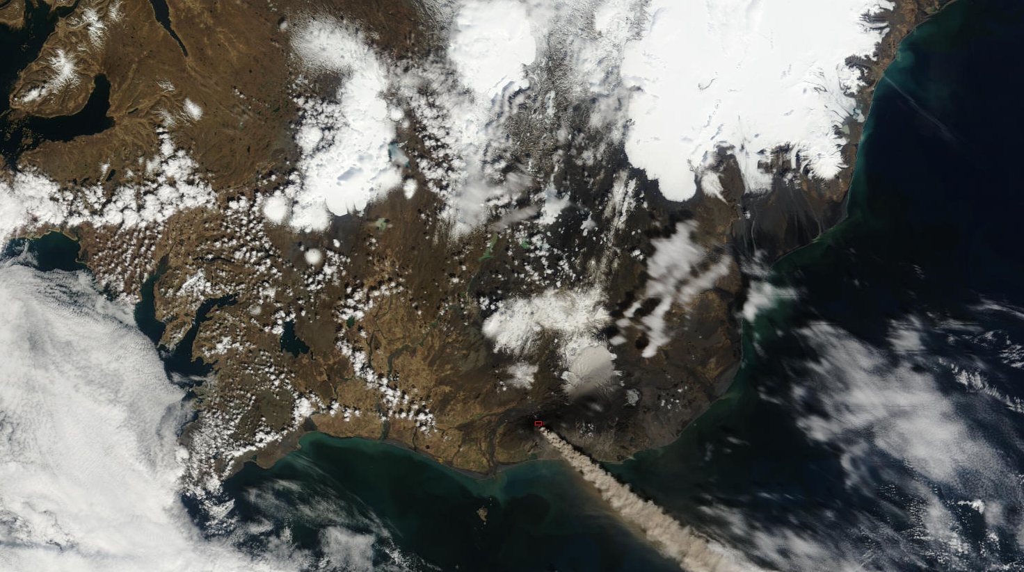
From NASA Modis sensor on the TERRA satellite. Ckick for full res.
There are several towns in Iceland that have been covered in thick ash from the volcano. That is not getting nearly the coverage that the flight delays are. You have to feel for those folks…
The nearby Katla volcano usually erupts within a few months of it’s neighbor. It’s eruptions are much bigger. MUCH BIGGER.
No sign of that happening…yet…
Dan
 Dan Satterfield has worked as an on air meteorologist for 32 years in Oklahoma, Florida and Alabama. Forecasting weather is Dan's job, but all of Earth Science is his passion. This journal is where Dan writes about things he has too little time for on air. Dan blogs about peer-reviewed Earth science for Junior High level audiences and up.