
8 May 2010
New Views of Iceland Ash Cloud & Gulf Oil Slick. Bad news on both.
Posted by Dan Satterfield
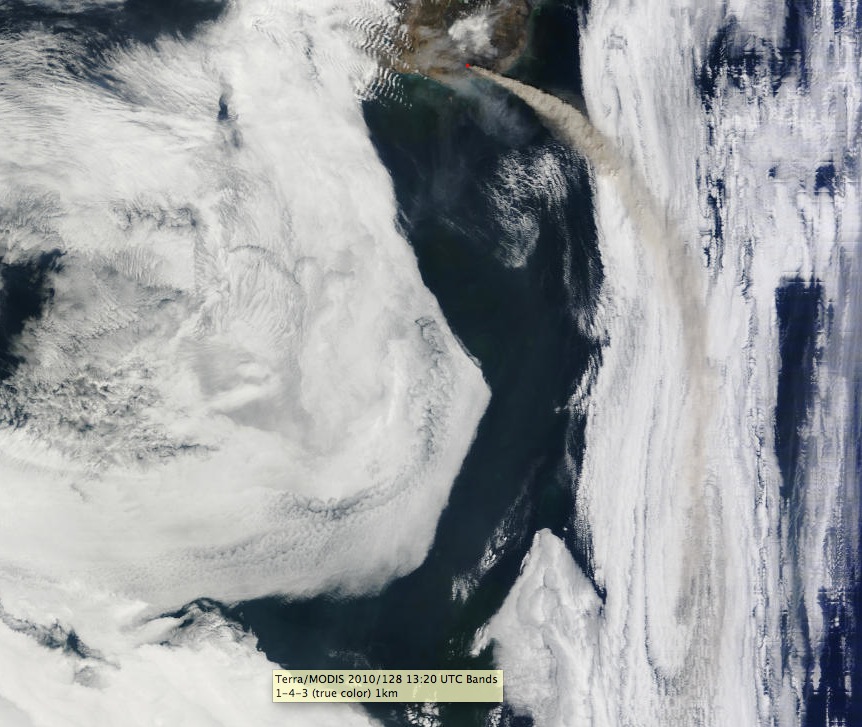
View of the Iceland ash cloud taken Saturday midday by NASA Terra Satellite. Click image for full res.
The winds aloft are blowing the ash mainly over the Atlantic today.
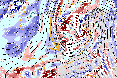
Wind flow at around 18,000 feet (500hpk) for Midnight Sunday. NOAA Numerical Weather model (GFS). (The red and blue shading is vorticity-weather geek stuff, just look at the black lines and my arrow toward the UK.)
Some of it is rotating around an upper level low and causing problems in Spain. The wind flow in the mid levels of the atmosphere will blow it more toward the UK and Europe starting late Sunday. Heathrow and Gatwick could very well be affected.
The ash is up to around 5,000 meters today. Transatlantic flights can get above it. If it gets higher (above 30,000 feet), then more widespread disruptions are likely.
The same satellite also passed over the Gulf just before Noon. It got a great shot of the oil.
See below.
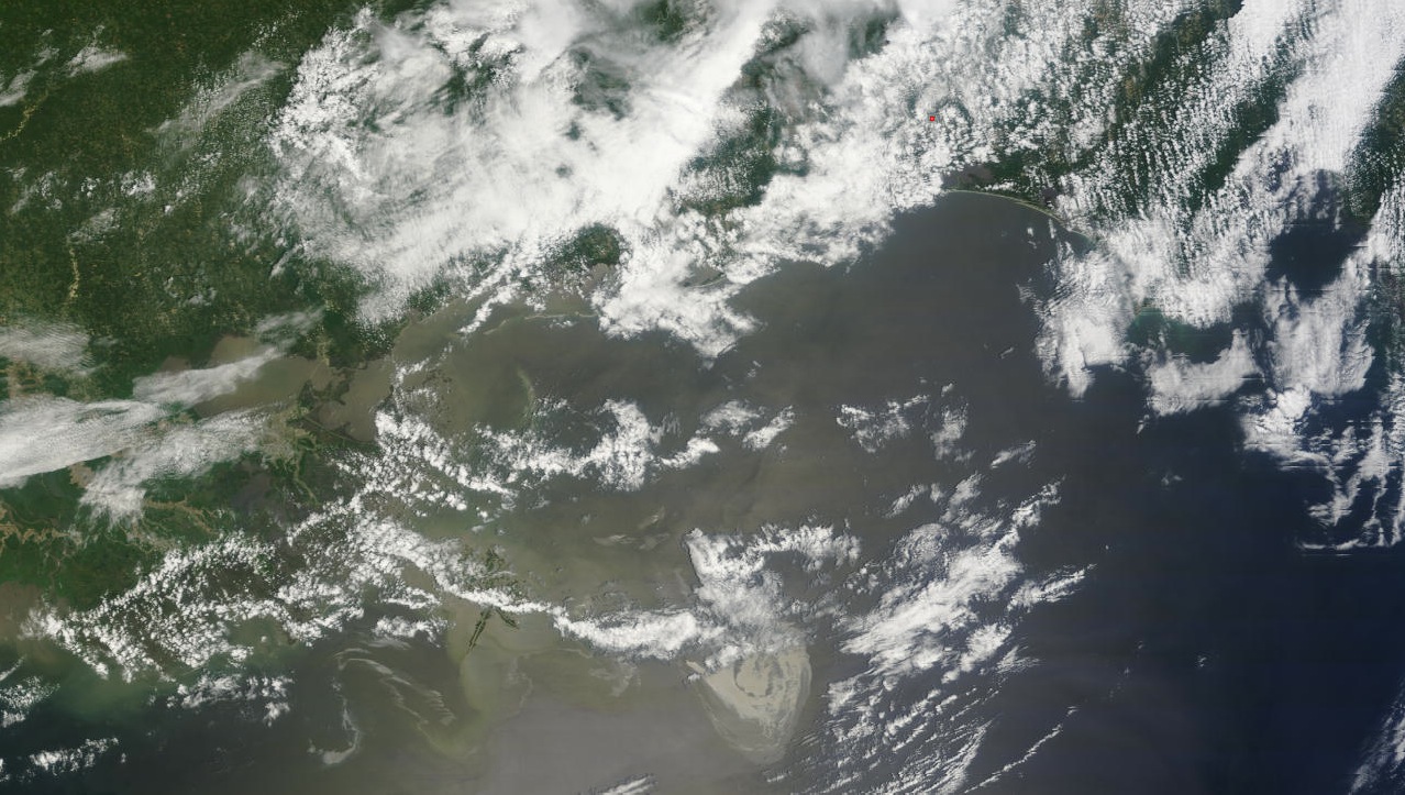
Oil slick is visible at the middle bottom of the pic. Click image for full resolution.
Late word tonight is that the attempt to put a cover over it has failed. Ice is forming in it.
This is probably from the sudden drop in pressure as the oil escapes the sea bed. The tremendous pressure differences between the sub surface and the sea bed are likely involved. The same differences in pressure from the sea floor to the surface will also make this EXTREMELY difficult.
You can demonstrate this to yourself by rapidly letting the air out of your car tires while holding onto the valve. Feel how cold it gets??
Dan
 Dan Satterfield has worked as an on air meteorologist for 32 years in Oklahoma, Florida and Alabama. Forecasting weather is Dan's job, but all of Earth Science is his passion. This journal is where Dan writes about things he has too little time for on air. Dan blogs about peer-reviewed Earth science for Junior High level audiences and up.
Methane coming up with the oil would cause the cooling. Does the combination of methane with water change the freezing temperature? Methane and ice presumably forms clathrites.
Yes it’s the clathrites that are causing the problem. Also at that depth, the water temp us likely just above freezing anyhow.