
30 April 2010
New Satellite Image Shows Oil Poised to Hit Coast over Wide Area
Posted by Dan Satterfield
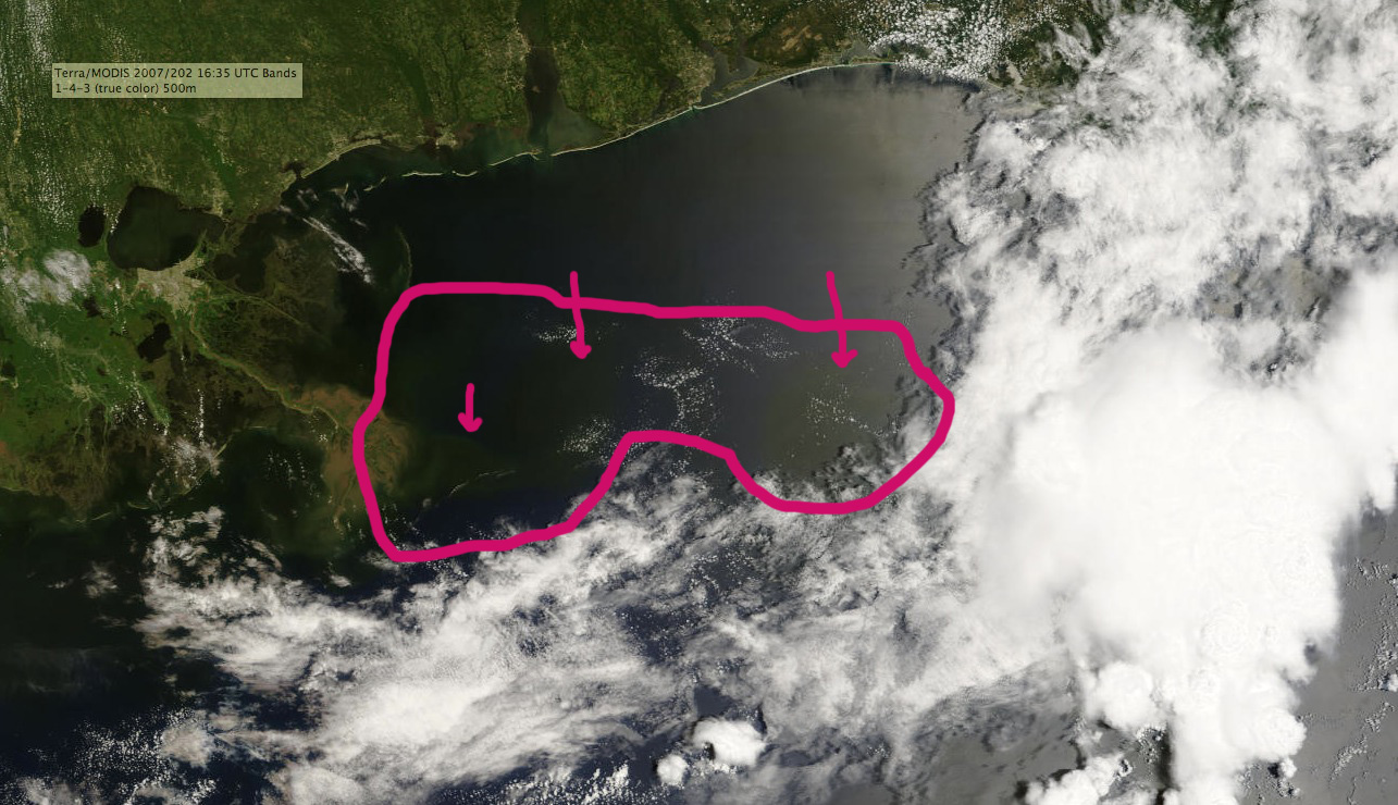
NASA Modis image taken at 11:35 AM CDT. The oil has spread into Louisiana and is now due South of the Florida Coast. Strong southerly winds will likely spread it onto shore over the weekend. Click image for full size.
The offshore weather buoys are now indicating winds of 20 knots sustained from the south. This will mix the oil some but also push it toward shore.
More soon.
 Dan Satterfield has worked as an on air meteorologist for 32 years in Oklahoma, Florida and Alabama. Forecasting weather is Dan's job, but all of Earth Science is his passion. This journal is where Dan writes about things he has too little time for on air. Dan blogs about peer-reviewed Earth science for Junior High level audiences and up.
Why isn’t anyone doing anything to prevent it from reaching shore? It’s almost as if BP/gov’t just threw up their hands.