
18 November 2009
Where The Clouds Are…
Posted by Dan Satterfield
Nasa has released an interesting image of Earth. It’s a composite of hundreds of images of the Earths clouds. No borders have been added. Just clouds. Where there are clouds most of the time you see gray.
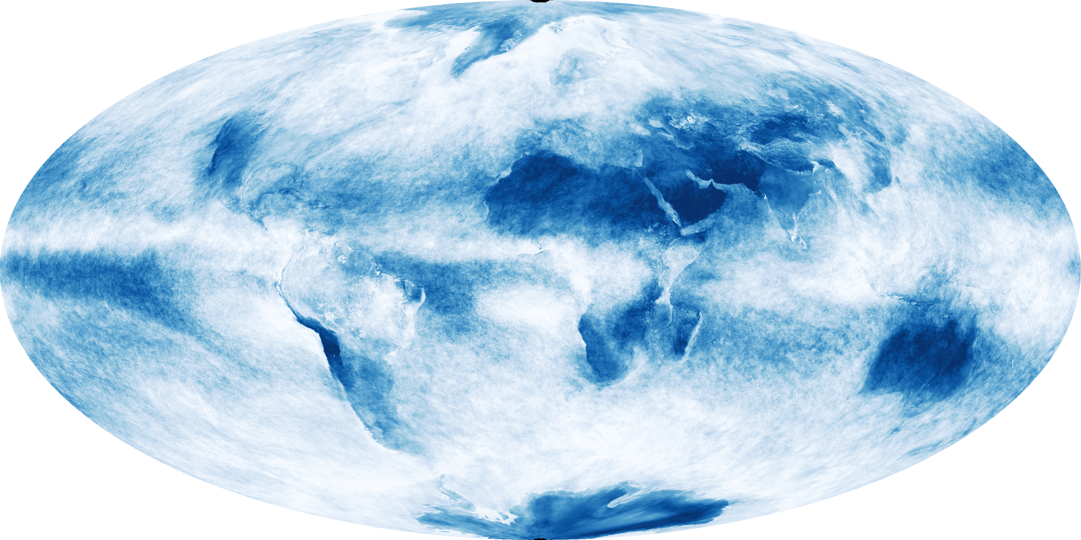
Image from NASA Modis sensor on the TERRA Satellite, of cloud cover averaged over October 2009. Click for the full size image (Large)
In places where the satellite saw clouds some of the time, but not often, you get a blue gray and areas where the satellite saw almost no cloud in any of the satellite passes, you get a dark blue.
Say you want to live in a place where there is almost always sunshine. Look at the image, move to a dark blue spot. Like a mix of rain and sun, gray blue will do you! What is most interesting here is that the difference in cloud cover, between land and sea, allows the continents to show up quite well in many areas!
Note also that there is little cloud cover over Greenland or the Antarctic. These spots have the Earth’s only remaining ice sheets. The cold air above the ice means the air can hold little moisture. The Antarctic especially, is a great white desert.
A desert I long to visit.
The band of constant cloud cover near the Equator is the Inter-tropical Convergence Zone (ITCZ).
 Dan Satterfield has worked as an on air meteorologist for 32 years in Oklahoma, Florida and Alabama. Forecasting weather is Dan's job, but all of Earth Science is his passion. This journal is where Dan writes about things he has too little time for on air. Dan blogs about peer-reviewed Earth science for Junior High level audiences and up.
Now that is interesting. Thanks for linking to the full size image which demonstrates the idea much better.