
18 August 2009
Full Disk image from Goes 14
Posted by Dan Satterfield
The newest GOES weather satellite is being checked out. NASA released the image below today. It was an image in Infra Red light at 10.7 microns. What you are really looking at is temperatures. High, cold clouds are bright white. Black ground is very warm. Low clouds over the oceans at about 5-10C are darker gray.
GOES satellites are at an altitude of 40,000 kilometers. At this altitude they orbit the Earth every 23 hours 56 mins. and 47 secs. Since it takes the Earth this same time to revolve once on it’s axis against the background of stars, (Sidereal Day) the satellite hovers over the same spot on Earth! This is far, far too high to be reached by the Shuttle.
It will be put in storage until the Goes East, or Goes West fails, and then become the operational weather satellite. It’s been said that if they could only spot hurricanes, they would be worth every penny. They do a lot more!
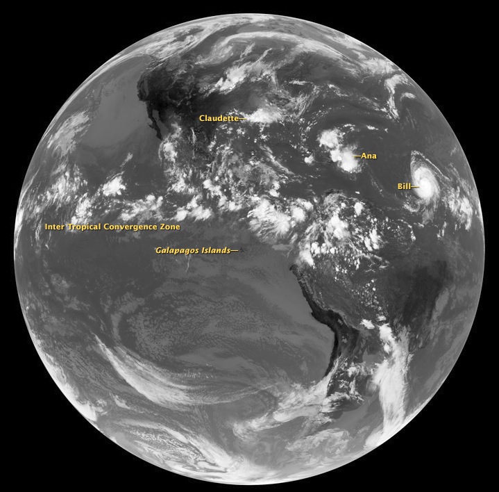
Goes 14 Image from NASA- Click for full size.
 Dan Satterfield has worked as an on air meteorologist for 32 years in Oklahoma, Florida and Alabama. Forecasting weather is Dan's job, but all of Earth Science is his passion. This journal is where Dan writes about things he has too little time for on air. Dan blogs about peer-reviewed Earth science for Junior High level audiences and up.